Sign up or log in to your Spatialnode account.

Takes less than a few seconds.

BCI 50ha Plot Tree Species Distribution

Milton Solano Sequeira
Milton Solano Sequeira•

June 15, 2022

BCI 50ha Plot Tree Species Distribution

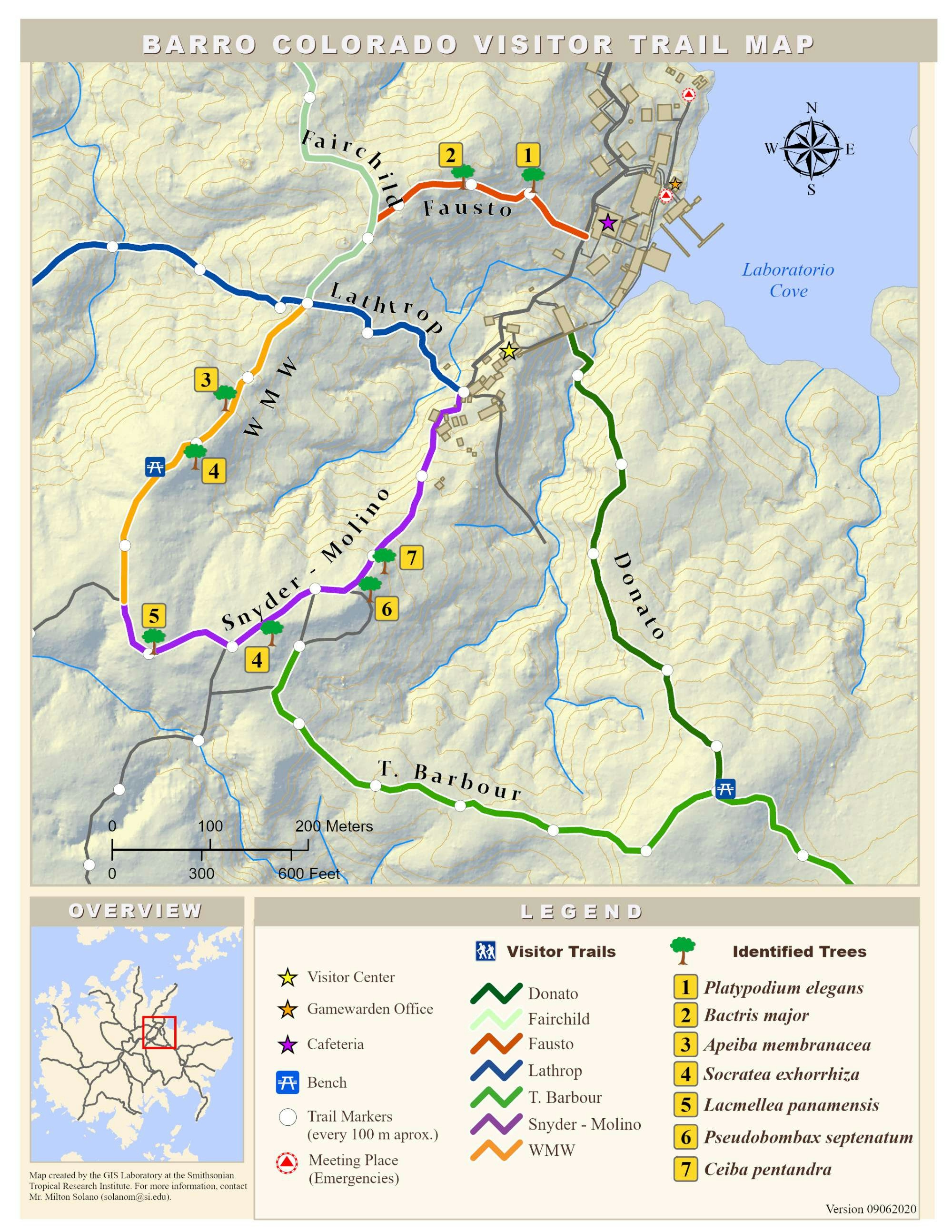
This map shows the distribution of some of the most important species within the 50ha research plot on Barro Colorado Island.


Tools used

ArcMapPaint.Net

Plug-ins used

None

tags

barro colorado bci

More by Milton Solano Sequeira

CTFS Plot Locations in Panama
33
Forest Cover Map for Republic of Panama
54
Geologic Map for the Republic of Panama
365
Barro Colorado Visitors Trail Map
20

You might also like

SDM of invasive records of C. furcoides
Philip Russo
SDM of invasive records of C. furcoides
Philip Russo
249
VisualAnalytics in Traffic Data Analysis
Leonie Engemann
VisualAnalytics in Traffic Data Analysis
Leonie Engemann
22
Composição RGB - morfometria
anderson rodrigues ribeiro
Composição RGB - morfometria
anderson rodrigues ribeiro
4
States by Bachelor's Degree
Whitney
States by Bachelor's Degree
Whitney
16
Modelo de Elevação Relativa
Gabriel Henrique Braga Matos
Modelo de Elevação Relativa
Gabriel Henrique...
34
Allentown, PA, Sanitary Sewer Design
Shrithik S
Allentown, PA, Sanitary Sewer Design
Shrithik S
9
Mapa de localização ilustrativo
Ludmila Silva Resende
Mapa de localização ilustrativo
Ludmila Silva Resende
120
Elevation Map Switzerland | Imhof Style
Viola Schweiger
Elevation Map Switzerland | Imhof Style
Viola Schweiger
115
Street Guide Map of Onitsha Metropolis
Elizabeth Ugwu
Street Guide Map of Onitsha Metropolis
Elizabeth Ugwu
51
NDVI de Cametá, PA
Giovanni Augusto Valente da Silva
NDVI de Cametá, PA
Giovanni Augusto...
31
MAPA GENERAL DE SAN MIGUEL DE VELASCO
GUSTAVO ABEL CACERES MARTINEZ
MAPA GENERAL DE SAN MIGUEL DE VELASCO
GUSTAVO ABEL...
93
Land use
omoogun bankole
Land use
omoogun bankole
2

Join the community!

We're a place where geospatial professionals showcase their works and discover opportunities.

Sign Up for free