Sign up or log in to your Spatialnode account.

Takes less than a few seconds.

Intersection Collisions in Louisville

Sean Willis
Sean Willis•

April 26, 2024

Intersection Collisions in Louisville

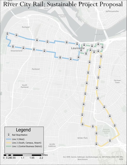
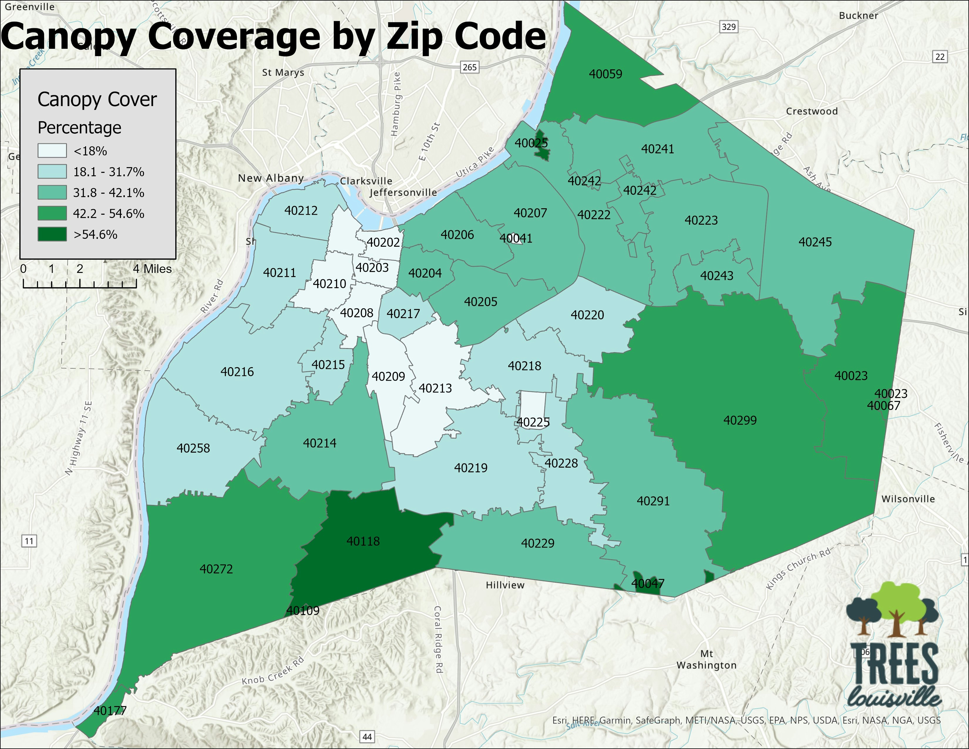
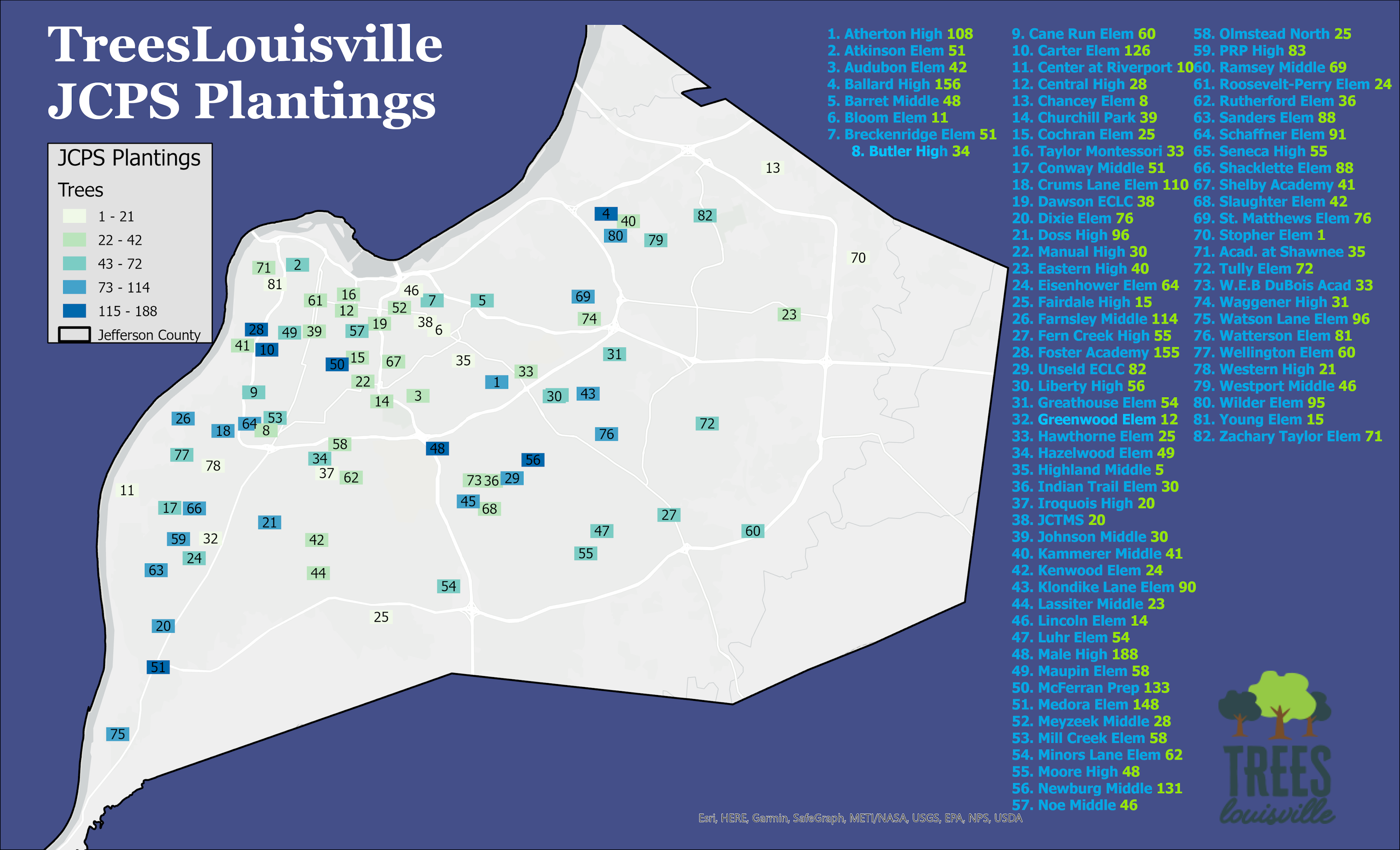
Made this map as part of a paper for one of my masters class. The map tracks all intersection crashes in Louisville, KY over a 9 year period between 2014 and 2023.


Plug-ins used

N/A

tags

carsDesigninfrastructurelouisvilletraffic

More by Sean Willis

Waste Container Inventory
22
Louisville Light Rail Proposal
89
Canopy Cover and Heat Severity
76
TreesLouisville JCPS Plantings
45
Priority Planting in Louisville, KY
121
Jefferson County Tax Income
61
JCPS District 4 Tree Plantings
43
Tree Canopy in Redlined Districts
125
TARC Stops by Headway
15
Old Louisville Property Tax Income
17
Canopy Cover by Zip Code
127
Louisville, KY Housing Density
25

You might also like

Hosp. DIstrbution In North-East Nigeria
Lukumon Lateef
Hosp. DIstrbution In North-East Nigeria
Lukumon Lateef
21
Traverses of Geophysical Survey, Unilag
Emeka Ude
Traverses of Geophysical Survey, Unilag
Emeka Ude
10
A region in Abuja
Afolabi Victor Ayodeji
A region in Abuja
Afolabi Victor Ayodeji
89
Levantamento de falha em cana-de-açúcar
Diogo Henrique Rodrigues Junior
Levantamento de falha em cana-de-açúcar
Diogo Henrique...
33
Street Tree Species in Boston, MA
Dylan Kelly
Street Tree Species in Boston, MA
Dylan Kelly
19
Mapa Topográfico
José Geraldo Ribeiro Junior
Mapa Topográfico
José Geraldo...
11
Oregon Groundwater & Abandoned Mines
Keran Nkongolo
Oregon Groundwater & Abandoned Mines
Keran NkongoloPro
32
NDWI Estação Seca
Henrique Pinheiro de Souza
NDWI Estação Seca
Henrique Pinheiro...
21
FLOOD HAZARD MAPPING PART OF (LOKOJA)
John Maduabuchukwu
FLOOD HAZARD MAPPING PART OF (LOKOJA)
John Maduabuchukwu
19
Biomas do Brasil   Sul de Minas Gerais
Gabriel Martins Corrêa
Biomas do Brasil Sul de Minas Gerais
Gabriel Martins Corrêa
9
Monitoramento Ambiental
Simone Malhado da Silva
Monitoramento Ambiental
Simone Malhado...
9
Hidrografia do município do Recife
Matheus Maciel
Hidrografia do município do Recife
Matheus Maciel
230

Join the community!

We're a place where geospatial professionals showcase their works and discover opportunities.

Sign Up for free