Sign up or log in to your Spatialnode account.

Takes less than a few seconds.

EzeAni Groundwater Quality

Emeka Ude
Emeka Ude•

December 24, 2022

EzeAni Groundwater Quality

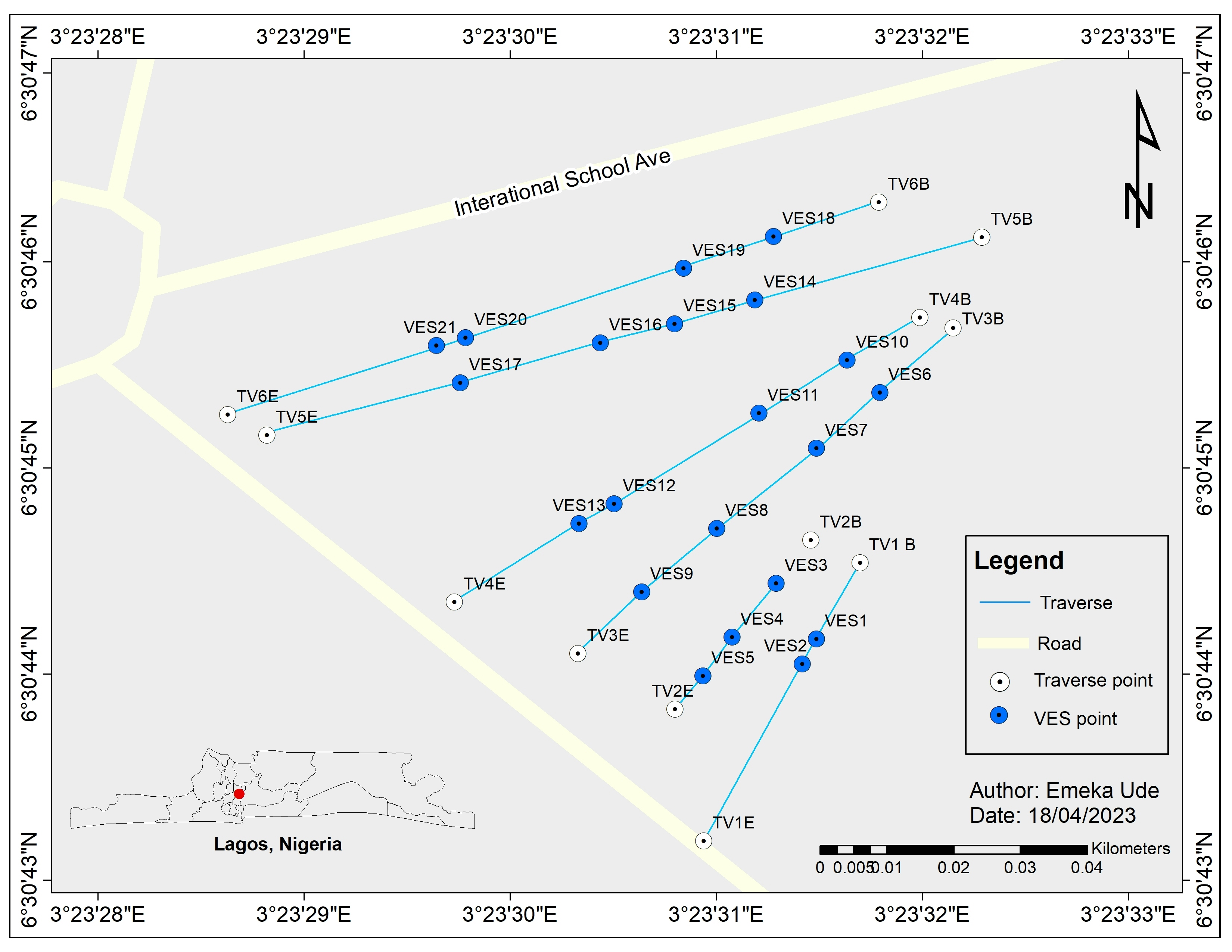
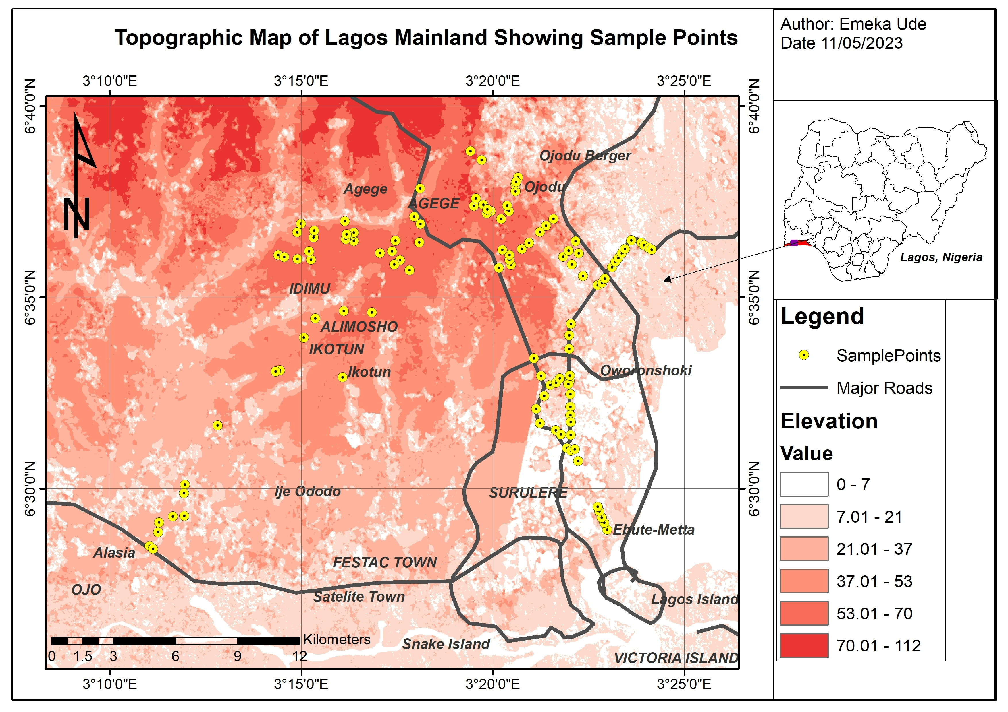
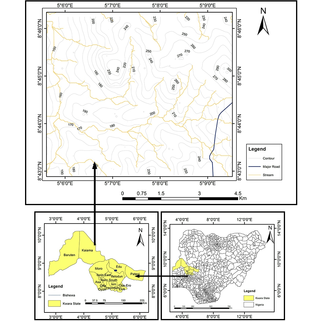
This map shows sampled locations for groundwater quality in Ezeani community, Nsukka, Nigeria.


Tools used

ArcMap

Plug-ins used

ArcGIS

tags

Environmental ManagementWater

More by Emeka Ude

Topographical Map of Lagos Mainland
84
Study Area in Southwest Nigeria
24
Elevation Map of Abakaliki Nigeria
50
Study Area Map of Nsukka Metropolis
101
Delineations of Asa River Watershed
99
Hourly Ozone Distribution in California
66
Osun State elections 2022
95
Liberty Ibadan Street Map
36
Topographic Map of Obukpa
133
Traverses of Geophysical Survey, Unilag
10
Temperature Along Nigerian Coastal Line
34
Geochemical Map in Southwest, Nigeria
21

You might also like

DESIGNATED POLICE STATIONS IN NAIROBI
Mary Muthee
DESIGNATED POLICE STATIONS IN NAIROBI
Mary Muthee
441
Comparação de Uso do Solo - UHEQQ
Leonardo Ruschel Horn
Comparação de Uso do Solo - UHEQQ
Leonardo Ruschel Horn
5
São Paulo - SP, ênfase no rio Tietê
Luis Renato Joaquim
São Paulo - SP, ênfase no rio Tietê
Luis Renato Joaquim
380
MAPA DE USO DO SOLO E COBERTURA VEGETAL
Gustavo da Silva Francisco
MAPA DE USO DO SOLO E COBERTURA VEGETAL
Gustavo da...
14
Vardar River REM
Efstathios Lymperis
Vardar River REM
Efstathios Lymperis
42
Declividade em Área de Manejo Florestal
Marina Martins de Almeida
Declividade em Área de Manejo Florestal
Marina Martins...
6
NDVI for 2001-2021
Mercy Onaopemipo Akintola
NDVI for 2001-2021
Mercy Onaopemipo Akintola
132
International Airports Connected to NAIA
Juan Carlos Gabriel Zacarias
International Airports Connected to NAIA
Juan Carlos...
10
Geotechnical Map of Greece on SRTM DEM
Efstathios Lymperis
Geotechnical Map of Greece on SRTM DEM
Efstathios Lymperis
195
Forest Structure and Disturbance
Dylan Kelly
Forest Structure and Disturbance
Dylan Kelly
21
NDVI entre dois municípios
Luis Renato Joaquim
NDVI entre dois municípios
Luis Renato Joaquim
347
Projeto de iniciação cientifica (RAIC)
Polliana Odeth de Melo Machado
Projeto de iniciação cientifica (RAIC)
Polliana Odeth...
33

Join the community!

We're a place where geospatial professionals showcase their works and discover opportunities.

Sign Up for free