
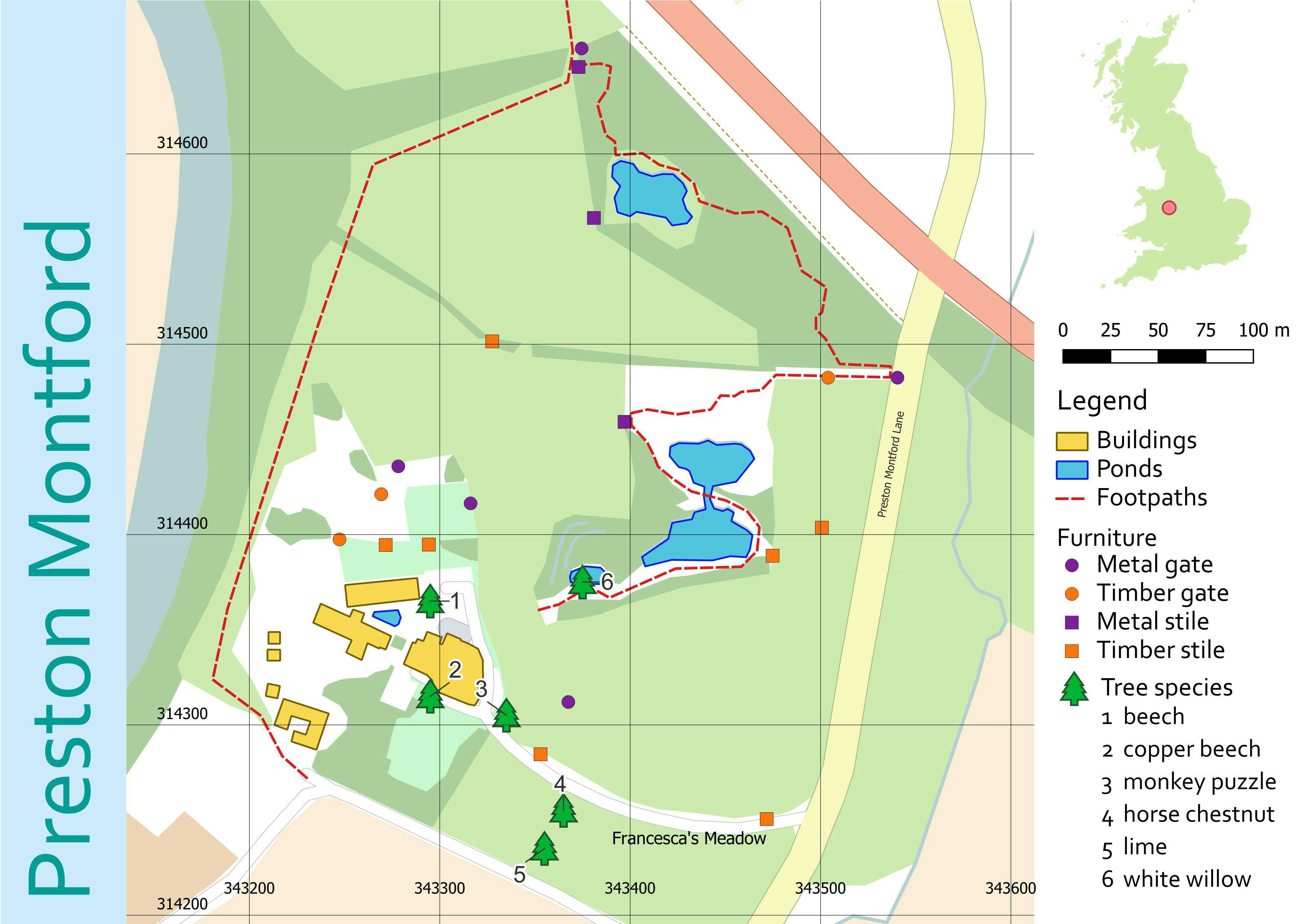
FSC QGIS for Ecologists course - days 1 & 2
In this project I learnt how to use the GeoCoding plugin, which allows you to search for a an address and uses this to plot a point. I also uploaded tree data collected in the field, and practised my digitising skills, in particular using the Advanced Digitising toolbar.


_645201.jpg&w=48&q=40 "Eguagie-suyi Precious")


