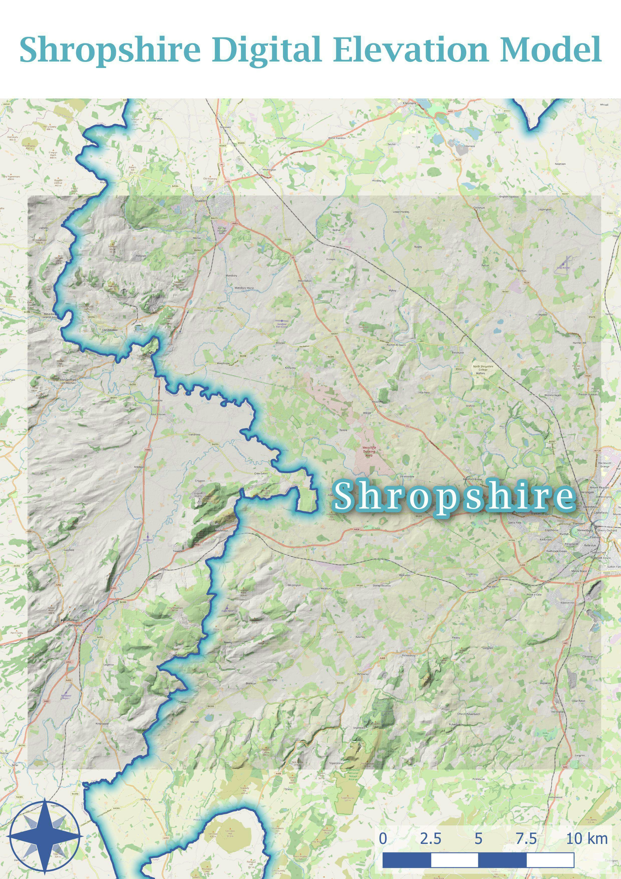
FSC QGIS for Ecologists course - day 3
In this project, I learnt about rendering layers, by adding a hillshade and blending the base map with the raster beneath. I also experimented with layer styling using feathering around the inside of the county border, and placing labels using the label toolbar.