

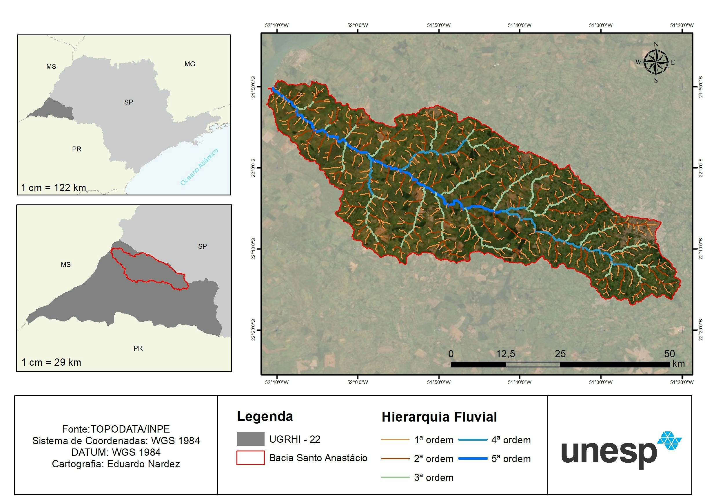
This is a land cover map of Ghana in the year 2024. The map shows land cover classes, including built-up areas, trees, water bodies, crops and bare ground. The land cover map was extracted from the Esri Sentinel 2 Land Cover Explorer dashboard and then uploaded in ArcGIS Pro and Blender 3D for further analysis and cartography work.
Ghana Land Use Land Cover Map 2024
tags
Remote SensingSpatial Analysis

You might also like


Join the community!
We're a place where geospatial professionals showcase their works and discover opportunities.