Sign up or log in to your Spatialnode account.

Takes less than a few seconds.

United States Subregions - Raster

Nick Linell
Nick Linell•

September 24, 2025

United States Subregions - Raster

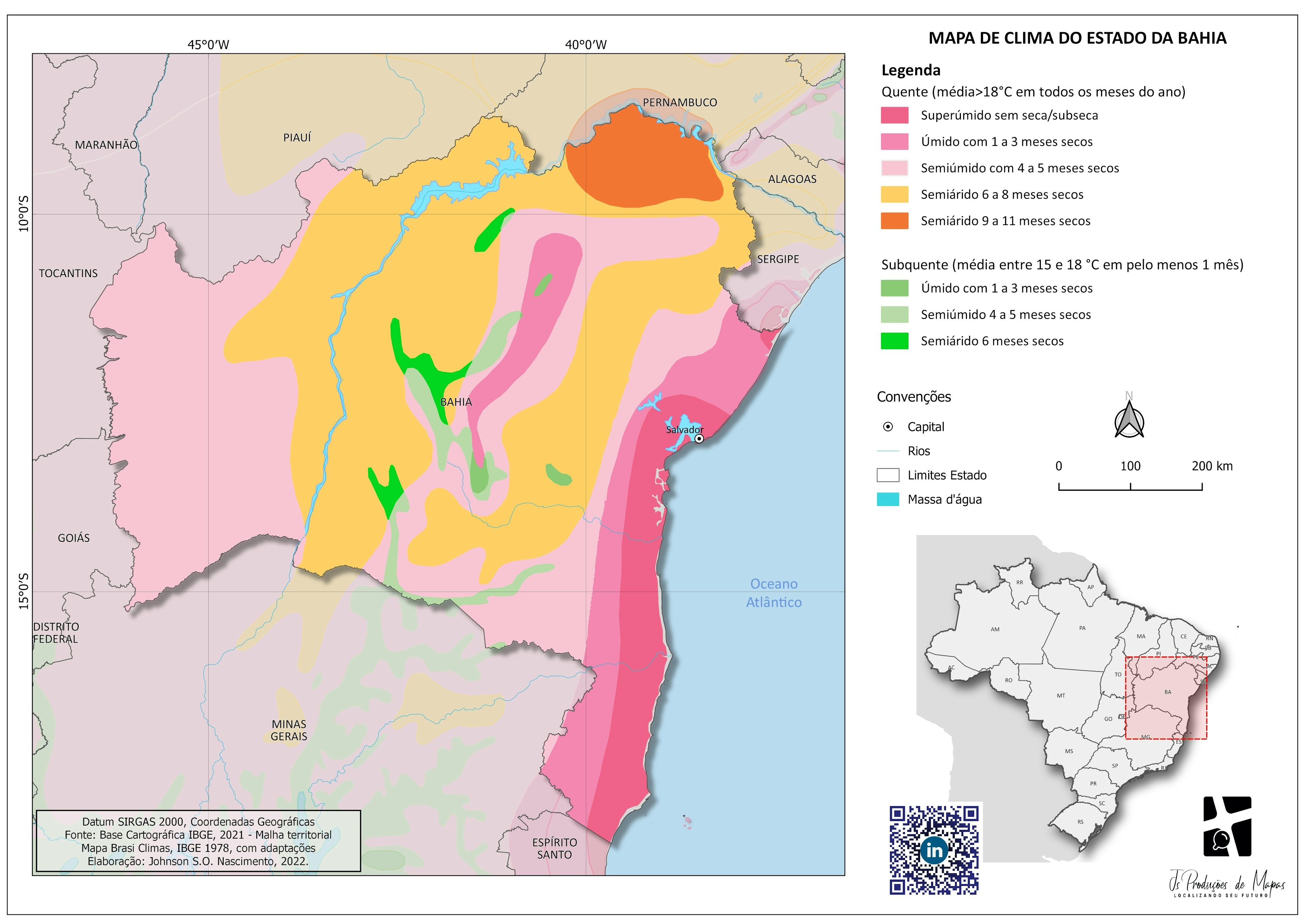
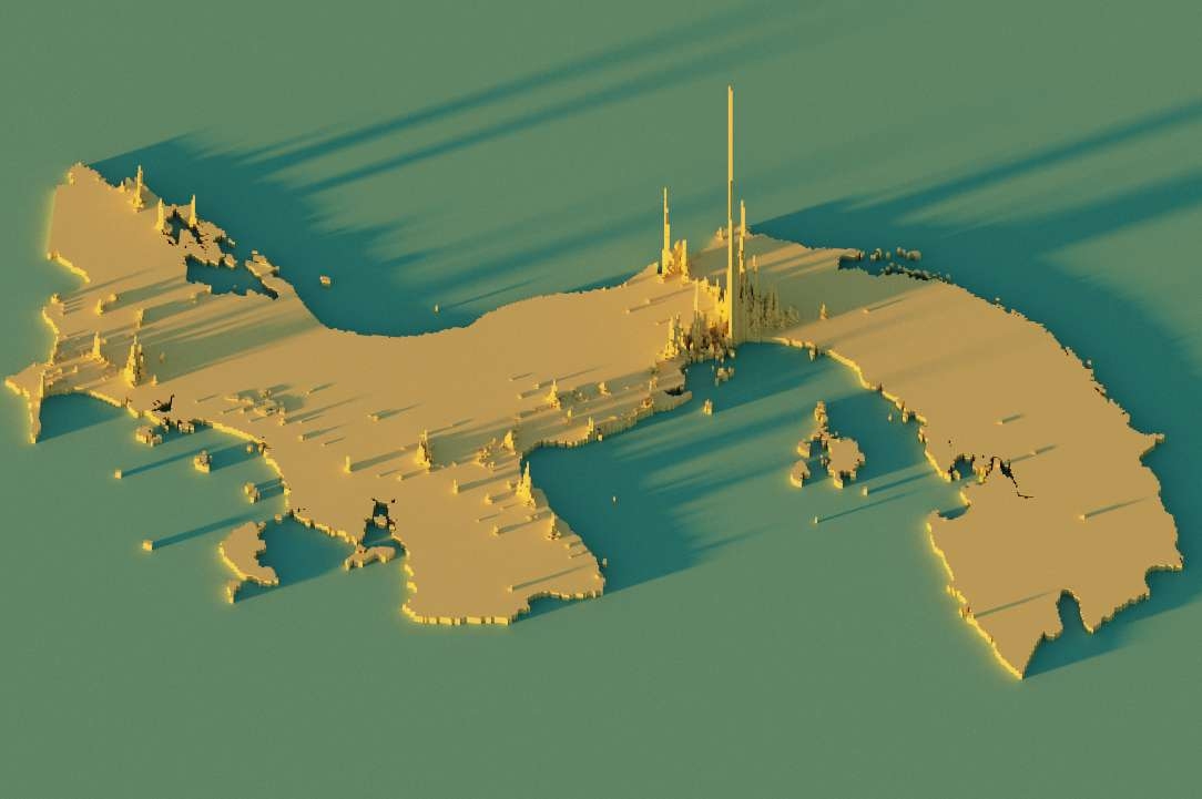
This project is an exercise in classifying and displaying Raster datasets in a simple and easily understood way.


tags

RasterUnited States

More by Nick Linell

United States Population Density
3
Emerald Ash Borer Risk Blue Earth County
7
Duck Lake, Nicollet County, MN Imagery
2
MN Forest Damage Causes
3
NHL Team Locations by Division
4
GeoEye-1 Image Composites
5
Arkansas Population Change
6
Pan-Sharpening Examples
7
Bridger Lakes Features - Wyoming
1
Coordinate Systems
Coordinate Systems
Coordinate Systems
Coordinate Systems
3
Percent of Global Population Change
8

You might also like

Redwood Tree Species Mapping
Anna
Redwood Tree Species Mapping
AnnaPro
14
Mombasa Tourist Guiding System
John Wahome Gathoni
Mombasa Tourist Guiding System
John Wahome Gathoni
320
CA Cities at Risk for Earthquakes
Ria Rathod
CA Cities at Risk for Earthquakes
Ria Rathod
14
Mapa Artístico do Recife-PE
Carlos Alberto
Mapa Artístico do Recife-PE
Carlos Alberto
22
UsoDoSolo - Santo André - SP
Carlos Alexandre Gomes
UsoDoSolo - Santo André - SP
Carlos Alexandre Gomes
155
Paper Cut Map - Fansipan Summit, VietNam
Nguyễn Văn Tín
Paper Cut Map - Fansipan Summit, VietNam
Nguyễn Văn Tín
19
Renda de moradores do Rio de Janeiro
Fernanda Dias Menezes
Renda de moradores do Rio de Janeiro
Fernanda Dias Menezes
71
Mapa de Risco Geológico
Matheus Sá
Mapa de Risco Geológico
Matheus Sá
11
Queimadas no Pantanal 2023
Rogério Gusmão Junior
Queimadas no Pantanal 2023
Rogério Gusmão Junior
10
DENSIDADE DEMOGRÁFICA DE PERNAMBUCO
Beatriz Vieira
DENSIDADE DEMOGRÁFICA DE PERNAMBUCO
Beatriz Vieira
108
CROP MAP OF PART OF IKOT ESSIEN VILLAGE
Edidiong Ekrikpo
CROP MAP OF PART OF IKOT ESSIEN VILLAGE
Edidiong Ekrikpo
20
Kenya Shaded Relief Map
Atieno Owino
Kenya Shaded Relief Map
Atieno Owino
43

Join the community!

We're a place where geospatial professionals showcase their works and discover opportunities.

Sign Up for free