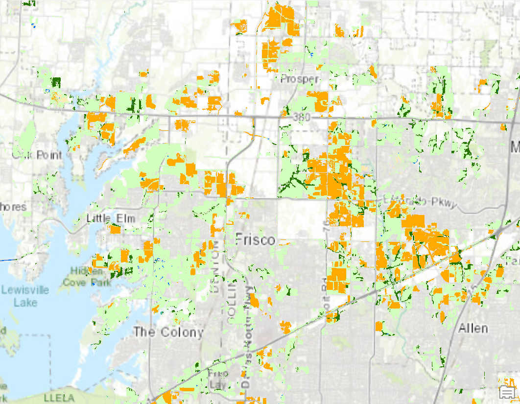
This project analyzes land cover change around Dallas, Texas from 2001 to 2016. I used two classified thematic rasters from a condensed NLCD image classification schema to measure the scope of various land cover types that changed into the "Developed" classification. The Change Detection Wizard helped to calculate and communicate both the cumulative difference and specific pixel changes in various land cover types over the years.
My workflow is described below:
- Add Data from NLCD to the project.
- Configure the Change Detection Wizard to quantify change in an output attribute table.
- Ensure the Method is set to Categorical Change.
- Ensure Class Configuration is set to Changed Only.
- Ensure Save Result As is set to Raster Dataset.
- Run the tool.
- Open the new .tif layer's attribute table and sort the Count and Area fields to learn the extent to which classes changed into developed land.
Data sourced from the National Land Cover Database, provided by Esri.