

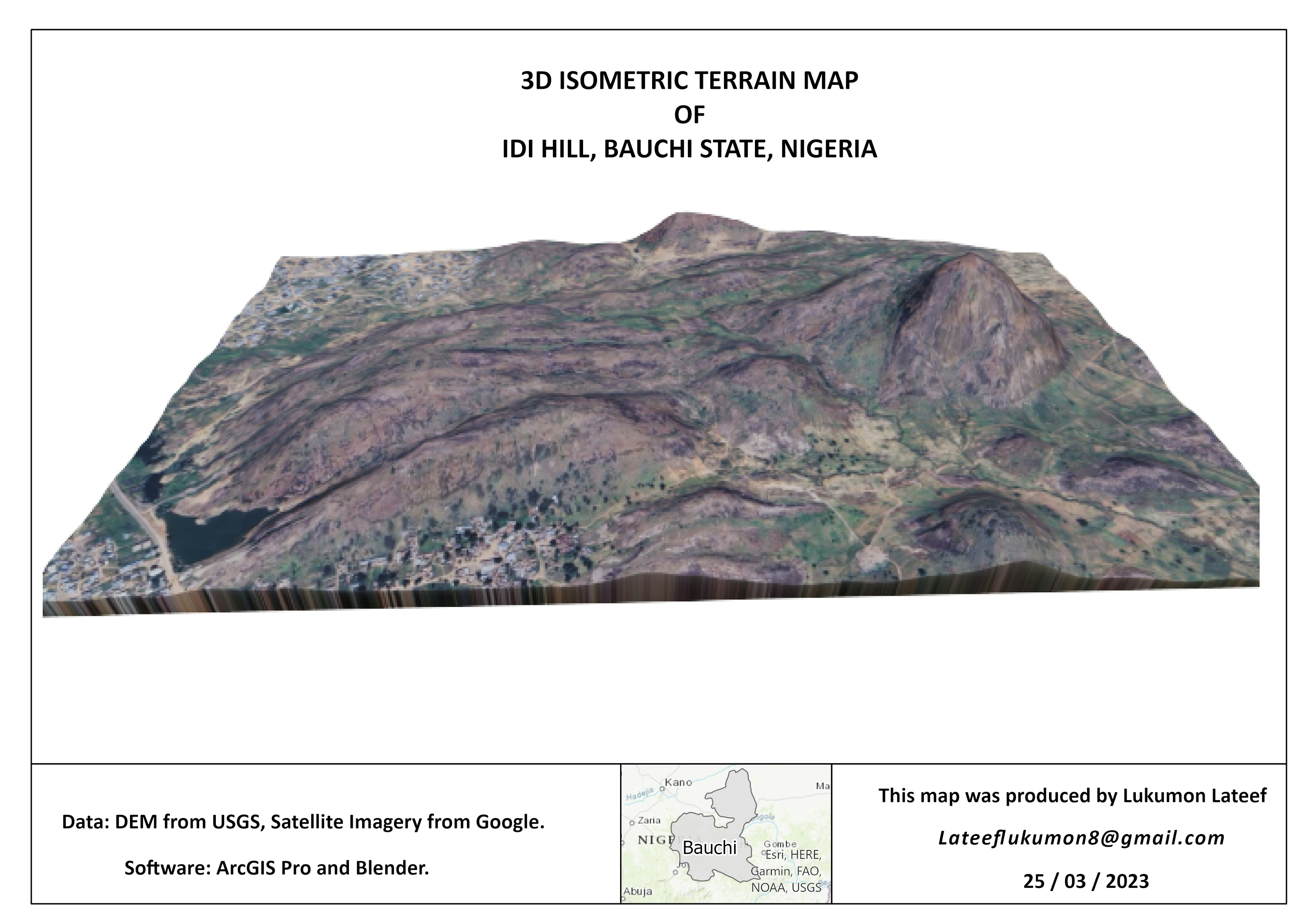
Discrete data points relating to Sulfer Dioxide measurments were interpolated in this project to uncover spatial relationships within the data. In this case a roadway was a found to be the major source of pollution. Various geoprocessing toolboxes within ArcGIS Pro were used to create this analysis.
Interpolating Sulfer Dioxide Data
Plug-ins used
Geoprocessing ToolsInterpolation
tags
IDW Interpolation
More by Emmet O Donnell


You might also like


_2461995.png&w=48&q=40 "Carmem Lúcia Ribeiro da Costa Soares")

Join the community!
We're a place where geospatial professionals showcase their works and discover opportunities.