Introduction
The Land Use Land Cover (LULC) study sought to determine the extent and distribution of various land cover types in Nigeria's Akwa Ibom State. Sentinel-2 satellite data covering the period from December 1, 2022, to January 23, 2022, were used to assess the research area. The data was obtained from the Google Earth Engine and processed using the ArcMap software. This report's goal is to show the findings from the classification of satellite images that were done both supervised and unsupervised.
Methods
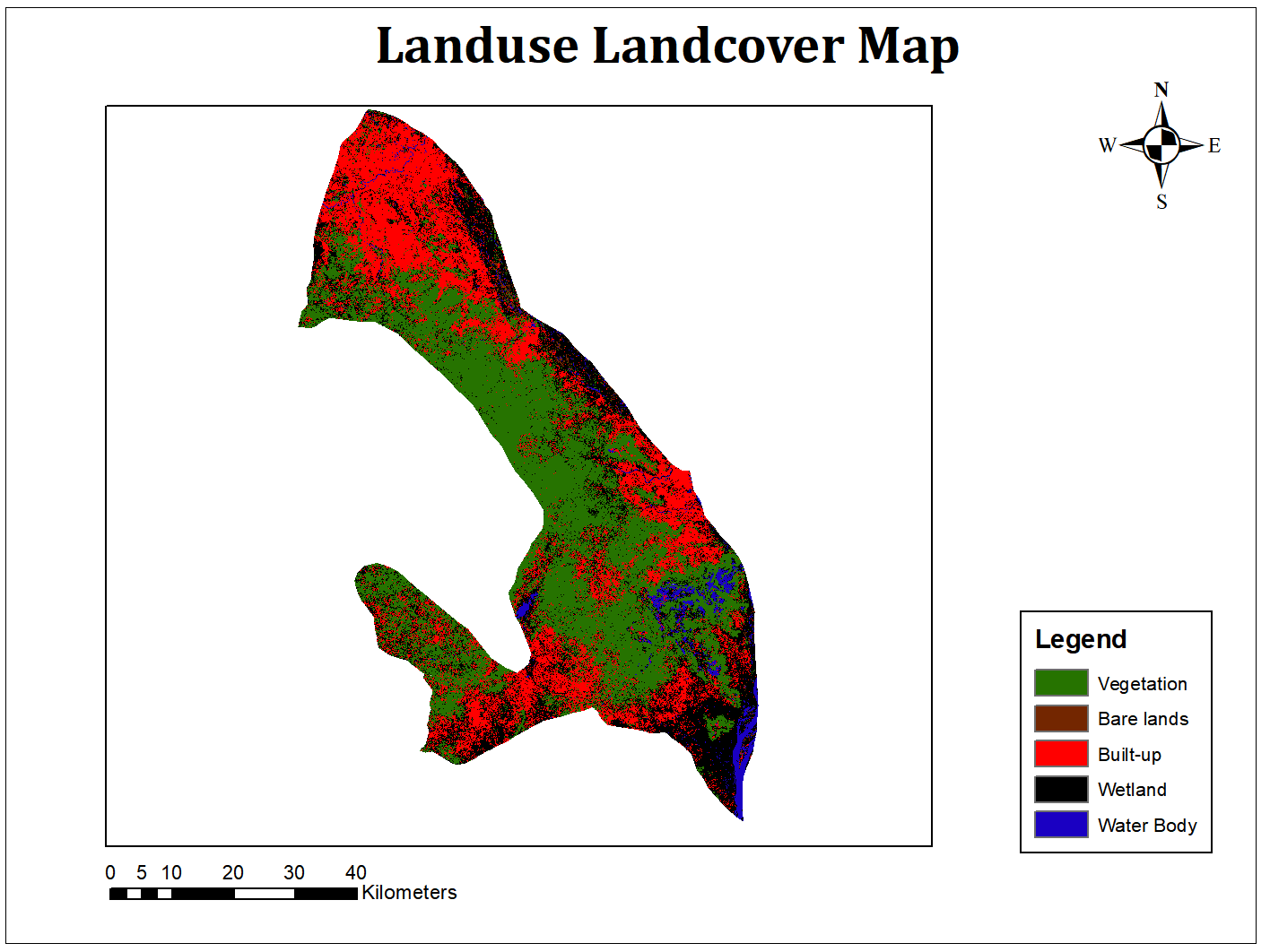
The satellite imagery was classified into various types of land cover using a supervised and unsupervised classification approach. The supervised classification classified the pixels into five land cover classes, including waterbody, wetland, vegetation, bare surface, and built-up, using training data from ground truth locations. The unsupervised classification was performed using the ISODATA algorithm and the resulting classes were compared to the supervised classification results.
Results
The results of the land use land cover classification showed that waterbody has a percentage cover of 2.7%, wetland 12.7%, vegetation 41.5%, bare surface 22.5%, and built-up 20.45%. These results suggest that vegetation appears to be the most common kind of land cover in Akwa Ibom State, with built-up areas and bare surfaces coming in second and third, respectively. The waterbody class is the smallest class, while the wetland class is the least significant.
Discussion
According to the findings of the land use land cover classification, vegetation appears to be the predominant kind of land cover in Akwa Ibom State. This is consistent with the region's tropical climate and the presence of lush vegetation. The significant proportion of bare ground and built-up areas points to human activity, such as urbanization, which has probably harmed the natural vegetation cover. Waterbodies and wetlands are signs that there are significant water sources and habitats for aquatic organisms in the area.
Conclusion
In conclusion, the land use land cover classification of Akwa Ibom State provides important information on the distribution and extent of land cover types. This information can be used by local authorities and stakeholders to make informed decisions about land use management and conservation initiatives in the region. Further studies could be conducted to monitor changes in land cover and land use over time and to assess the impacts of human activities on the environment.