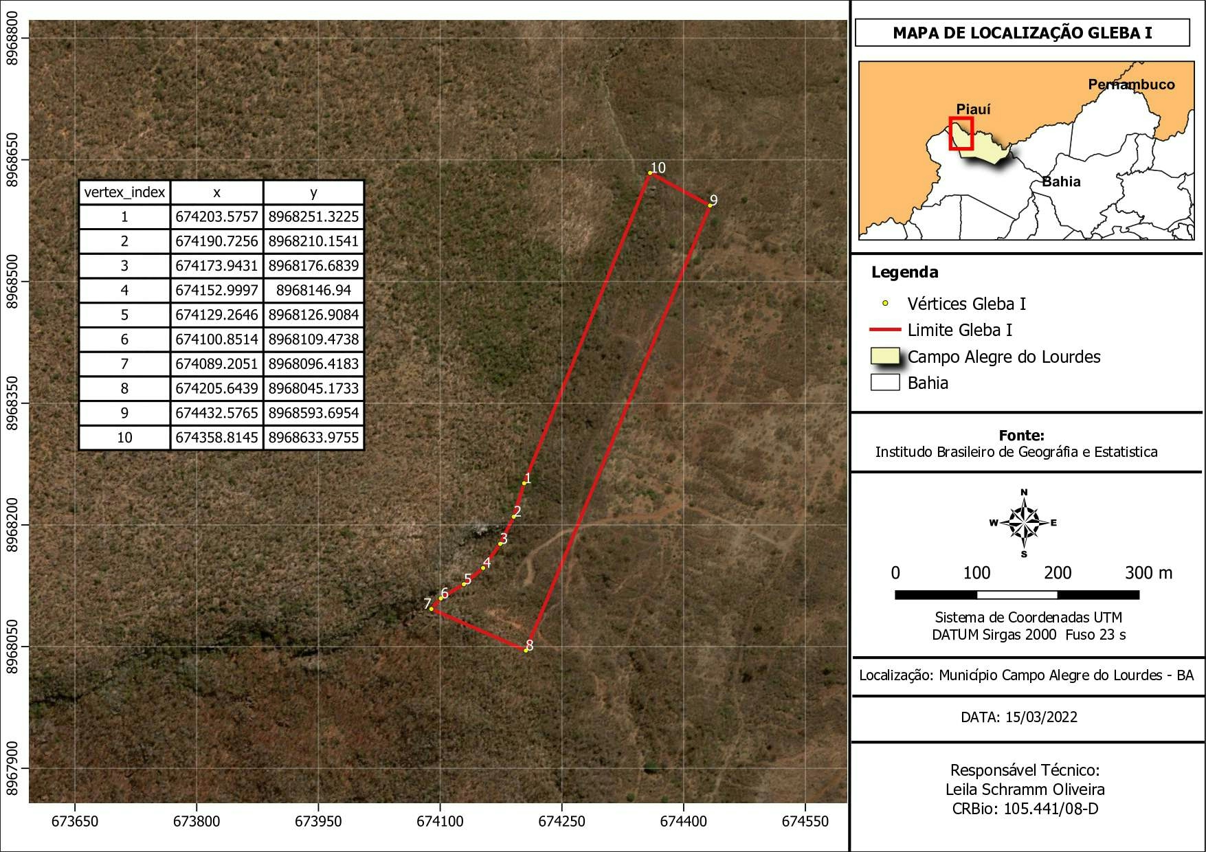
LOCALIZAÇÃO DE CAVIDAS MONITORADAS

Tools used
QGIS
Plug-ins used
Google Earth Engine(GEE)
tags
LICENCIAMENTOQGIS
More by Edvaldo Alves Neto


You might also like


Join the community!
We're a place where geospatial professionals showcase their works and discover opportunities.