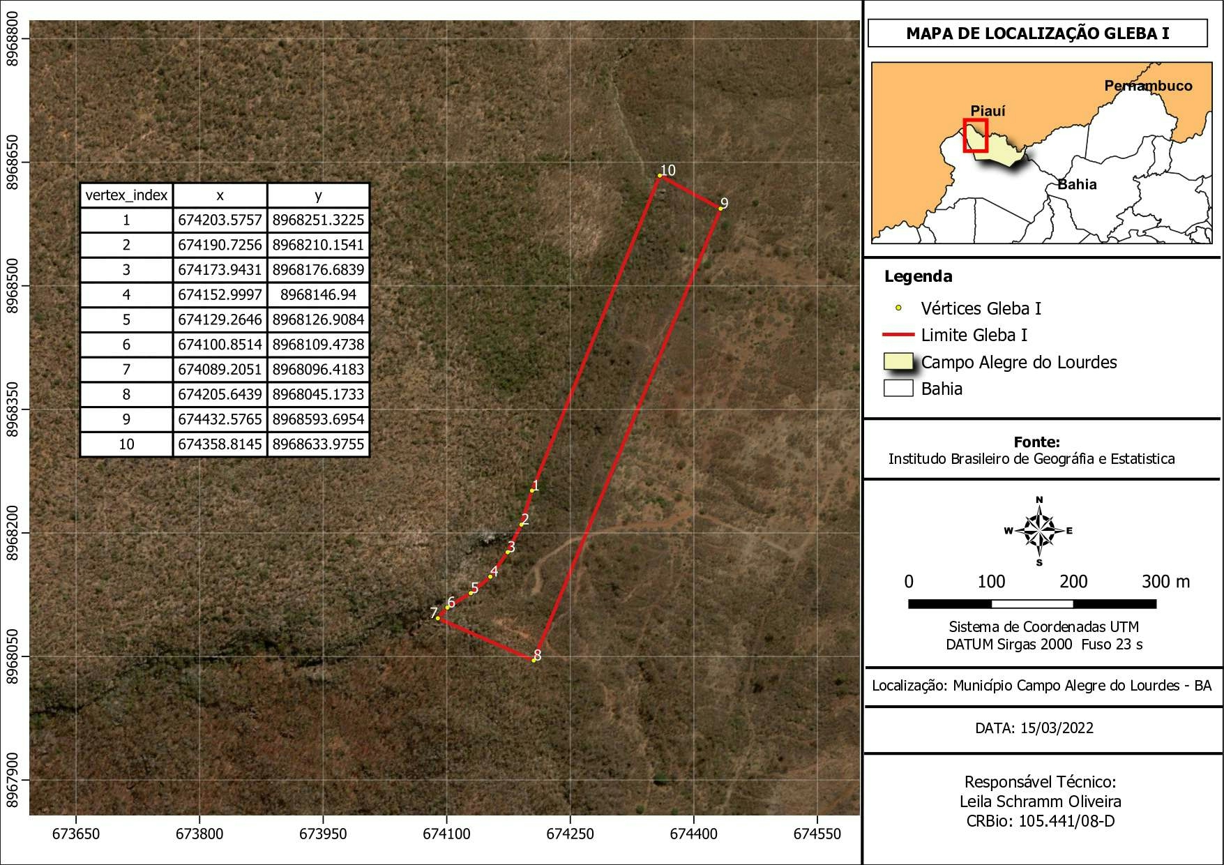
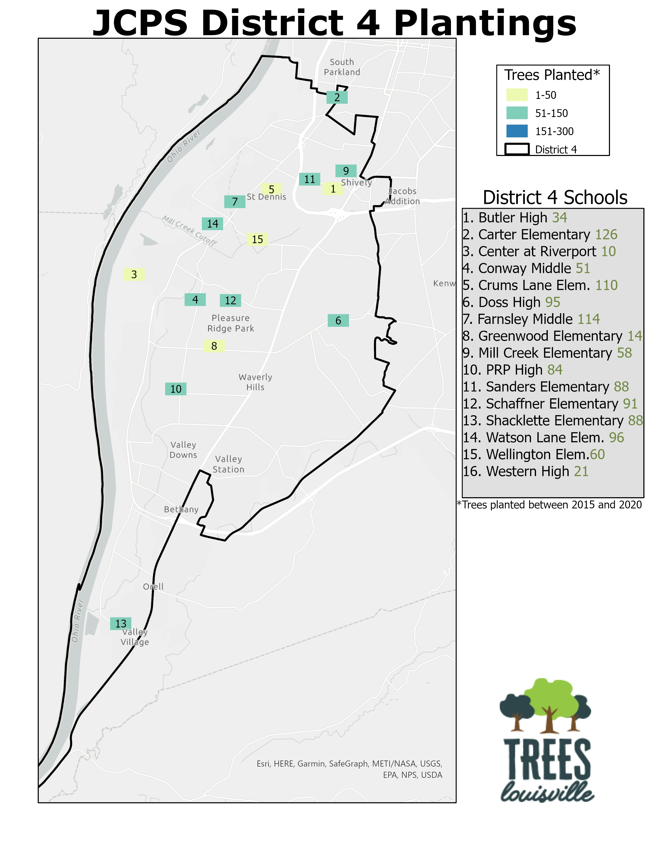
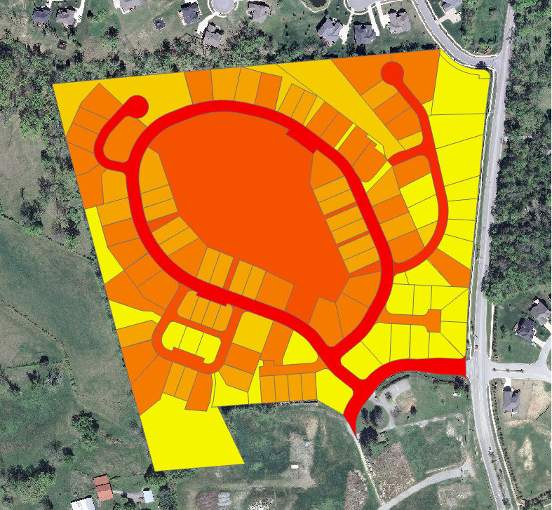
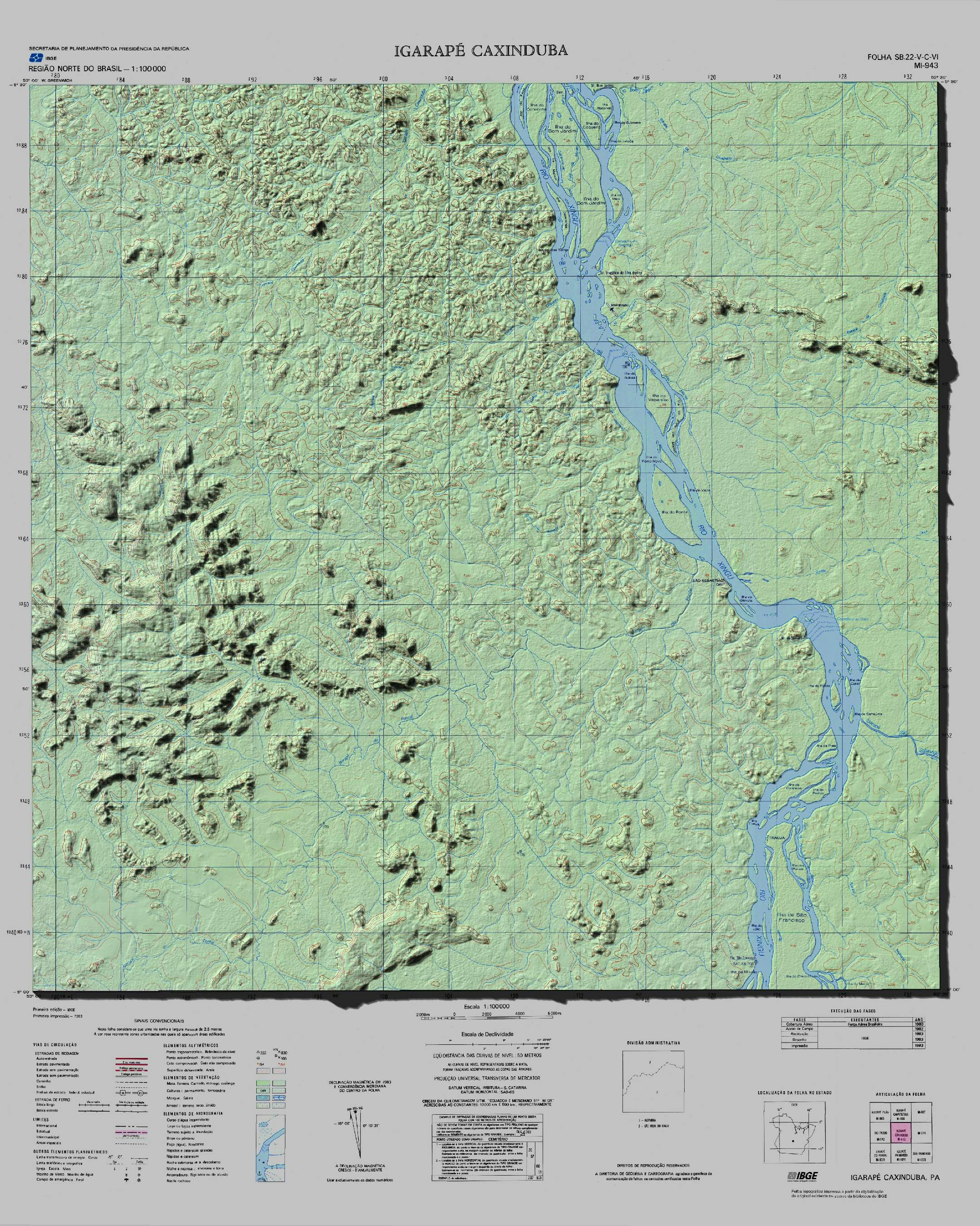
USO E OCUPAÇÃO DO SOLO

Tools used
QGIS
Plug-ins used
Spatial analyst
tags
OCUPATION QGISSpatial analyst
More by Edvaldo Alves Neto


You might also like


Join the community!
We're a place where geospatial professionals showcase their works and discover opportunities.