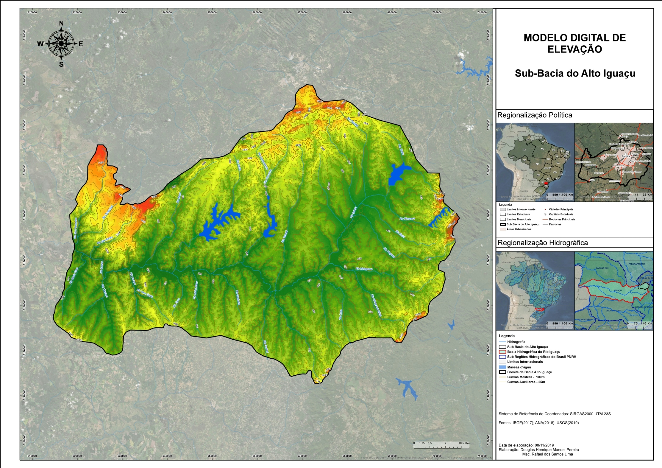
Remote Sensing Lab
For one of my labs from my remote sensing course, I created a digital surface model of University of Washington campus. I first turned a lidar point cloud into a raster, then made both a digital elevation and digital surface model, and created a normalized digital surface model from the two models. Then, I was able to use the surface model to measure the tree heights and crown areas of different trees on campus.