Sign up or log in to your Spatialnode account.

Takes less than a few seconds.

Northern Morocco Shaded Relief

Hamza Bouarakia
Hamza Bouarakia•

July 11, 2022

Northern Morocco Shaded Relief

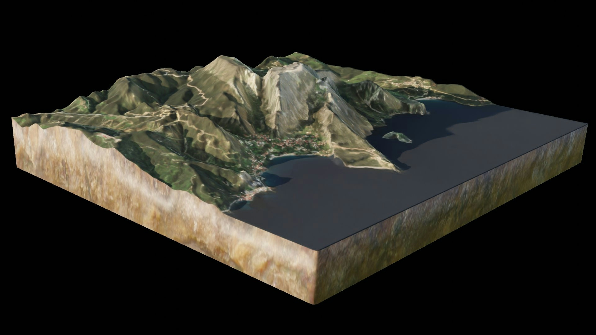
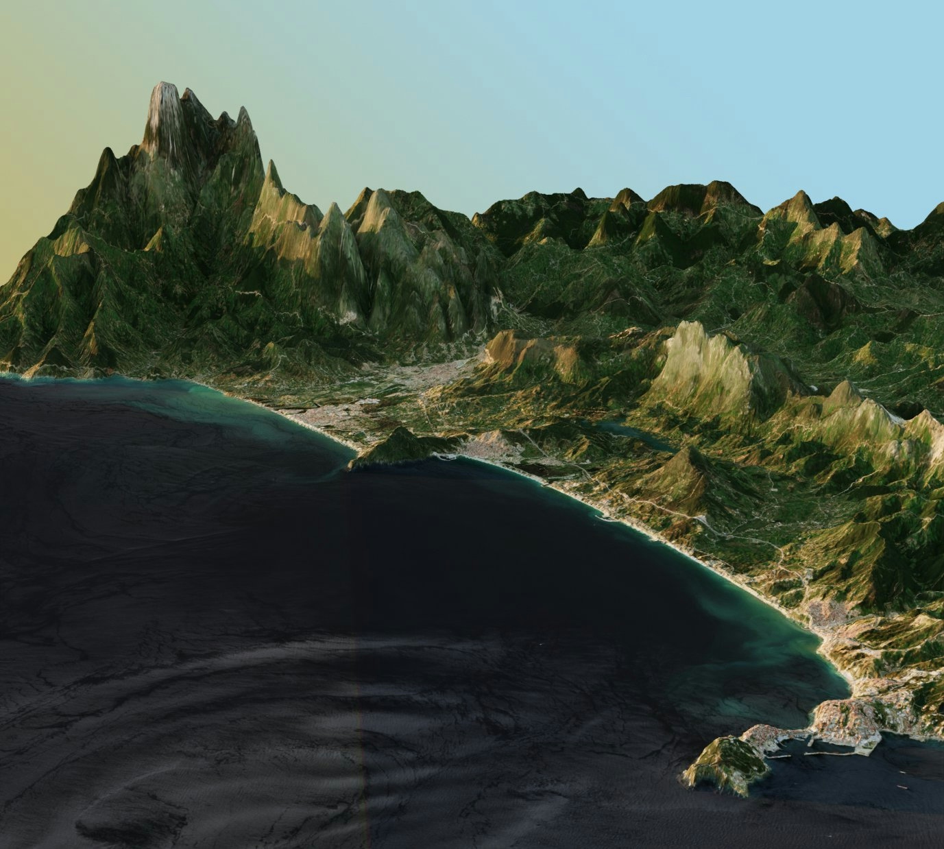
Cloudless Sentinel 2 Image drapped over a shaded relief generated in Blender using multidirection lightings


Tools used

BlenderQGIS

Plug-ins used

QGIS

tags

Blender#mappychallengeQGISsentinel-2

More by Hamza Bouarakia

Jbel Moussa Landscape
194
SMBA Dam Lake 2021-2022, Morocco
67
Bougherba, Taza Forest Fire
113
Global Flight Paths
Global Flight Paths
114
Tagragra of Akka, Morocco
165
Vintage Map of Tétuan, Morocco
141
Tétouan Coastline
Tétouan Coastline
129
RSK Population Density
160

You might also like

Mapa Temático - Assentamentos
Gabriel Henrique Braga Matos
Mapa Temático - Assentamentos
Gabriel Henrique...
36
Quality Health Care
Jesse Kato
Quality Health Care
Jesse Kato
29
Riverside Geospatial Support
Armster Edwards
Riverside Geospatial Support
Armster Edwards
27
KENYA SPACE AGENCY
Lawrence Kimutai
KENYA SPACE AGENCY
Lawrence Kimutai
28
Mapa de Kernel - Queimadas
Brenner Rodrigues
Mapa de Kernel - Queimadas
Brenner Rodrigues
14
Duck Lake, Nicollet County, MN Imagery
Nick Linell
Duck Lake, Nicollet County, MN Imagery
Nick LinellPro
2
Distribution of SNAP Rate across US
Girma Kussa
Distribution of SNAP Rate across US
Girma Kussa
43
Map of Udi LGA in Enugu State, Nigeria
Chukwulobe Martins Ugonna
Map of Udi LGA in Enugu State, Nigeria
Chukwulobe Martins Ugonna
204
Washtenaw County: Land Use & Population
Yuxin (Sienna) He
Washtenaw County: Land Use & Population
Yuxin (Sienna) He
22
Alcoser watershed
Aahed Alhamamy
Alcoser watershed
Aahed Alhamamy
180
Fire Vulnerability Analysis - Raster
Cedar Bachmann
Fire Vulnerability Analysis - Raster
Cedar BachmannPro
2
MAPPING WATER EXTENTS USING WOFS
Francis Ndiritu
MAPPING WATER EXTENTS USING WOFS
Francis Ndiritu
37

Join the community!

We're a place where geospatial professionals showcase their works and discover opportunities.

Sign Up for free