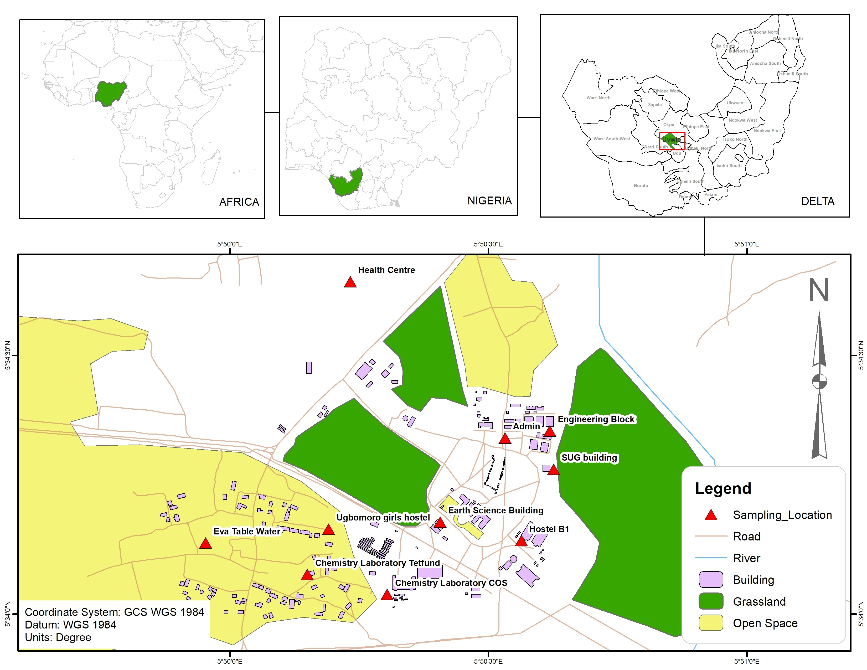
Using Catalyst Object detection software and tools, this assignment was designed to take an image captured by a drone (Matrice 300 RTK with a Micasense Altum payload) and classify the area.
Classification results were brought into ESRI ArcGIS Pro to visualize and create a data product.