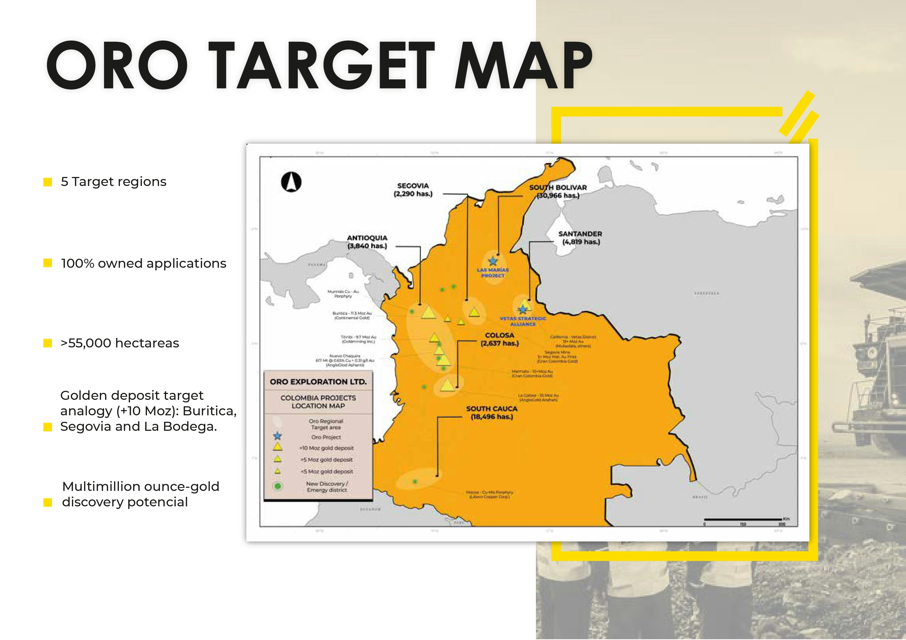
In preparation for my Summer Field Geology Mapping Capstone that involved a 5 week camping trip to the White and Inyo Mountain ranges within the Sierras, I created this map highlighting the locations of Rhyolite domes in the area.
I then took attitude data that was collected by my professor in previous years and overlayed a rose diagram using Stereonet on the map in order to display the S-W trend of normal faulting in this area, that can also be seen all throughout California.
This map shows an interesting pattern where the rhyolitic domes pop up in a straight line, following the trend of normal faulting and the rose diagram which is evidence that the rhyolitic magma came up through those particular areas because they were under stress from the normal faulting.


.svg "Keran Nkongolo")