Sign up or log in to your Spatialnode account.

Takes less than a few seconds.

QGIS Map (Southern Europe)

Martin Nuñez Igarzabal
Martin Nuñez Igarzabal•

September 26, 2023

QGIS Map (Southern Europe)

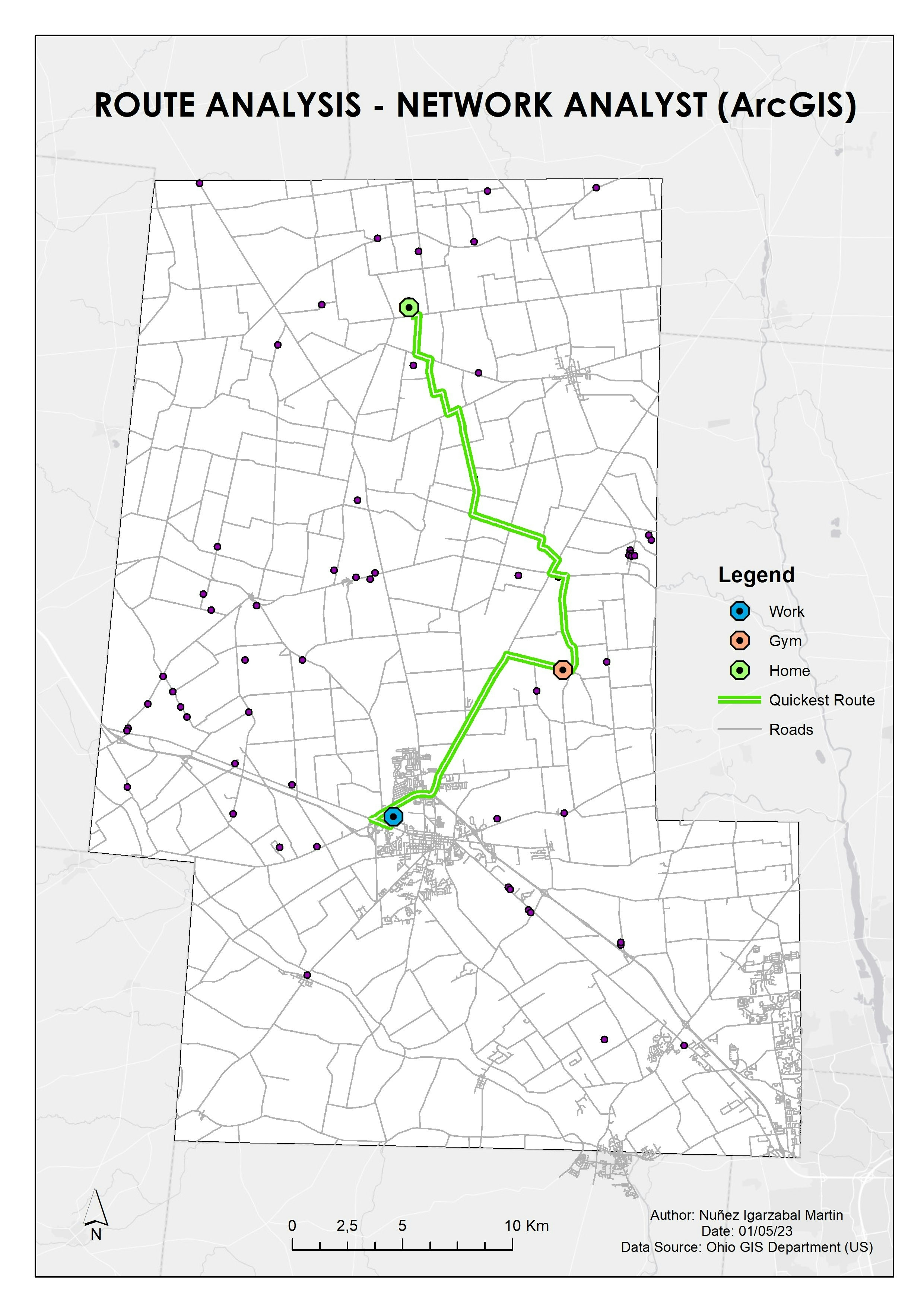
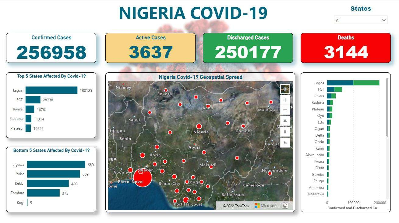
Southern Europe countries using QGIS and open source data


Plug-ins used

GIS

tags

QGIS

More by Martin Nuñez Igarzabal

Digitalization of roads - New Guinea
4
Drive Time Areas Map
9
Digital Elevation Model - Buenos Aires
59
Spatial Analysis - Drive time (QGIS Map)
16
Temperature Heat Map - Argentina
29
Voting data in California
19
Population Density Map of Arkansas
47
ArcGIS Map (Ozone concentration)
14
Infographic Map - Mining Company
9
Population Heat Map - Arkansas
35
Geological Map Digitalization
5
Route Analysis (ArcGIS Network Analyst)
15

You might also like

Geospatial Data for Corsan Sanitation
Kaio Serrano Galvão
Geospatial Data for Corsan Sanitation
Kaio Serrano Galvão
13
Georeferencing Lord of the Rings
Luana Moraes Costa
Georeferencing Lord of the Rings
Luana Moraes Costa
26
Landslide Hazard Assesment
Sara Fatimah
Landslide Hazard Assesment
Sara Fatimah
32
Diving Monterey Atlas
Andrew Middleton
Diving Monterey Atlas
Andrew Middleton
304
Assessing the accuracy of iPhone 7 GPS
Hannah Mosiniak
Assessing the accuracy of iPhone 7 GPS
Hannah MosiniakPro
9
QGIS Custom function example
Rafael Pinheiro Machado
QGIS Custom function example
Rafael Pinheiro Machado
61
Seasonal Change, Colorado
Sammer
Seasonal Change, Colorado
Sammer
7
Maine Endangered Fish
Keran Nkongolo
Maine Endangered Fish
Keran NkongoloPro
8
Sea Surface Temp in the Gulf of Mexico
Emily Colgan
Sea Surface Temp in the Gulf of Mexico
Emily Colgan
6
Fator de uso e ocupação do solo
ana karla rodrigues lobato
Fator de uso e ocupação do solo
ana karla...
7
Redistricting Plan 3-Collin County
Richard Wierengo
Redistricting Plan 3-Collin County
Richard Wierengo
17
EUMETSAT Imagery Updated Every Few Min
Karion Mohamad
EUMETSAT Imagery Updated Every Few Min
Karion Mohamad
257

Join the community!

We're a place where geospatial professionals showcase their works and discover opportunities.

Sign Up for free