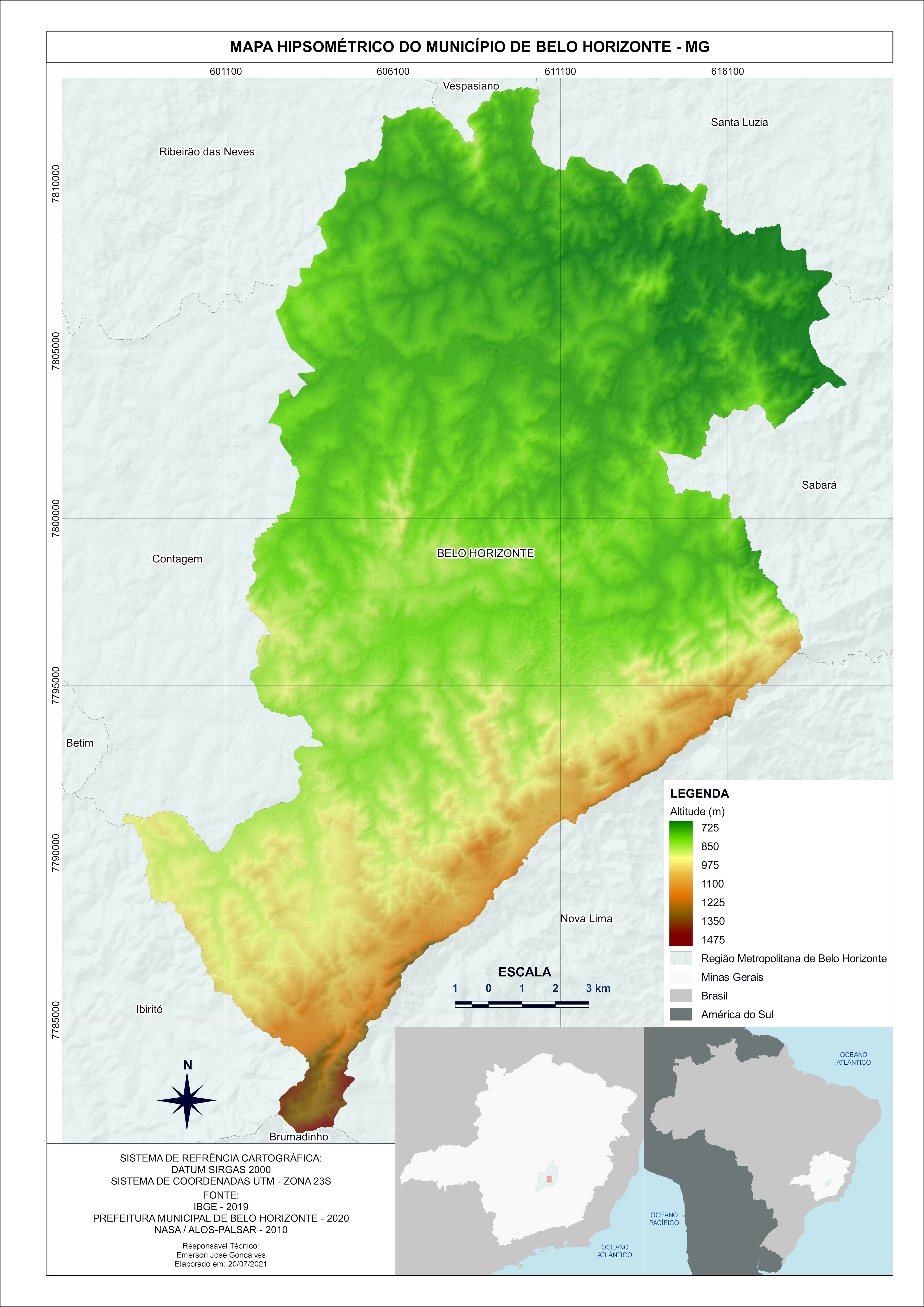
Uso do solo Regional Centro Sul / Bhte


Tools used
QGIS
More by Emerson José Gonçalves


You might also like


Join the community!
We're a place where geospatial professionals showcase their works and discover opportunities.
Uso do solo Regional Centro Sul / Bhte
More by Emerson José Gonçalves
You might also like
We're a place where geospatial professionals showcase their works and discover opportunities.