It's probably best to warn you that I am really new when it comes to processing geospatial data. I still need to learn a lot of things. This is probably my first personal project with geospatial data outside of work.
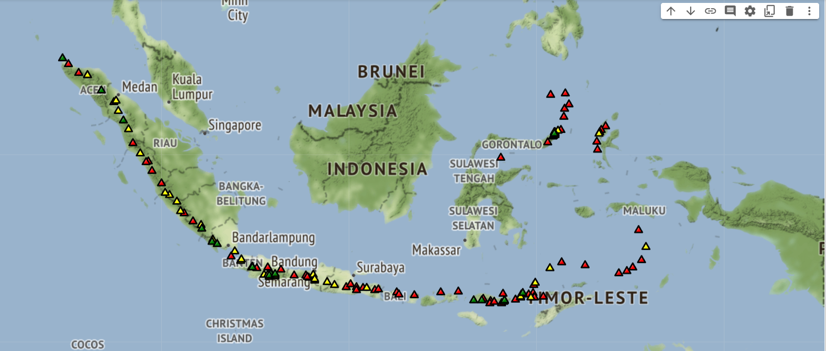
I use Python and Folium to plot the location data of all the active volcanoes in Indonesia. There are at least 127 volcanoes across the country, ranging from active volcanoes with eruption histories as recent as a few months ago to volcanoes with no known history of eruption. Essentially, Indonesia leads the world with the largest number of active volcanoes.
I gathered the volcanoes data from a government’s website called MAGMA Indonesia and stored them into a CSV file.
According to the website, there are 3 kinds of volcanoes in Indonesia.
- Type A, with a total number of 76, are volcanoes with a history of eruption since the year of 1600s.
- Type B, with a total number of 30, are volcanoes with a history of eruption before the year 1600.
- Type C, with a total number of 21, are volcanoes with no known history of eruption, but still show traces of volcanic activities, such as solfatara or fumarole.
So, I plotted every 127 volcanoes in Indonesia according to their volcanic activity. Type A, the most active ones, are colored red, Type B are colored yellow, and Type C the least active ones are colored green.
You can read more and see more maps I have created on my Medium blog here or check out the notebook on my Github page here.