
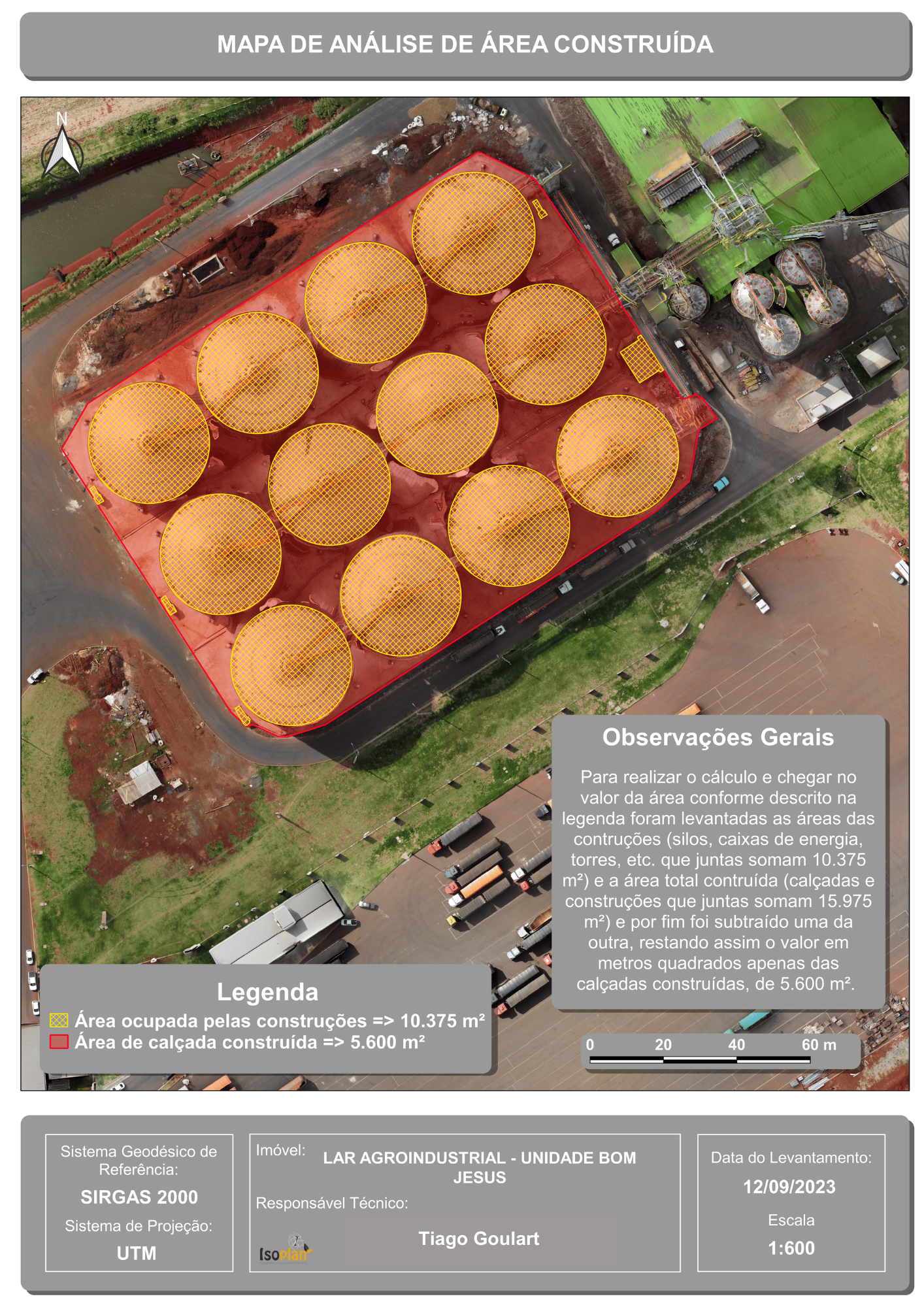
I created a map for a feed production facility that includes several silos. At the request of my client, I calculated the area of all the silos and the constructed pavement. To accomplish this, I used an image generated by a drone, which I personally captured in the field. After processing the data through Open Drone Map, I arrived at the final results, as depicted in the following map.
Area Analysis by Photogrammetry
Plug-ins used
LFtoolsQuickMapServices
tags
aerial imageryDronePhotogrammetry
More by TIAGO LANDIM GOULART DE OLIVEIRA


You might also like


Join the community!
We're a place where geospatial professionals showcase their works and discover opportunities.