Sign up or log in to your Spatialnode account.

Takes less than a few seconds.

Contour Map and Topographic Profile

Amira Ramadan
Amira Ramadan•

March 02, 2022

Contour Map and Topographic Profile

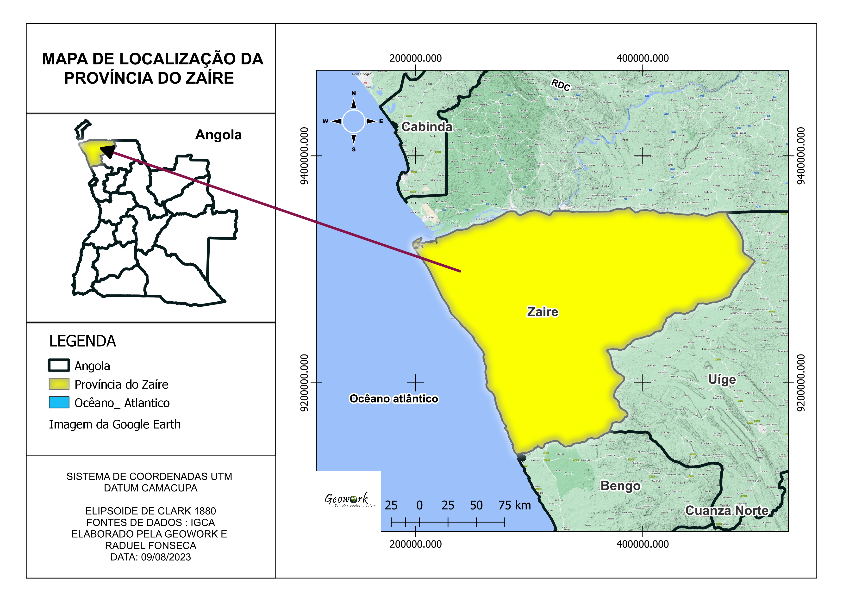
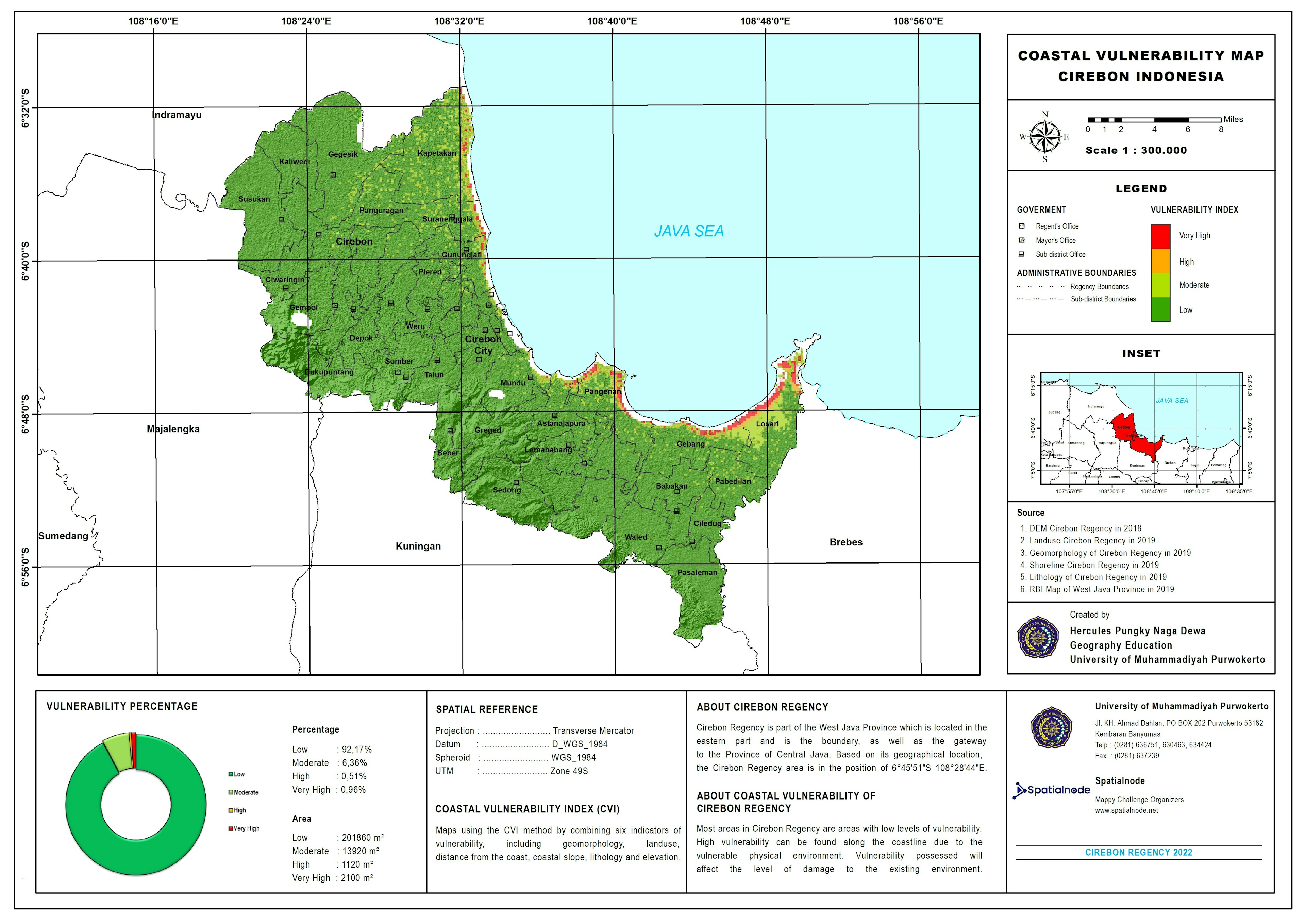
Contour Map and Topographic Profile of Sina


Tools used

ArcMapContour Data Visualization

Plug-ins used

ArcMapData Visualization

tags

SinaTopographic

More by Amira Ramadan

Deforestation in Rondonia, Brazil
320
The Soil Map Of Ethiopia
810

You might also like

Mapeamento urbano de Curitiba
Fernanda Rezende
Mapeamento urbano de Curitiba
Fernanda Rezende
18
Virtul Ambiental
Hugo Pereira Lima
Virtul Ambiental
Hugo Pereira Lima
9
Mapa Agrícola para Penhor de Grãos
Simone Malhado da Silva
Mapa Agrícola para Penhor de Grãos
Simone Malhado...
4
Declividades do Rio de JAneiro - RJ
LETICIA MARIA LEAL MALHEIROS
Declividades do Rio de JAneiro - RJ
LETICIA MARIA...
16
Hypsometric map of Curitiba, Brazil
ANGELO RAFAEL ANDRADE
Hypsometric map of Curitiba, Brazil
ANGELO RAFAEL ANDRADE
345
Current and Future Land Use Analysis
TIAGO LANDIM GOULART DE OLIVEIRA
Current and Future Land Use Analysis
TIAGO LANDIM...
22
Identification of species in Slavonice
Miguel Santellan
Identification of species in Slavonice
Miguel Santellan
20
Mapping of cities and air polution
Ani Pearn
Mapping of cities and air polution
Ani Pearn
12
Idaho Wells and Lead Mines
Keran Nkongolo
Idaho Wells and Lead Mines
Keran NkongoloPro
3
VCI - Drought monitoring
anderson rodrigues ribeiro
VCI - Drought monitoring
anderson rodrigues ribeiro
11
Setores Fundiários - REBIO DO TINGUÁ
Williane de Vasconcelos Meneses
Setores Fundiários - REBIO DO TINGUÁ
Williane de...
6
Mapa Base - Guia de campo e Localização
Ariel Horst
Mapa Base - Guia de campo e Localização
Ariel Horst
8

Join the community!

We're a place where geospatial professionals showcase their works and discover opportunities.

Sign Up for free