 He")
.png&w=3840&q=100)
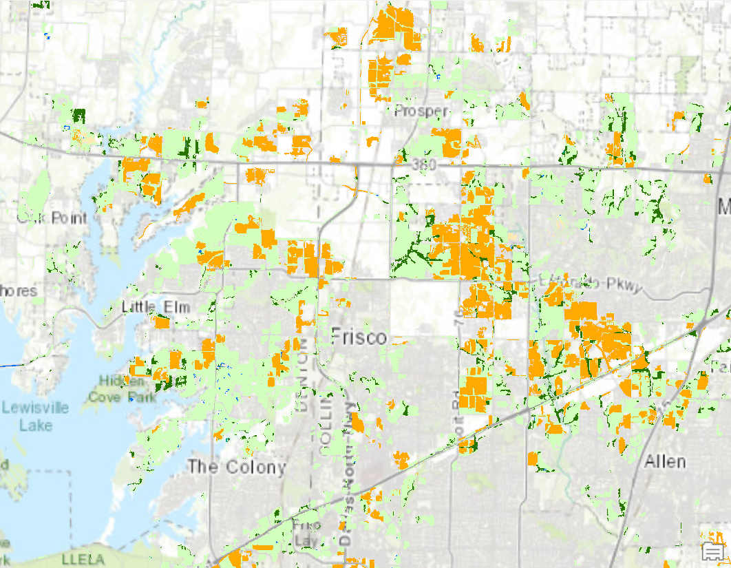
This project explored the relationship between environmental hazards and racial disparities in Wayne County, Michigan. I geocoded the locations of Toxic Release Inventory (TRI) facilities using address-based data and created 1-mile buffers to analyze population exposure. Census block group data was intersected with these buffers to calculate the minority population percentage near TRI sites. Two methods were compared: whole block group analysis and proportional area-based population estimation. The results revealed how minority communities may disproportionately live near hazardous sites. This project combined geocoding, spatial overlay, and demographic analysis to address an environmental justice question using GIS.
Geocoding and Environmental Justice
Plug-ins used
ArcGIS Pro Geocoding ToolsBuffer ToolCensus Attribute Analysisraster calculatorSpatial Join / Intersect
tags
ArcGIS ProCensus Dataenvironmental justicegeocoding Toxic Exposure
More by Yuxin (Sienna) He
.png&w=3840&q=100)


.png&w=3840&q=100)
.png&w=3840&q=100)

You might also like


Join the community!
We're a place where geospatial professionals showcase their works and discover opportunities.