Sign up or log in to your Spatialnode account.

Takes less than a few seconds.

Jefferson County Tax Income

Sean Willis
Sean Willis•

April 06, 2023

Jefferson County Tax Income

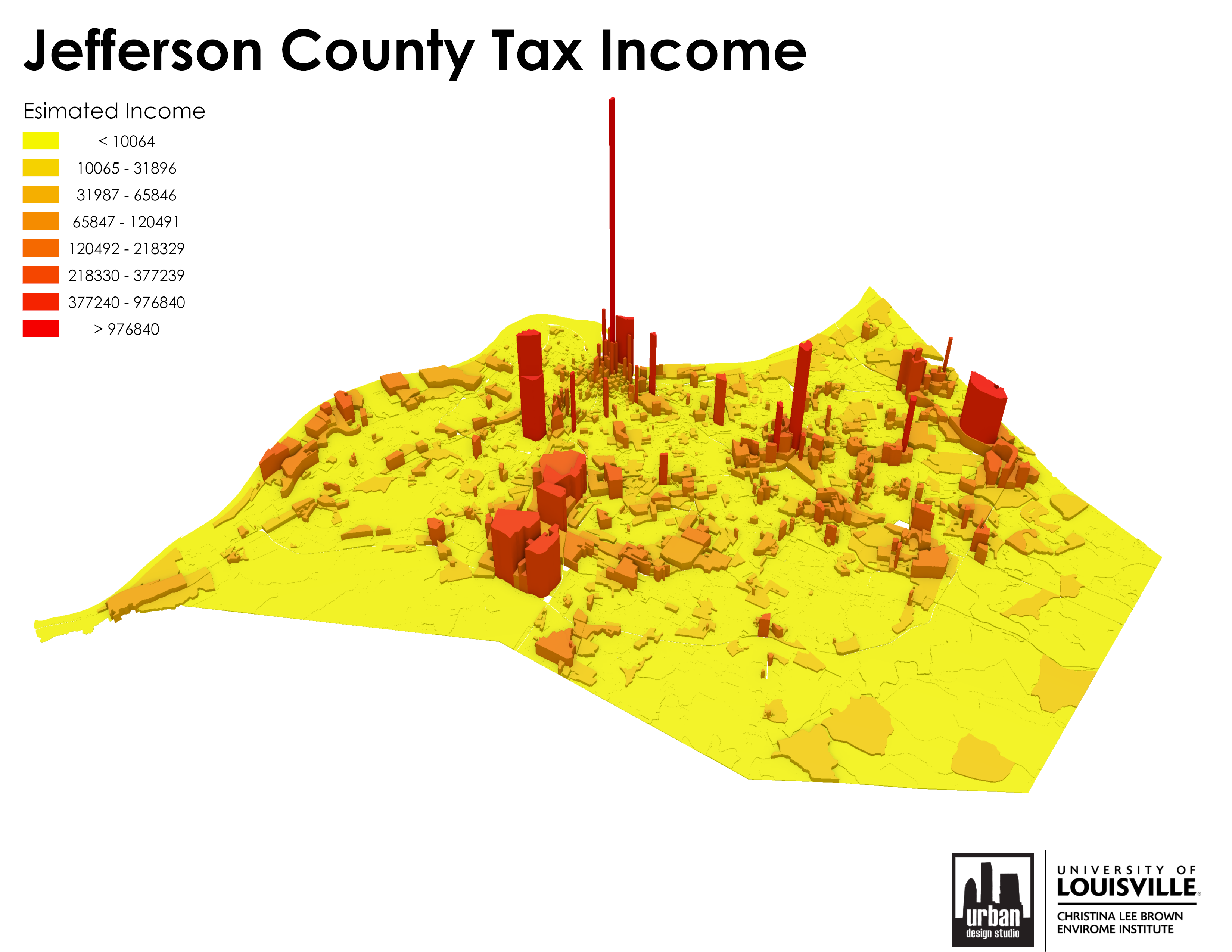
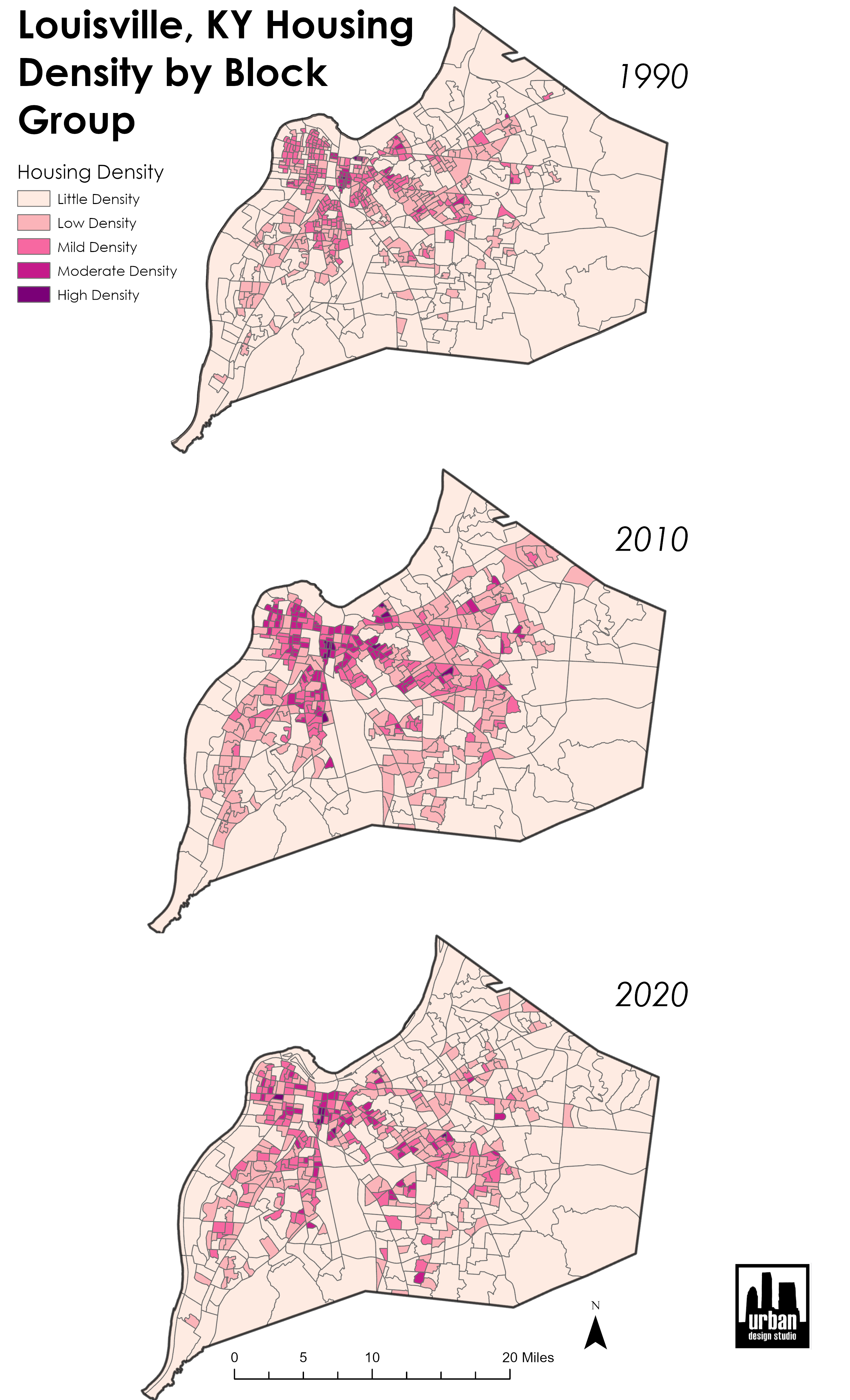
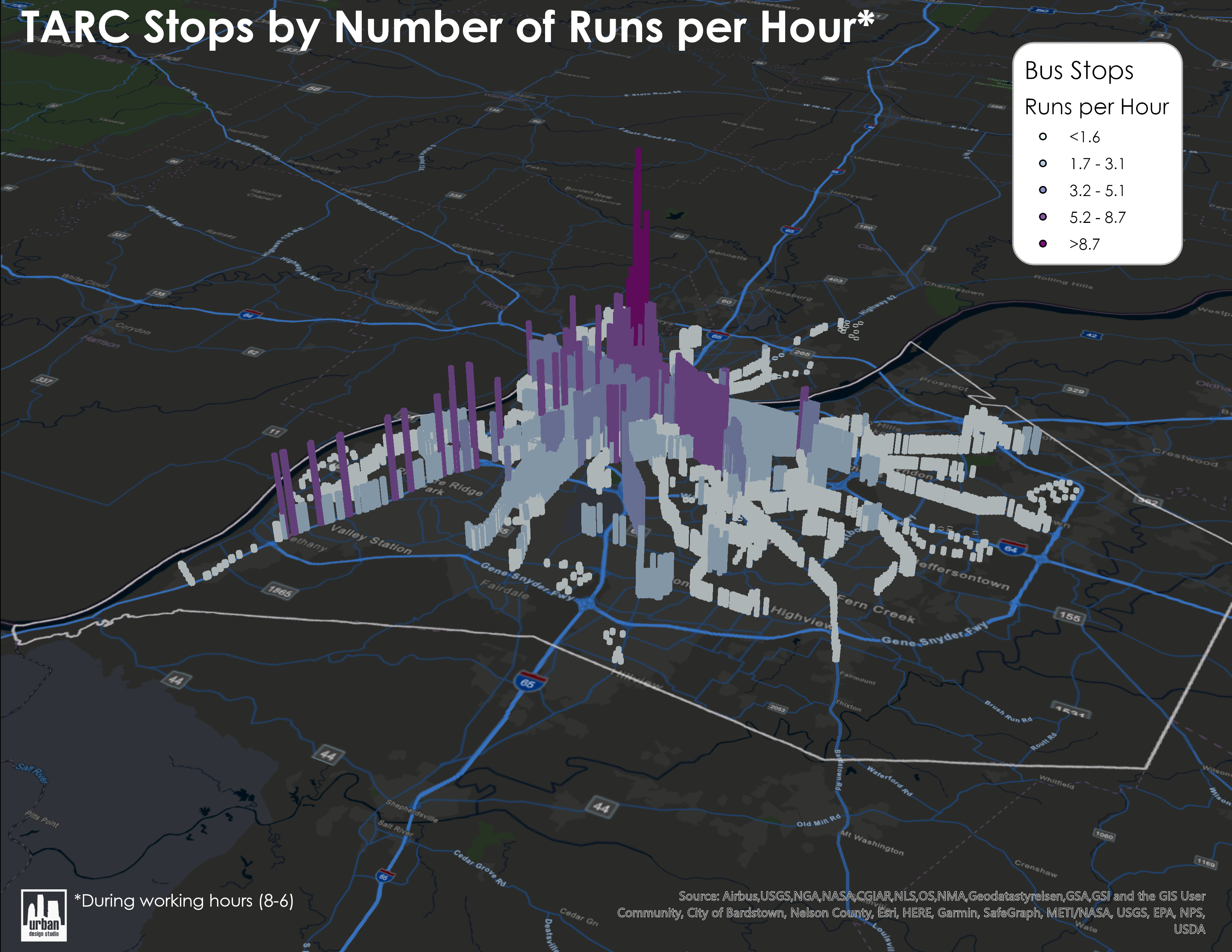
Part of a series of maps. I created multiple maps of tax income for different neighborhoods in order to compare what types of zoning and buildings generate the most tax revenue and increase the economic viability of neighborhoods.


Tools used

ArcGIS Pro

Plug-ins used

None

tags

3DArcGISlouisvilleTax

More by Sean Willis

Canopy Cover and Heat Severity
74
Louisville, KY Housing Density
20
JCPS District 4 Tree Plantings
41
TreesLouisville JCPS Plantings
42
Canopy Cover by Zip Code
117
Tree Canopy in Redlined Districts
118
Priority Planting in Louisville, KY
119
Old Louisville Property Tax Income
16
Waste Container Inventory
19
Louisville Light Rail Proposal
85
Intersection Collisions in Louisville
20
TARC Stops by Headway
12

You might also like

Mapa Litológica
RODRIGO DE ARAUJO BELOTE
Mapa Litológica
RODRIGO DE...
0
URBAN ACREAGE ALONG US-MEX BORDER
Spencer Scoresby
URBAN ACREAGE ALONG US-MEX BORDER
Spencer Scoresby
8
Communities Concentration
Marcelo Aguilera
Communities Concentration
Marcelo Aguilera
602
Hipsométrico de Santa Fé de Goiás-GO
JULIMAR ALVES DE PAULA
Hipsométrico de Santa Fé de Goiás-GO
JULIMAR ALVES...
290
Diving Monterey Atlas
Andrew Middleton
Diving Monterey Atlas
Andrew Middleton
294
Concentração de Cádmio
Sidney dos Santos
Concentração de Cádmio
Sidney dos Santos
15
London Region Average Income for 2010
Ologun Emmanuel Ayowole
London Region Average Income for 2010
Ologun Emmanuel Ayowole
3
Advanced map: Vintage map
Franciele Morlin Carneiro
Advanced map: Vintage map
Franciele Morlin Carneiro
7
Global distribution of C. furcoides
Philip Russo
Global distribution of C. furcoides
Philip Russo
229
Grant Application Map
Robert McCann
Grant Application Map
Robert McCann
86
Landsat 8: Mapping Wildfires
Sara Fatimah
Landsat 8: Mapping Wildfires
Sara Fatimah
13
MUNICÍPIO DE BELÉM EM 1988
Mapa_Geo
MUNICÍPIO DE BELÉM EM 1988
Mapa_Geo
41

Join the community!

We're a place where geospatial professionals showcase their works and discover opportunities.

Sign Up for free