Sign up or log in to your Spatialnode account.

Takes less than a few seconds.

Old Louisville Property Tax Income

Sean Willis
Sean Willis•

August 30, 2023

Old Louisville Property Tax Income

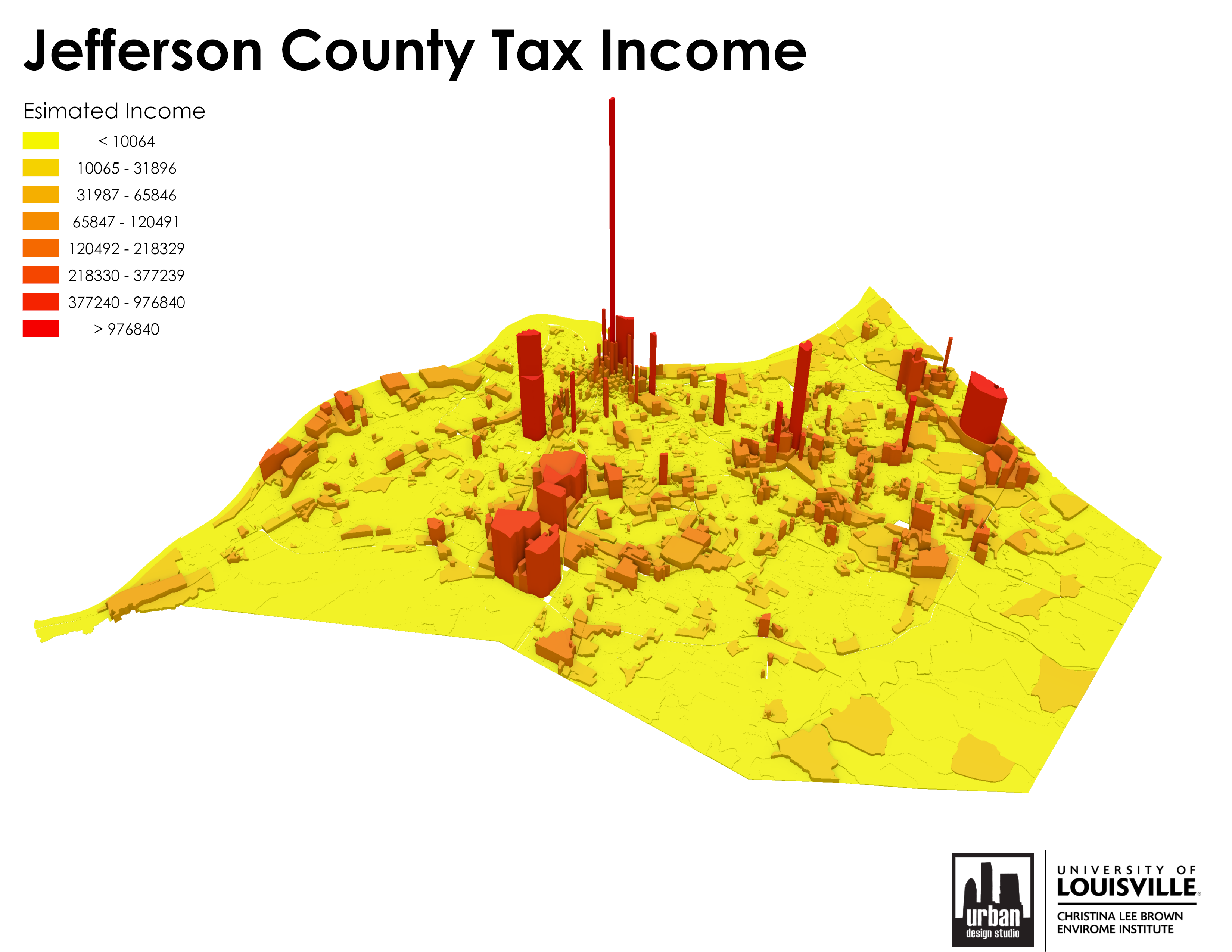
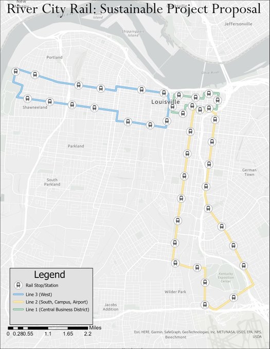
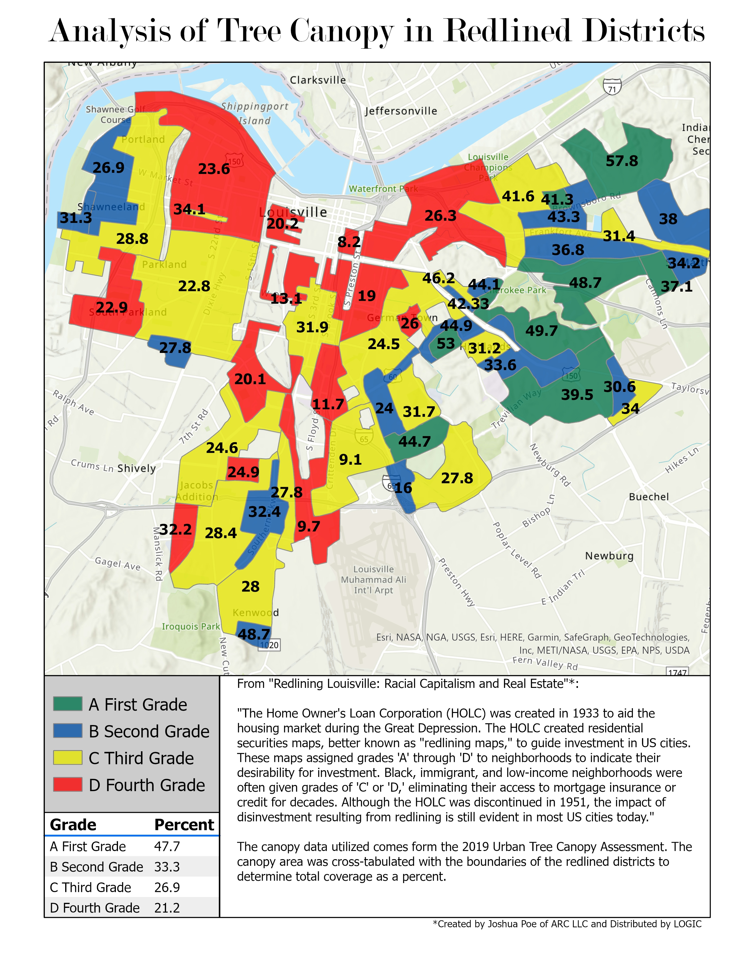
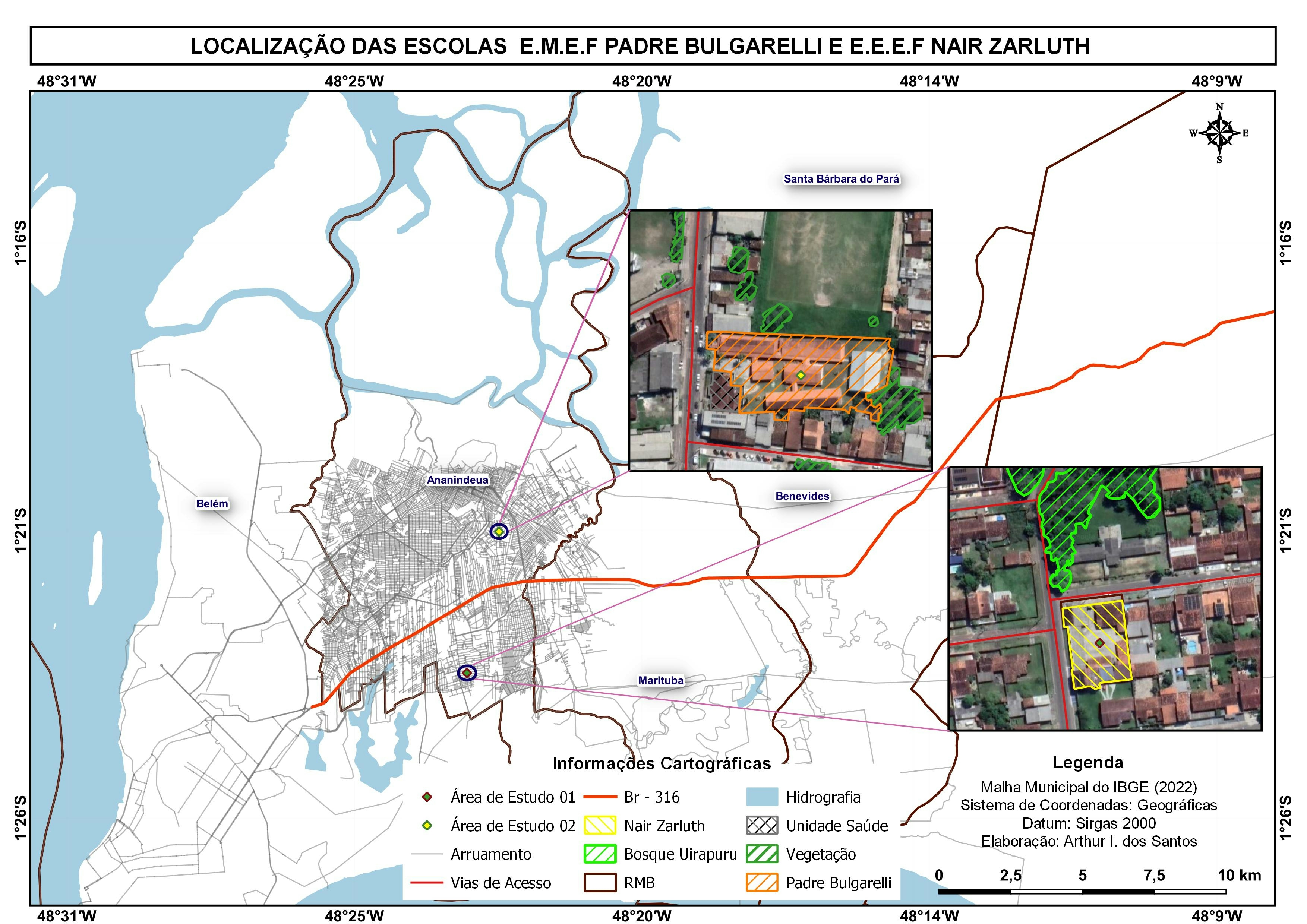
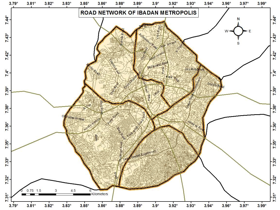
This is one of the completed versions of the maps made for the property tax project, I uploaded a preliminary version of Jefferson County as a whole before. Decided to upload this as well to show a few tweaks and because I love Old Lou.


Plug-ins used

None

tags

3DArcGIS ProTaxTax Income

More by Sean Willis

Intersection Collisions in Louisville
21
Waste Container Inventory
23
TreesLouisville JCPS Plantings
46
JCPS District 4 Tree Plantings
44
Priority Planting in Louisville, KY
123
Louisville Light Rail Proposal
90
Jefferson County Tax Income
61
Louisville, KY Housing Density
25
Tree Canopy in Redlined Districts
129
TARC Stops by Headway
16
Canopy Cover by Zip Code
128
Canopy Cover and Heat Severity
81

You might also like

Localização da área de estudo
Lucas de Siqueira Cardinelli
Localização da área de estudo
Lucas de...
48
Train Station Catcment Area
Victor James
Train Station Catcment Area
Victor James
10
Walking Range for DC Schools
j
Walking Range for DC Schools
j
9
Mapa de Localização
Lucas de Siqueira Cardinelli
Mapa de Localização
Lucas de...
31
temperature map
Adriano jose de Barros
temperature map
Adriano jose...
22
Focos de queimada Pantanal
José Geraldo Ribeiro Junior
Focos de queimada Pantanal
José Geraldo...
6
Utah Air Emissions
Keran Nkongolo
Utah Air Emissions
Keran NkongoloPro
23
Mapa de localização SLB
Vanessa Cristiane Santos
Mapa de localização SLB
Vanessa Cristiane Santos
48
Location of wells in Jacaré Pagua
fernand Lopes
Location of wells in Jacaré Pagua
fernand Lopes
11
Sand mining in Rio Pardo
Fernando Santos
Sand mining in Rio Pardo
Fernando Santos
10
Supervised classification image of Hall County, Georgia
Kolawole Arowoogun
Supervised classification image of Hall County, Georgia
Kolawole Arowoogun
254
Flood Hazard Mapping of Osogbo City
Faith Abiala
Flood Hazard Mapping of Osogbo City
Faith Abiala
40

Join the community!

We're a place where geospatial professionals showcase their works and discover opportunities.

Sign Up for free