Sign up or log in to your Spatialnode account.

Takes less than a few seconds.

New York City Open Data

Harrison Hyatt
Harrison Hyatt•

May 24, 2022

New York City Open Data

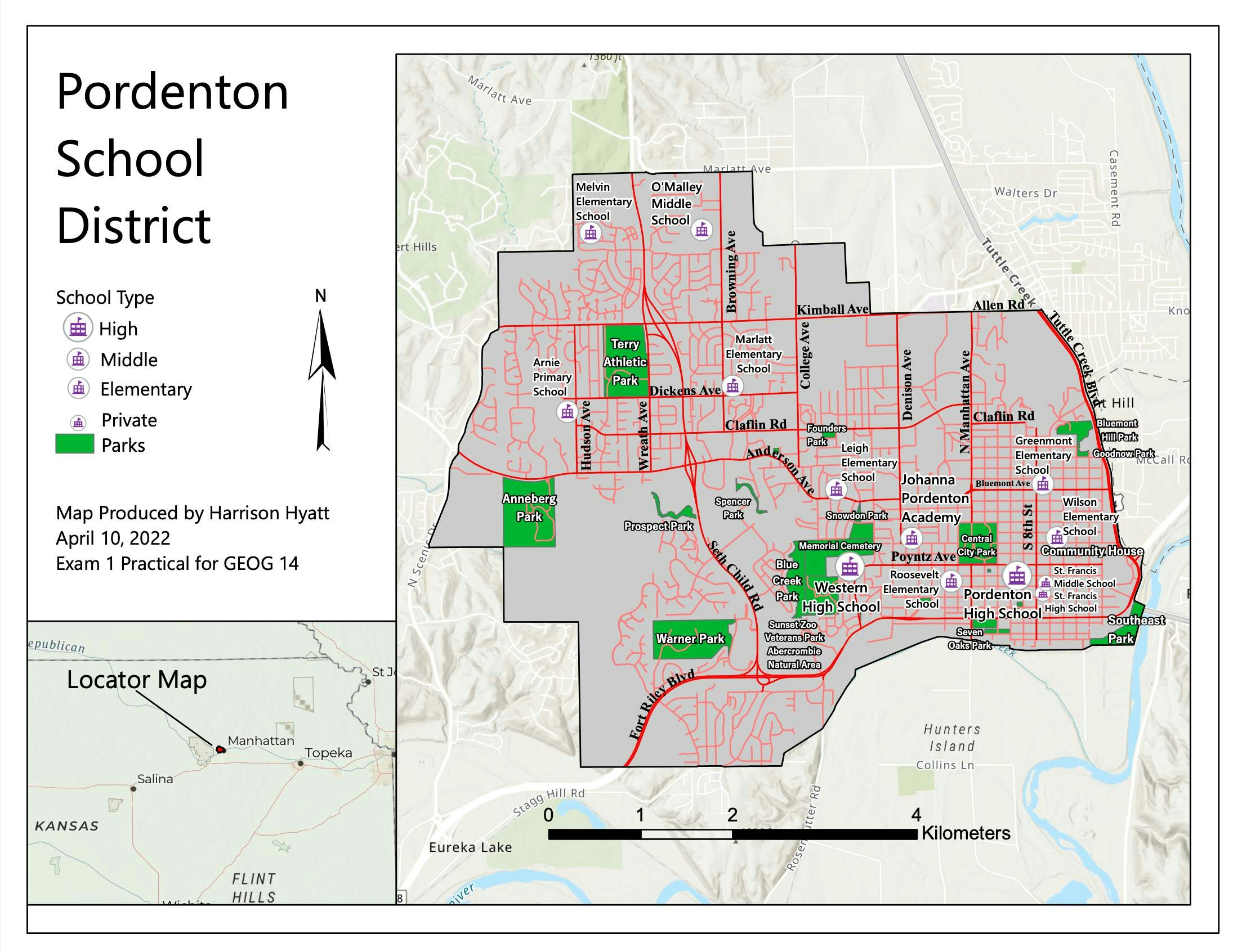
This dashboard explores NYC's libraries, school districts, and housing density.

Demo

Tools used

ArcGIS Dashboards

tags

nyc

More by Harrison Hyatt

Pordenton School District
36
City of Redding
City of Redding
25
A Visitor's Guide to Miracle Mile, LA
28
Car Collisions in Los Angeles 2014-2019
80
Boundaries of Waters of the US
24
Saving Kauai's Seabirds
18

You might also like

Demography of Refugee Camps, CXB
Sukanto Das
Demography of Refugee Camps, CXB
Sukanto Das
194
Socioeconomic vulnerability risk
Balogun Temitope
Socioeconomic vulnerability risk
Balogun Temitope
567
Central Part of Osun LGA
Tijani Habeeb Temitayo
Central Part of Osun LGA
Tijani Habeeb Temitayo
292
Louisville, KY Housing Density
Sean Willis
Louisville, KY Housing Density
Sean Willis
26
Supervised Classification
Marvin Ayeh
Supervised Classification
Marvin Ayeh
17
Land use of the RH7, SC, Brazil (2019)
Nathalia Jastrombek
Land use of the RH7, SC, Brazil (2019)
Nathalia Jastrombek
41
Population density Map (ROU)
Ioana Zaharie
Population density Map (ROU)
Ioana Zaharie
14
Mapa Comparativo sobre o método (DOS)
Breno Nunes
Mapa Comparativo sobre o método (DOS)
Breno Nunes
15
MAPA TOPOGRÁFICO DE SÃO JOÃO D´ALIANÇA
Fenando Paulo Neto Alberto
MAPA TOPOGRÁFICO DE SÃO JOÃO D´ALIANÇA
Fenando Paulo...
201
Florida DEM
John Parker Dinkins
Florida DEM
John Parker Dinkins
61
Visualizing Patch Metrics with Fragstats
Ali Mulla
Visualizing Patch Metrics with Fragstats
Ali Mulla
59
Análise de Fragmentação da Paisagem
Paulo Vitor Moraes Estella
Análise de Fragmentação da Paisagem
Paulo Vitor...
7

Join the community!

We're a place where geospatial professionals showcase their works and discover opportunities.

Sign Up for free