Sign up or log in to your Spatialnode account.

Takes less than a few seconds.

Planta de Georreferenciamento IFPA

Giovanni Augusto Valente da Silva
Giovanni Augusto Valente da Silva•

December 18, 2023

Planta de Georreferenciamento IFPA

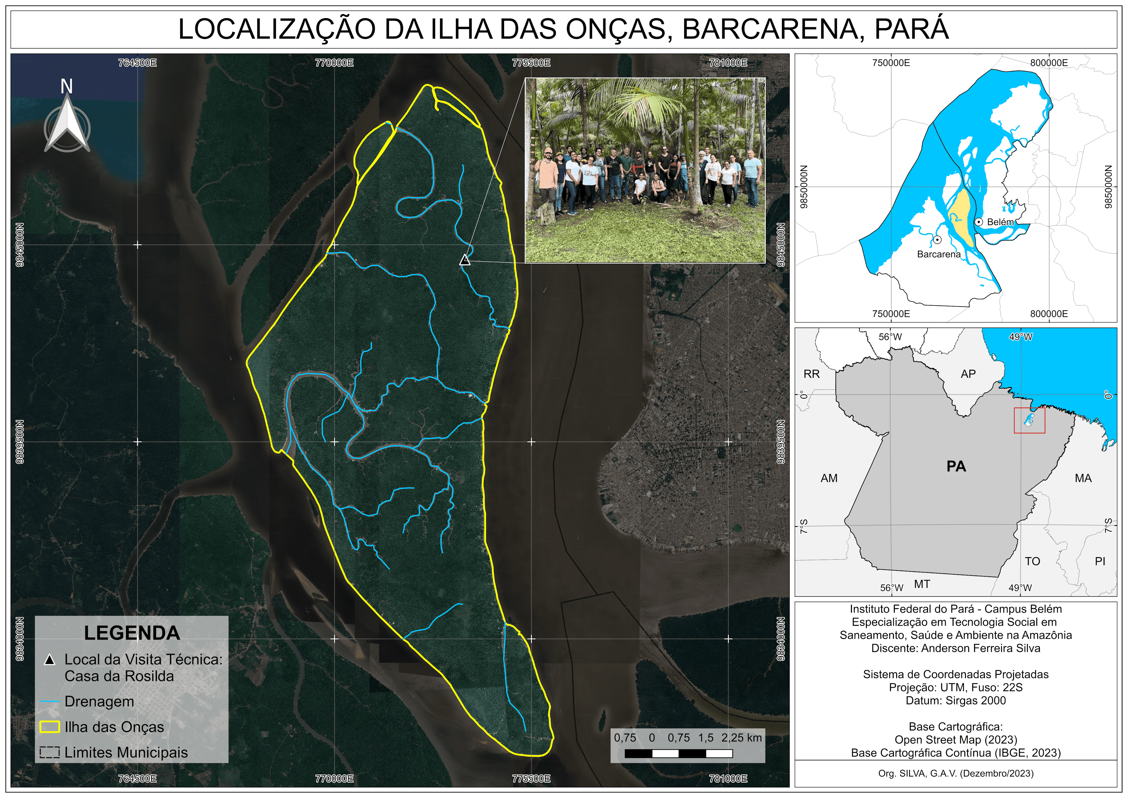
Planta de Georreferenciamento do IFPA - Campus Belém


Plug-ins used

Autodesk

tags

georeferencingGeorreferenciamentoPlanta

More by Giovanni Augusto Valente da Silva

Macrófitas no Parque Estadual Utinga, PA
18
MUNICÍPIO DE ABAETETUBA, PARÁ
69
UCS, IVAS, TST, de Ananindeua, PA
4
Poligonal por Distância e Azimutes
20
BH Rio Mutum, São Félix do Xingu, PA
26
Localização Ilha das Onças, Barcarena-PA
49
NDVI de Cametá, PA
NDVI de Cametá, PA
22
MDEde Parauapebas, PA
18
Intersecção antenas - escolas/hospitais
12

You might also like

PATHIX - A GUIDE MAP
Ogungbemi Ezekiel Tobiloba
PATHIX - A GUIDE MAP
Ogungbemi Ezekiel Tobiloba
216
Maternal Mortality & Poverty in USA
Solena Kronstedt
Maternal Mortality & Poverty in USA
Solena Kronstedt
18
Forest Trends in Nyungwe National Park
Marissa Kulkarni
Forest Trends in Nyungwe National Park
Marissa Kulkarni
40
Duhernal Lake Pollutant Load Modeling
Shrithik S
Duhernal Lake Pollutant Load Modeling
Shrithik S
8
Soil Map of Campo Largo, Brazil
ANGELO RAFAEL ANDRADE
Soil Map of Campo Largo, Brazil
ANGELO RAFAEL ANDRADE
289
2020 USA Elections
Ireoluwa Orodiji
2020 USA Elections
Ireoluwa Orodiji
10
USGS Topo 1909 Idaho Modern Hillshade
Michael Nau
USGS Topo 1909 Idaho Modern Hillshade
Michael Nau
23
Stinchfield Woods Land Cover
Hugo He
Stinchfield Woods Land Cover
Hugo He
6
Land Surface Temperature of Niterói/RJ
Pedro Marcus Santos Heizer
Land Surface Temperature of Niterói/RJ
Pedro Marcus...
123
Mapa de Localização
Lucas de Siqueira Cardinelli
Mapa de Localização
Lucas de...
29
Variability in Extent of Malheur Lake
Brittany Biro
Variability in Extent of Malheur Lake
Brittany Biro
5
Flood Risk Map of Mokwa LGA, Niger State
Akor, Daniel Enechojo
Flood Risk Map of Mokwa LGA, Niger State
Akor, Daniel Enechojo
9

Join the community!

We're a place where geospatial professionals showcase their works and discover opportunities.

Sign Up for free