

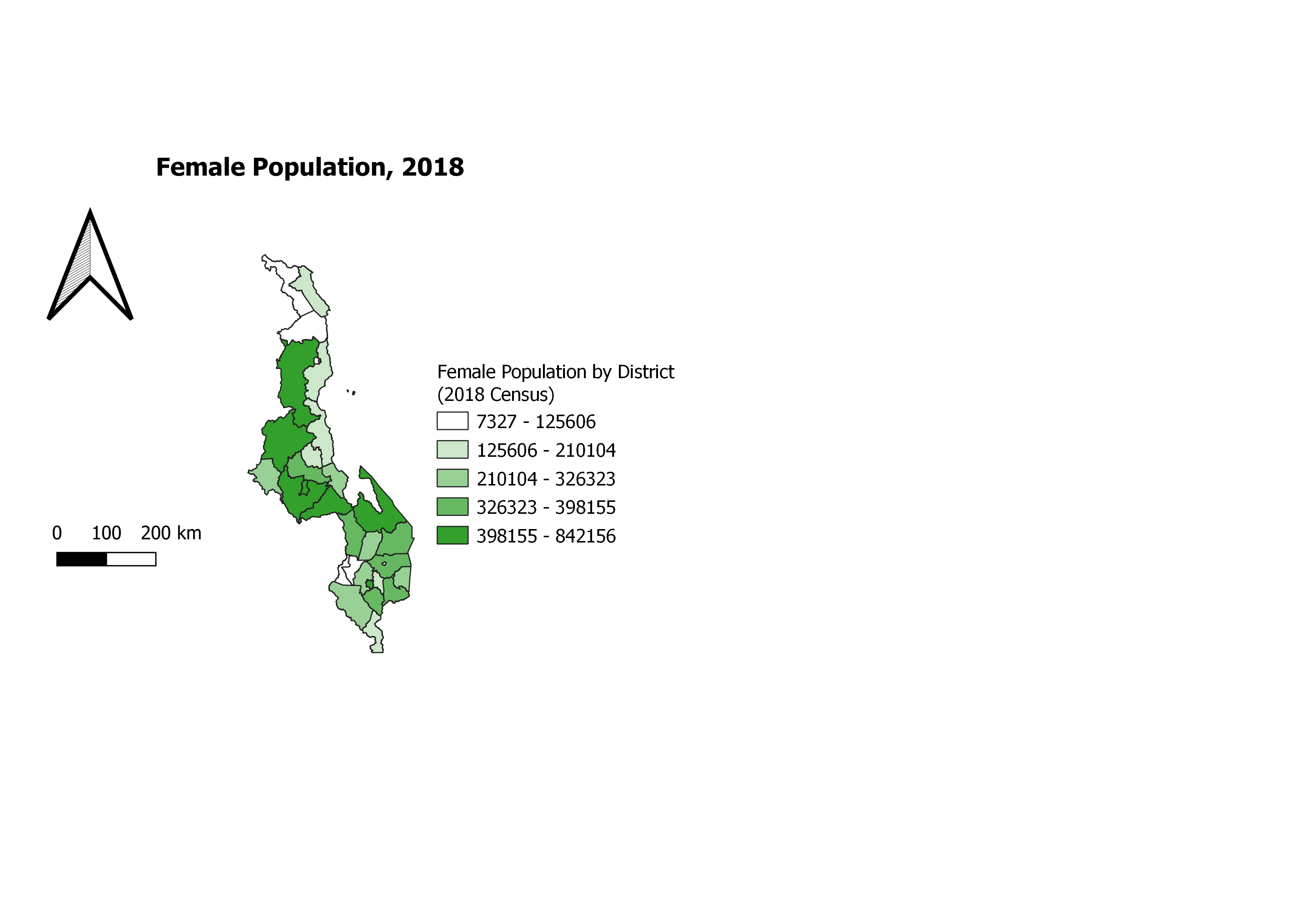
This map shows the population change with the year 2008 and 2018. The parts with white to light green colours, the change wasn't much, compared to areas with deep green. The change was drastic.
Population Change in Malawi
Tools used
ArcGIS OnlineArcMapQGIS
Plug-ins used
ArcGIS OnlineArcMapQGIS
tags
ArcMapData VisualizationMySQLQGIS
You might also like


Join the community!
We're a place where geospatial professionals showcase their works and discover opportunities.