

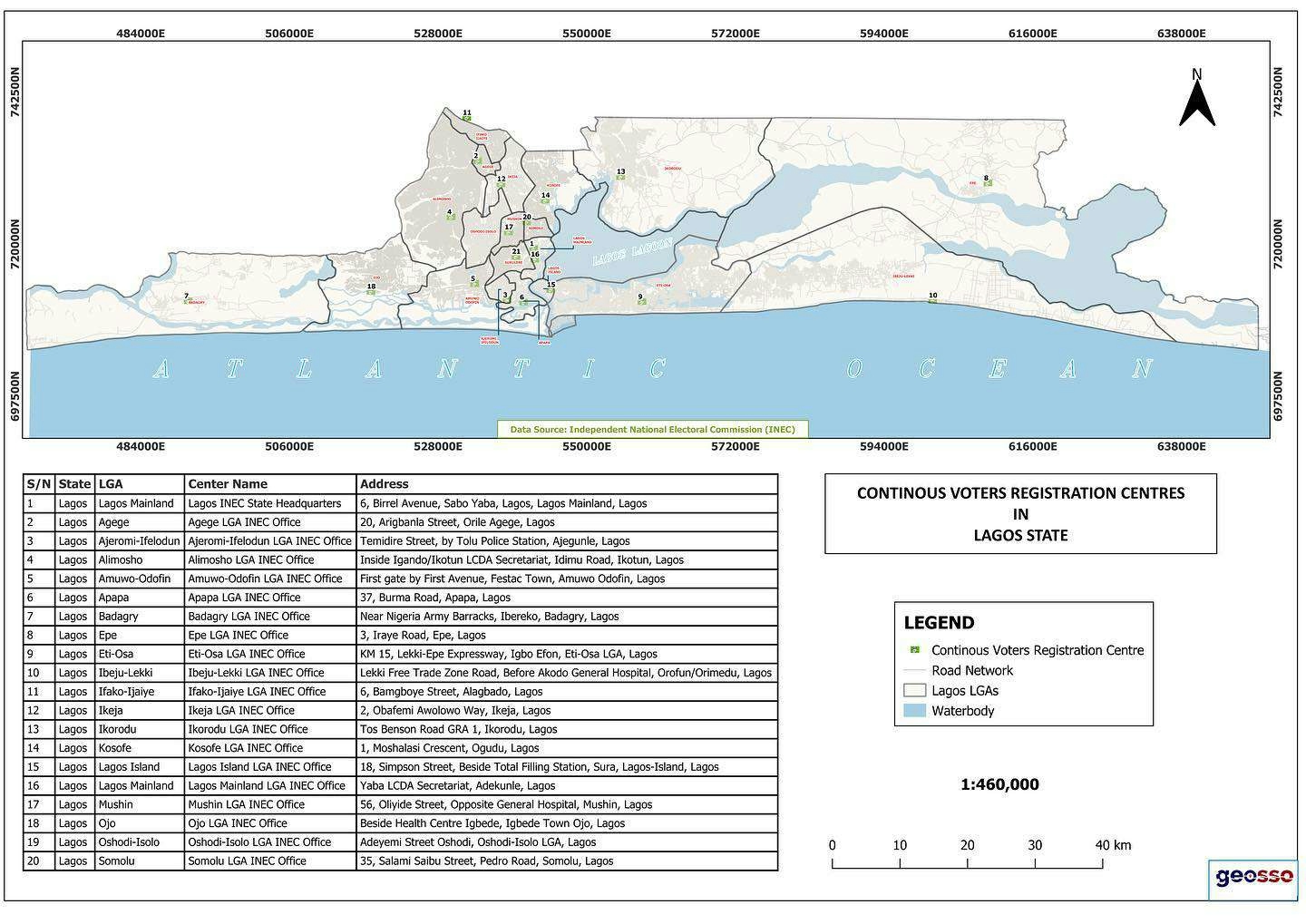
Choropleth map depicting probability of accessing skilled birth services in the Northern province of Rwanda. Derived from averaging raster files from Worldpop into administrative shape files level 5 (village) using R. STATA was used for map.
Skilled birth(Rwanda -Northern province)
Tools used
R Studio
tags
Demographicsdistancetopographic map
More by Jose Rubio-Valverde


You might also like

.svg "Keran Nkongolo")


Join the community!
We're a place where geospatial professionals showcase their works and discover opportunities.