

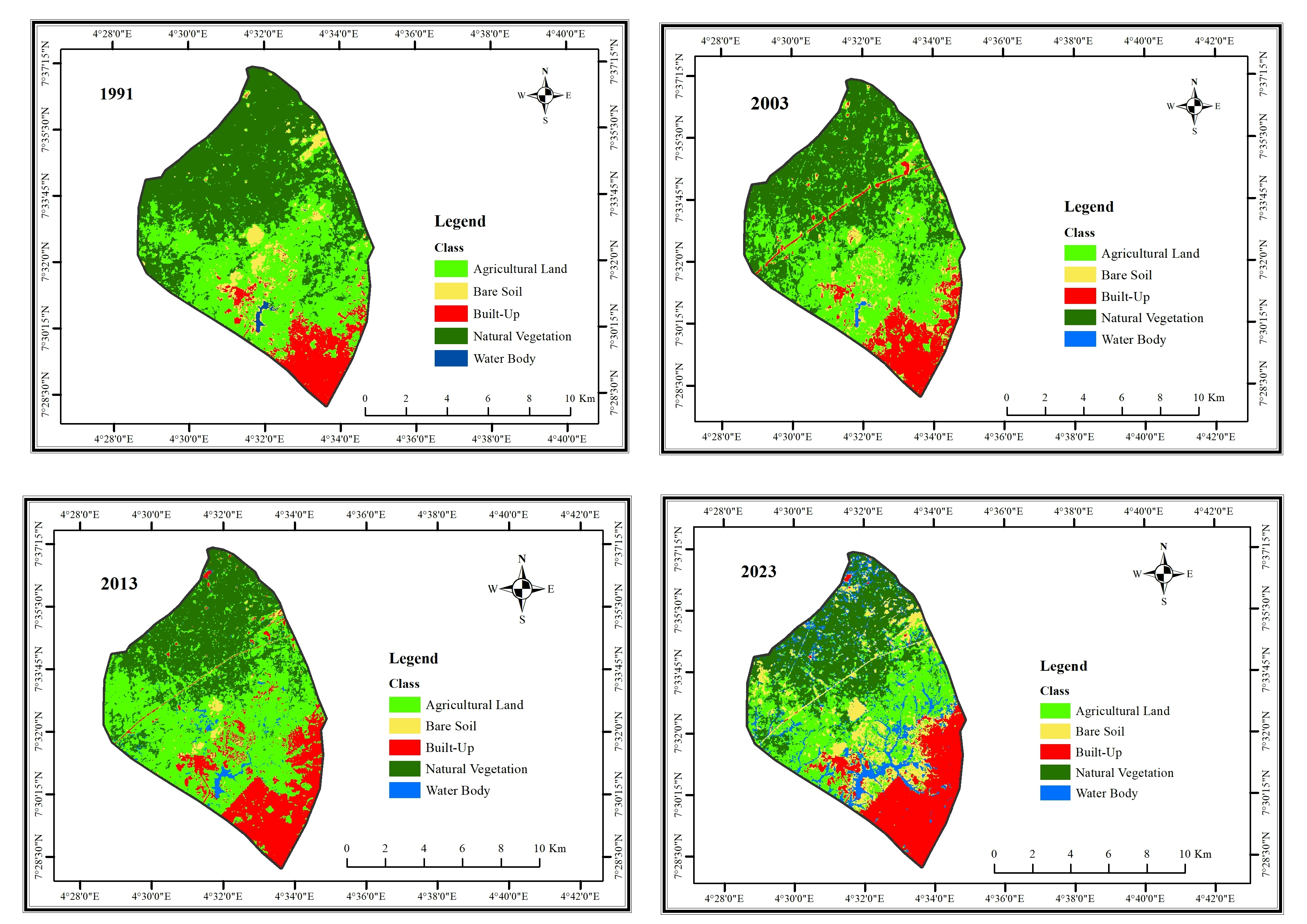
Selected parks for a research in Ibadan, Oyo State
Study Area Map
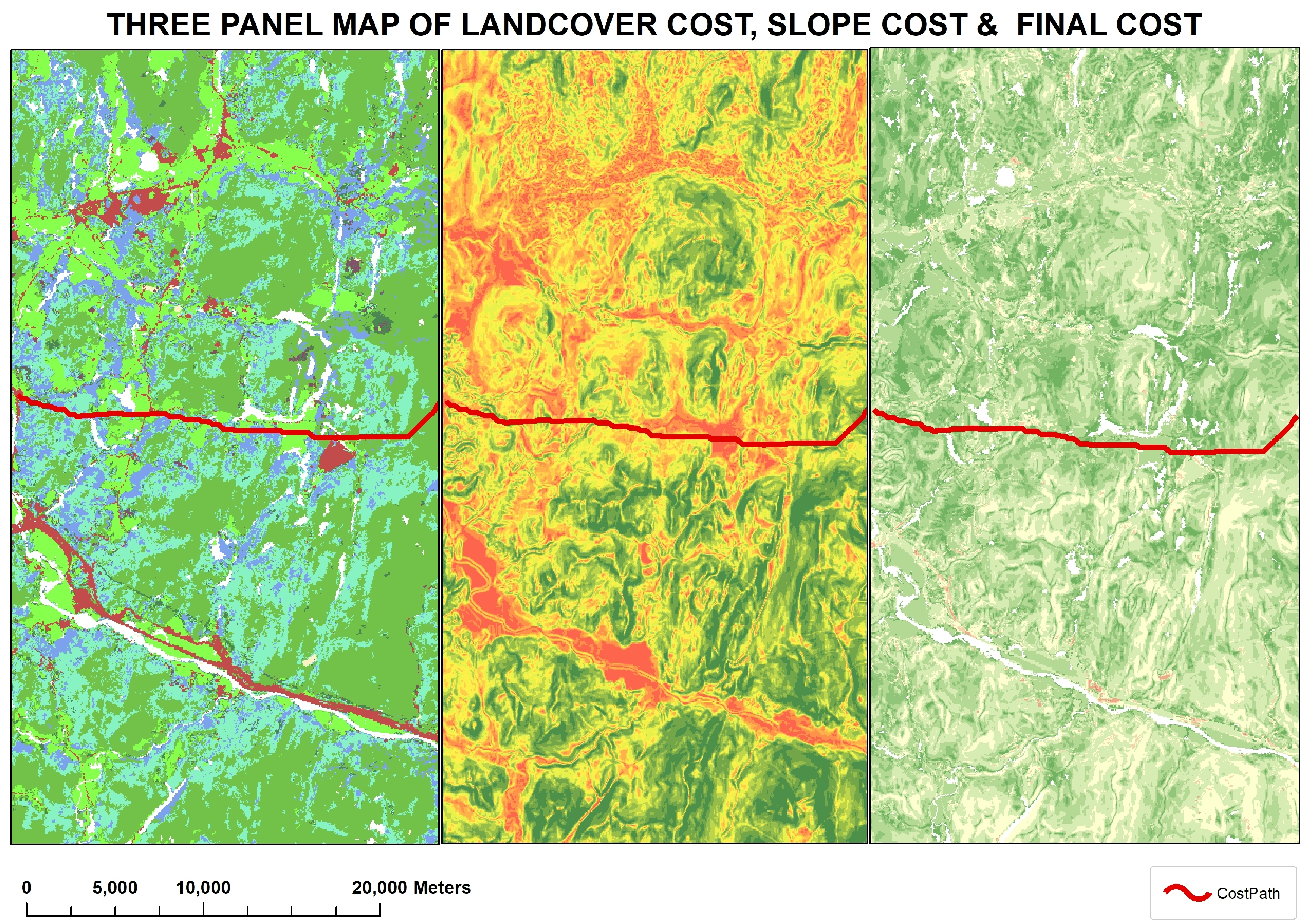
Tools used
ArcMapQGIS
tags
parks
More by Damilola Fadipe


You might also like


.png&w=3840&q=100)


Join the community!
We're a place where geospatial professionals showcase their works and discover opportunities.