
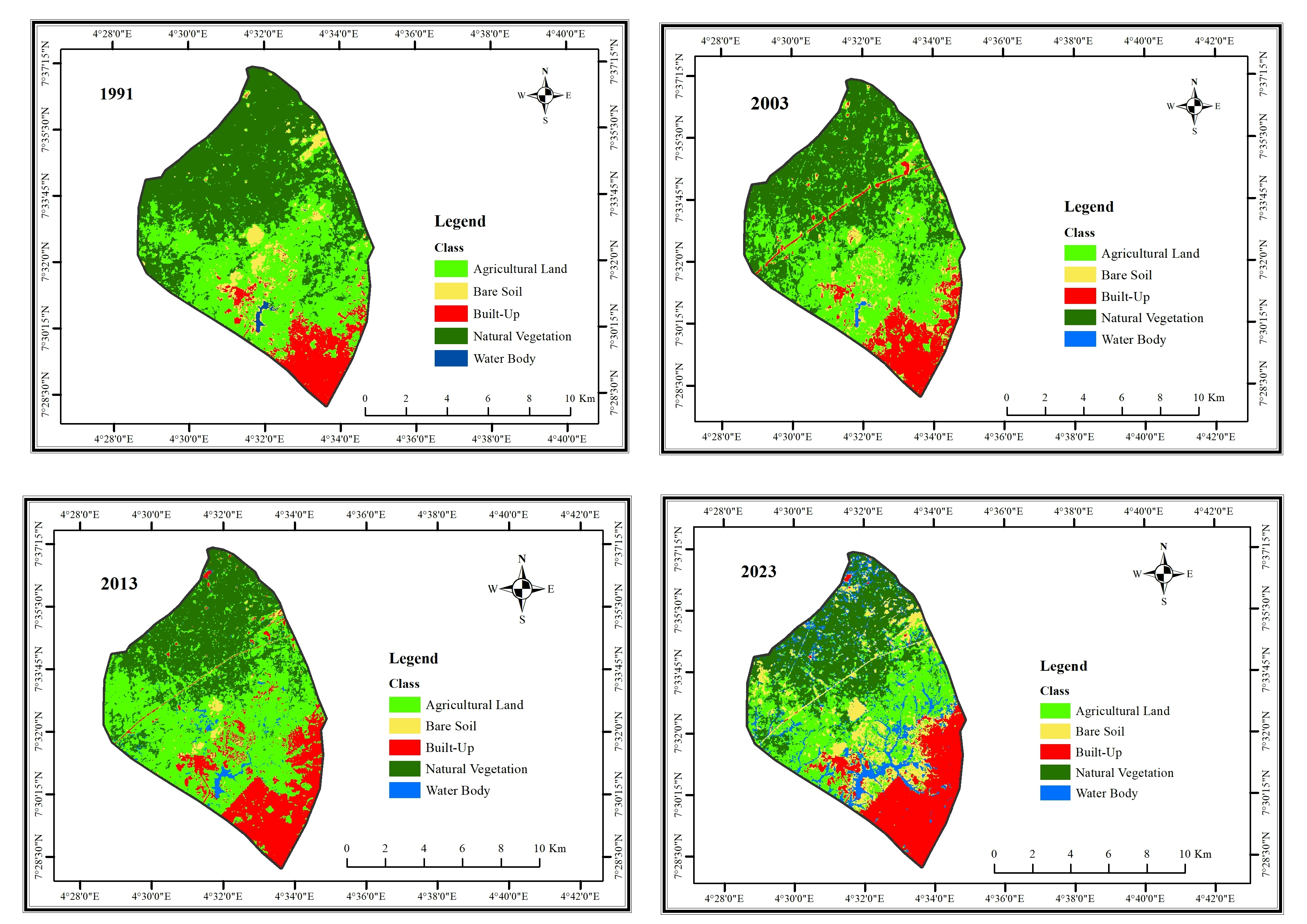
Satellite images download from USGS Earth Explorer
LGA boundary download from OpenStreetMap
QuickOSM plugin on QGIS was used to download the LGA boundary
ArcMap was used to classify the different land covers and produce the map
LAND COVER CHANGES IN IFE CENTRAL LGA
Tools used
ArcMapQGISUSGS Earth Explorer
Plug-ins used
maximum likelihood classificationQuickOSM
tags
land coverLandsatLULC
More by Damilola Fadipe


You might also like

.svg "Keran Nkongolo")


Join the community!
We're a place where geospatial professionals showcase their works and discover opportunities.