

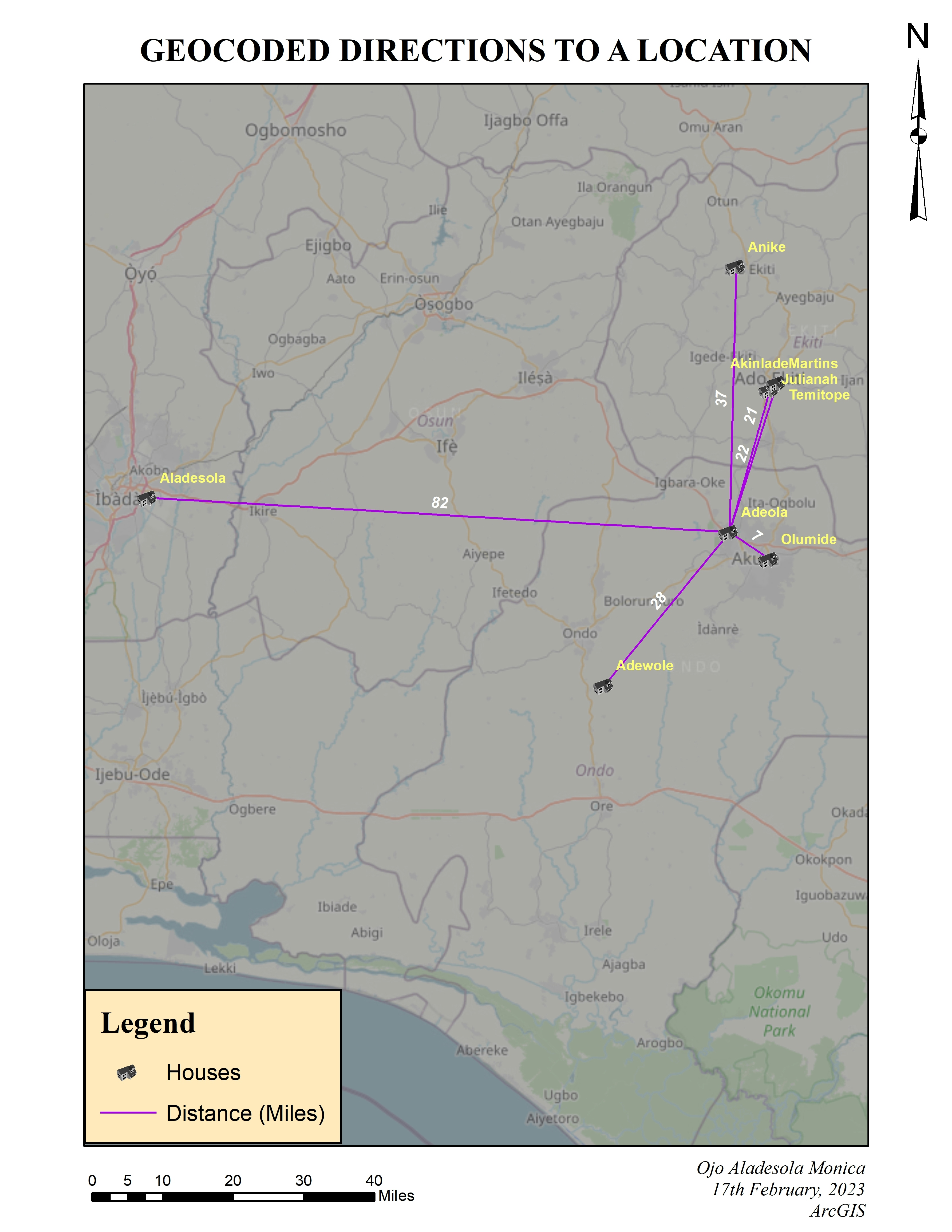
This project started with a copy of a 20 year old physical map to delineate fire boundary and spread.
Skills used in this project
· Georeferencing
· Heads’ up digitization
· Create custom address locator (achieved in part by some of the following listed)
· Geocoding
· Attribute Domains for standardization
· Joins and relates


.svg "Keran Nkongolo")