To manage the water infrastructure data for Troutdale, Oregan shapefiles were converted into geodatabase feature classes to more accurately display current data. Attribute domains were created to ensure data, like pipe diameters, was consistent to reduce the amount of errors in data entry. The snapping tool was used to create water lines that connected to existing valves. Additionally, adjusted water pressure zones by splitting and merging polygons to reflect the current data for Troutdale. Errors on the map, like a misplaced waterline and old unused well, were fixed by moving or deleting features.
These tools can be used in environmental management for tracking deforestation or habitat loss. By converting a shapefile of a forest area into a geodatabase would more effectively track changes over time. Using snapping tools to create forest boundaries, as well as merging or splitting polygons to adjust highly impacted areas would ensure up to date data of land degradation and forest health. This is very useful for conservation planning to make informed decisions and actions based on protecting ecosystems.

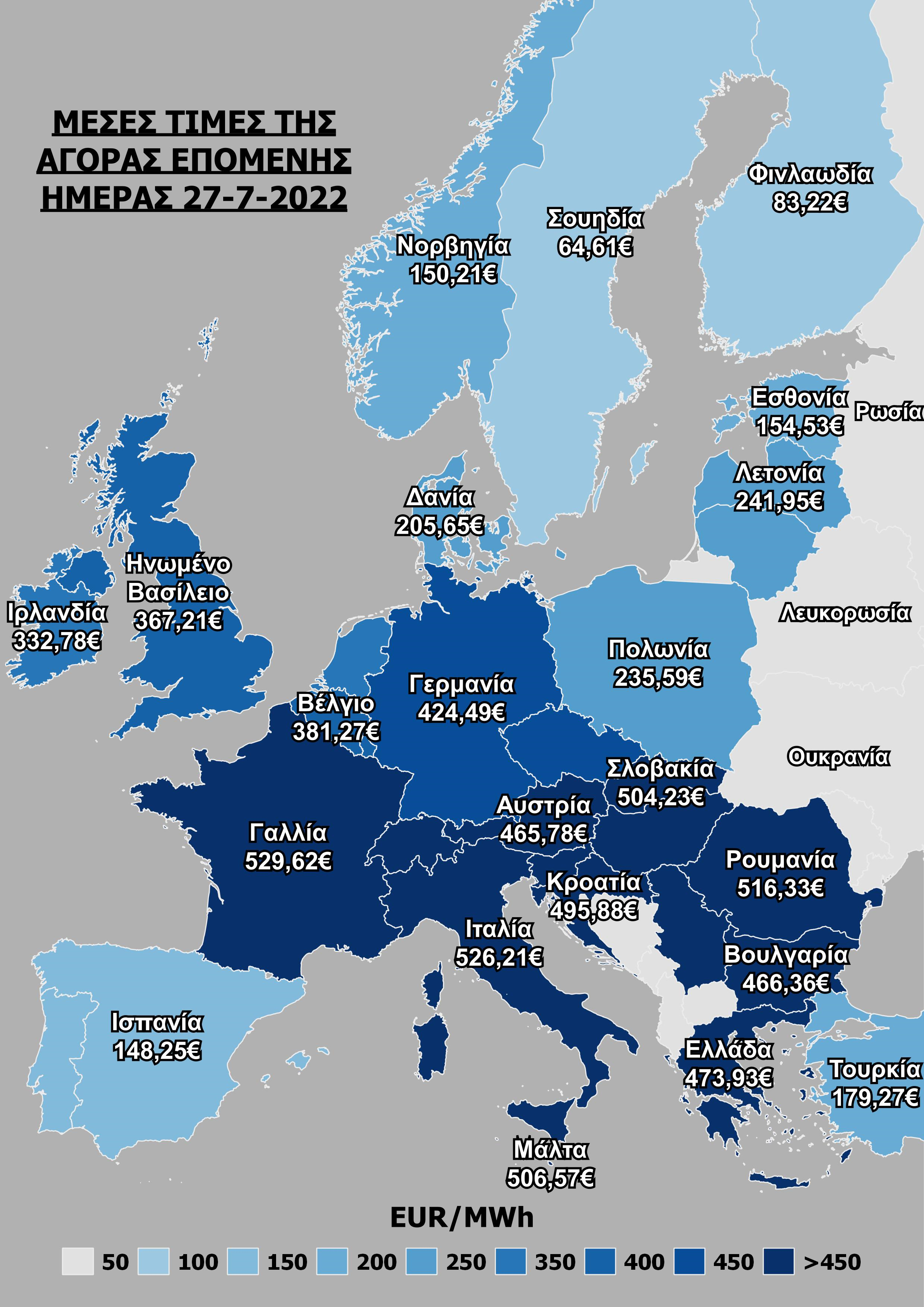
.png&w=3840&q=100)
.png&w=3840&q=100)