

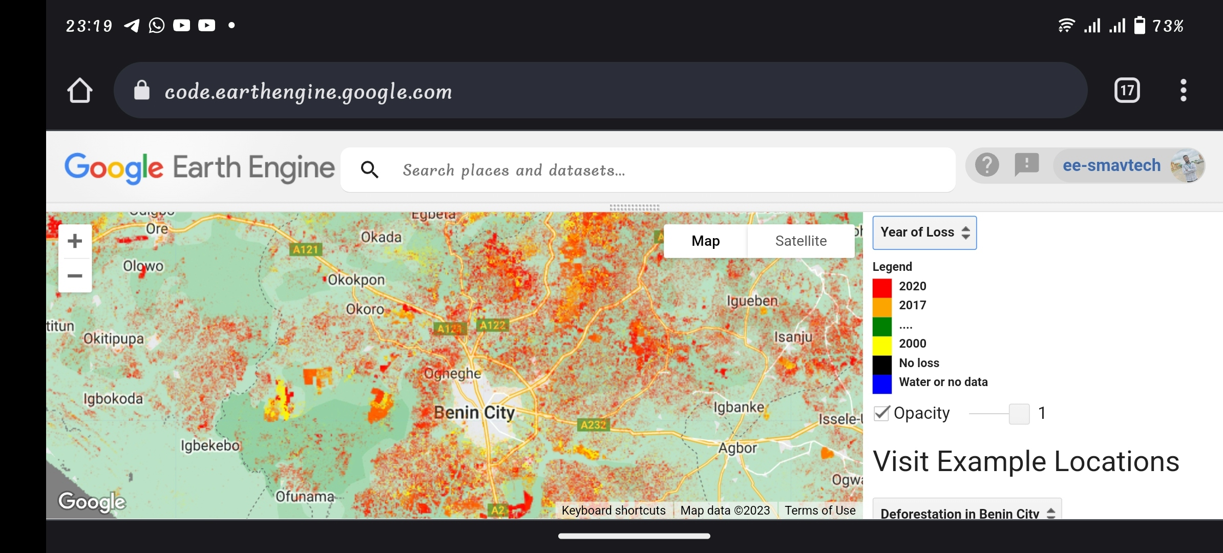
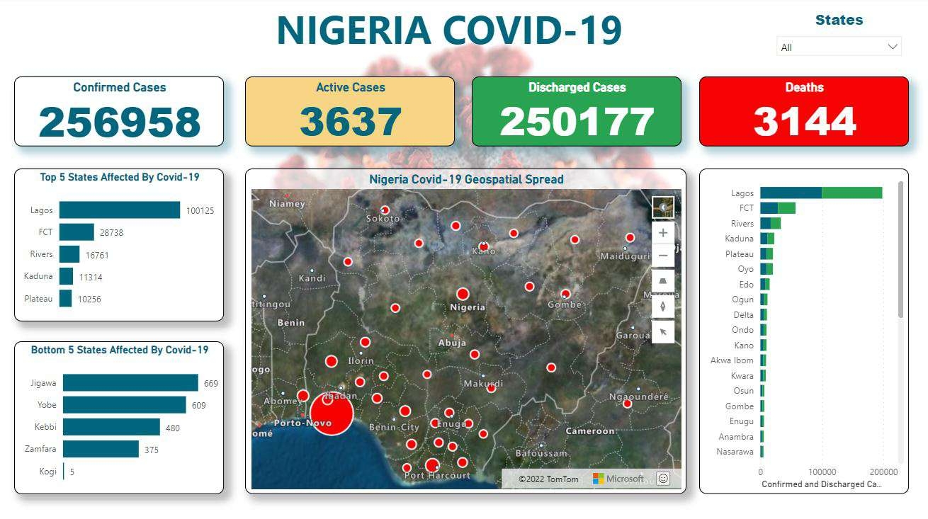
This was part of a project I completed while at Purdue for my CE 508 class. This project involved mapping COVID cases/casualties in states over time (red) as well as COVID cases in Indiana counties over time (blue). I used the "Join Features" tool and the Time Slider tool to display the county-wide COVID cases in Indiana and state-wide COVID cases in the United States. In addition, I mapped the population of each state for the viewers reference, with darker states being more populous.
COVID Mapping Over Time - Purdue
Tools used
ArcGIS Pro
Plug-ins used
Spatial Analyst ToolboxTime Slider
tags
COVID-19disease mapSpatial AnalysisTime Slider
More by Shrithik S


You might also like


Join the community!
We're a place where geospatial professionals showcase their works and discover opportunities.