
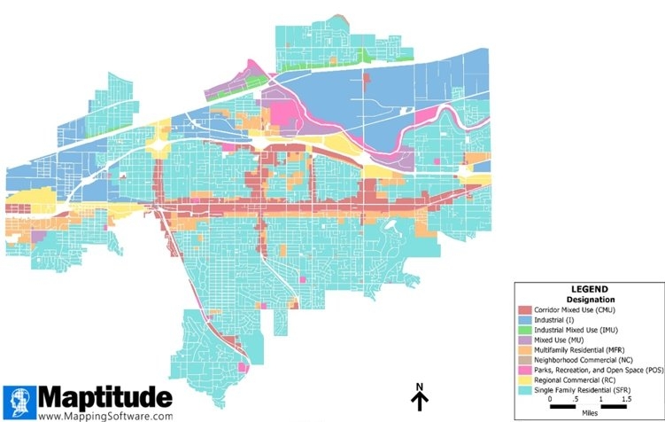
This article explores how to use one of Maptitude’s latest add-ins for "Land Use Mix." Land use mix calculations are useful to local municipalities in quantifying access to services. The tool looks at a specific land use category and compares that to other types within the same geography. This entropy measure quantifies the balance of types using a score of 0 to 1 to describe equitable access. The primary application of the tool is for zoning or with Comprehensive Plan land use maps. Typically, a zoning layer is measured using a GIS (Geographic Information System) and we use Maptitude Mapping Software in this analysis.
How to Measure Land Use Mix via Entropy
Tools used
maptitude
Plug-ins used
Maptitude
tags
GISlanduselocation analysisMAPPINGMaptitude
More by Stewart Berry


You might also like


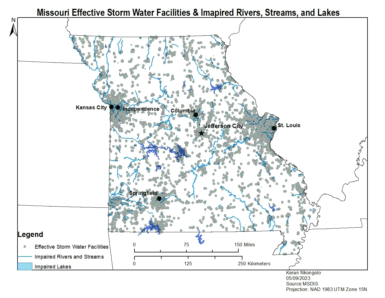
.svg "Keran Nkongolo")


Join the community!
We're a place where geospatial professionals showcase their works and discover opportunities.