Sign up or log in to your Spatialnode account.

Takes less than a few seconds.

Mapa analítico exposição rochosa SE

Aristoteles Fernandes da Silva Filho
Aristoteles Fernandes da Silva Filho•

March 10, 2023

Mapa analítico exposição rochosa SE

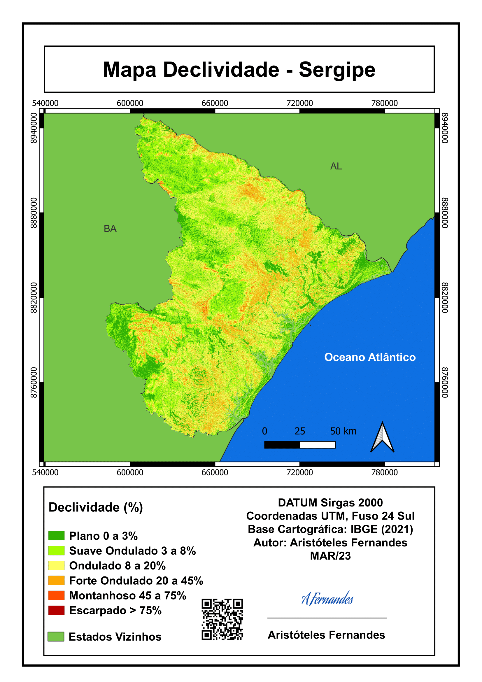
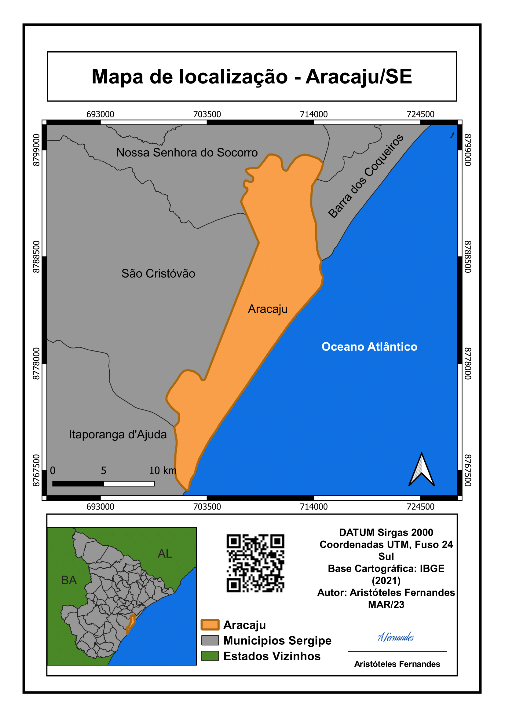
Mapa analítico sobre o mapa de calor das exposições rochosas no estado de Sergipe


Tools used

QGIS

Plug-ins used

Kernel Density EstimationOpenTopographyDEMDownloader

tags

geoprocessamento

More by Aristoteles Fernandes da Silva Filho

Mapo analítico declividade Sergipe
40
Mapa de localização Aracaju/SE
56
Mapa analítico topografia Sergipe
130
Mapa temático ocorrência de minerais SE
32
Mapa temático mesorregiões Sergipe
34
Distribuição UBS em Sergipe
4
Mapa vintage sec XVII Sergipe
18

You might also like

Distribution of Churches in U.S.
Niroj Shrestha
Distribution of Churches in U.S.
Niroj Shrestha
29
A Self-Motivated and Committed Learner
Zach Torres
A Self-Motivated and Committed Learner
Zach Torres
65
River Basin map in Himachel Pradesh Area
Cameron
River Basin map in Himachel Pradesh Area
Cameron
13
Flood Hazard Map of a Part of Lokoja
Elizabeth Ugwu
Flood Hazard Map of a Part of Lokoja
Elizabeth Ugwu
65
Air Pollution and Urbanization: Toronto
Volkan Ozturk
Air Pollution and Urbanization: Toronto
Volkan OzturkPro
18
Curvas de nível córrego Marrecas
luiz felipe maçon
Curvas de nível córrego Marrecas
luiz felipe maçon
10
Walking Analysis to Libraries in Madison
Laura Scott
Walking Analysis to Libraries in Madison
Laura Scott
41
Defect Mapping
Defect Mapping
Defect Mapping
Defect Mapping
Oluwadara Tobi Oladele
Defect Mapping
Oluwadara Tobi Oladele
116
 Mapa Artístico
Gabriel Henrique Braga Matos
Mapa Artístico
Gabriel Henrique...
36
BARINGO COUNTY PROPOSED CONSERVANCIES
John Wahome Gathoni
BARINGO COUNTY PROPOSED CONSERVANCIES
John Wahome Gathoni
95
KERIO VALLEY AGROECOLOGICAL ZONES, Kenya
John Wahome Gathoni
KERIO VALLEY AGROECOLOGICAL ZONES, Kenya
John Wahome Gathoni
88
Detect Vegetation Cover Change with NDVI
Moez Labiadh
Detect Vegetation Cover Change with NDVI
Moez Labiadh
886

Join the community!

We're a place where geospatial professionals showcase their works and discover opportunities.

Sign Up for free