As part of an academic activity in my course "GEOG 124: Geographic Information Systems for Human Geographic Research" specifically our Exercise 4 Output, a QGIS window screenshot showing the digitized version of the Pantabangan-Carranglan Watershed raster was submitted. This exercise is an application of the learned process workflows of data capturing, data preprocessing, and data preparation for digitizing.
Familiarizing and increasing proficiency with SQLite or SpatialLite handling.
This includes creating new SpatiaLite layers, adding fields, and defining the appropriate field types.
Defining and recalibrating the features to an appropriate Coordinate Reference System (CRS).
Working with Georeferencer to georeference map image files and establish ground control points via the Add Point Tool.
Transforming input raster images to geotagged output rasters.
This includes the processes of image rectification, transformation (Affine, Polynomial 1), and resampling (Nearest Neighbor).
Manipulating the Attributes Form to prepare for digitizing.
This includes Widget encoding and inputting Value Map CSV tables.
Utilizing constraints and rules.
Using the Advanced Digitizing Toolbar to create new feature attributes.
This includes the proficiency in using the Vertex Tool, Fill Ring, and Split Polygon.
Checking for Topological and Geometrical Validity by setting rules and manually addressing possible errors.
Explored the v.clean tool and evaluated its output quality in comparison to manual.


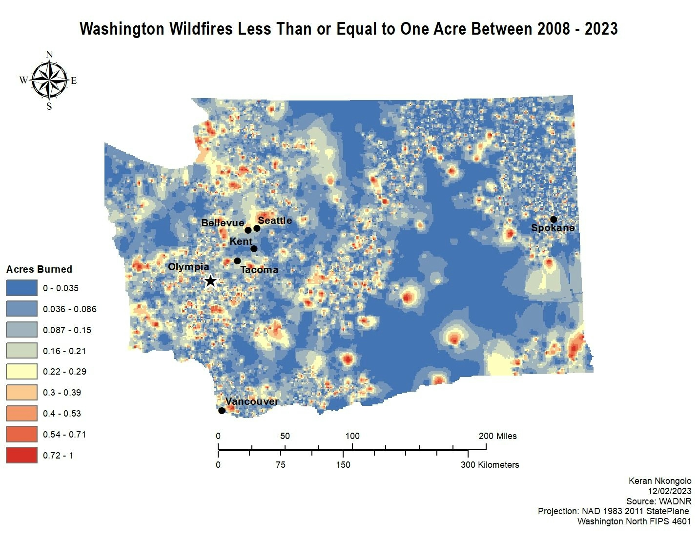
.svg "Keran Nkongolo")