

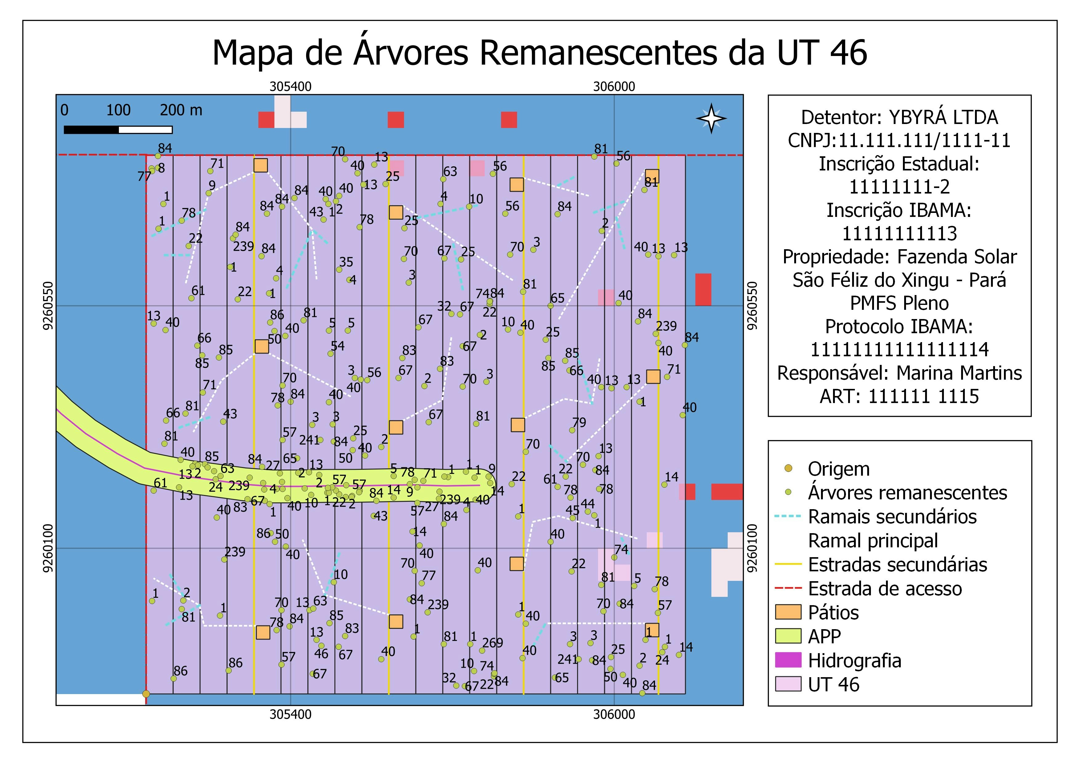
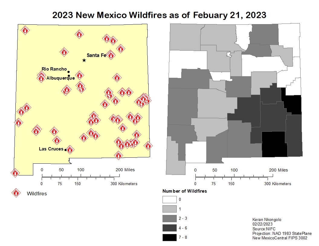
As part of an academic activity in my course "GEOG 124: Geographic Information Systems for Human Geographic Research" specifically our Exercise 3 Output, is a relief map of the critical watersheds of the Cordillera Administrative Region (CAR) in the Philippines.
Familiarizing and learning Digital Elevation Models (DEM) from SRTM 4.1
Manipulating Hillshade Relief Maps to accentuate height
Overlapping layers to add more dimension and depth to the DEM and improve the preciseness of spatial analysis.
Using Administrative Boundary Layers from Humanitarian Data Exchange (HDX) of UN-OCHA
Exploring the Print Composer with guidance from basic cartographic principles and knowledge.


.svg "Keran Nkongolo")


