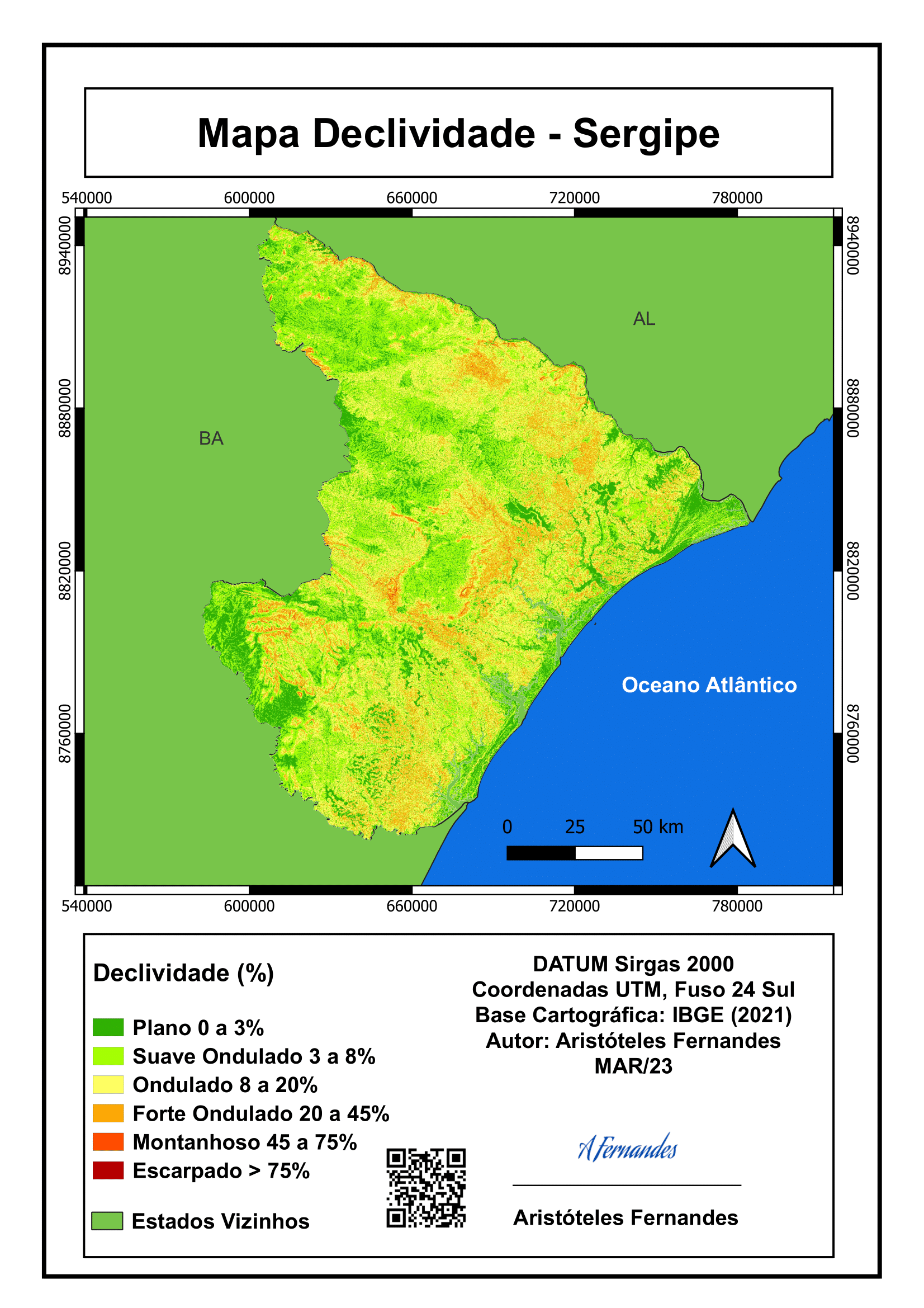
As part of an academic activity in my course "GEOG 124: Geographic Information Systems for Human Geographic Research" specifically our Exercise 5 Output, a landuse map with charts that show the share of each municipality in the Pantabangan-Carranglan Watershed and its different uses was submitted. This exercise teaches the geoprocessing workflow needed for processing, analyzing, and mapping spatial data.
Using QGIS styles (.qlr) files.
Using Web Map Tile Services (WMS) or XYZ Tiles.
Getting familiar with the Python Console, specifically to install XYZ Tiles.
Employ Geoprocessing Tools such as Dissolve to simplify boundaries and Intersection for determining the municipalities that have jurisdiction over parts of the watershed.
Operating the Field Calculator to convert 7 Landuse Classes to 3 Codes.
This included creating a new field, reclassifying fields (via CASE conditional operations), and generate area in hectares fields (via $area function).
Contribute to an existing SpatialLite database by saving and exporting layers.
Use Research tools to Select by location and Processing tools for Statistics by categories to calculate statistics of hectares by polygons.
Working with Plugins such as v.clean and DataPlotly.
Using the Expression String Builder to assign HTML notation colors to the bar chart and remap labels from numbers to descriptions.
Creating new charts, editing the Feature Subset Expression, and exporting the chart as an HTML file.
Applying learned techniques for designing maps in the Print Layout.
This includes locking layers, implementing inset maps, and inserting charts with an HTML source.