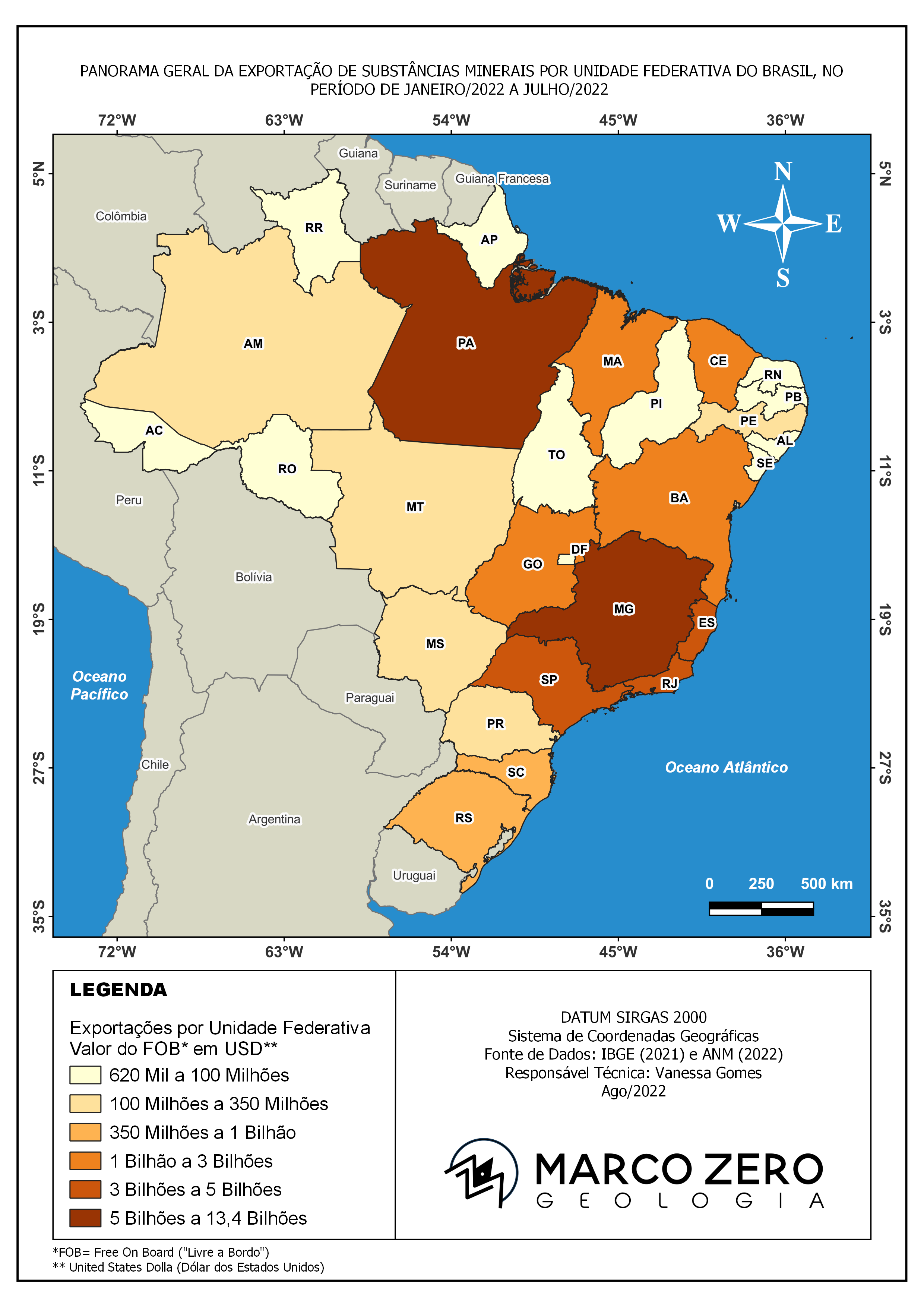
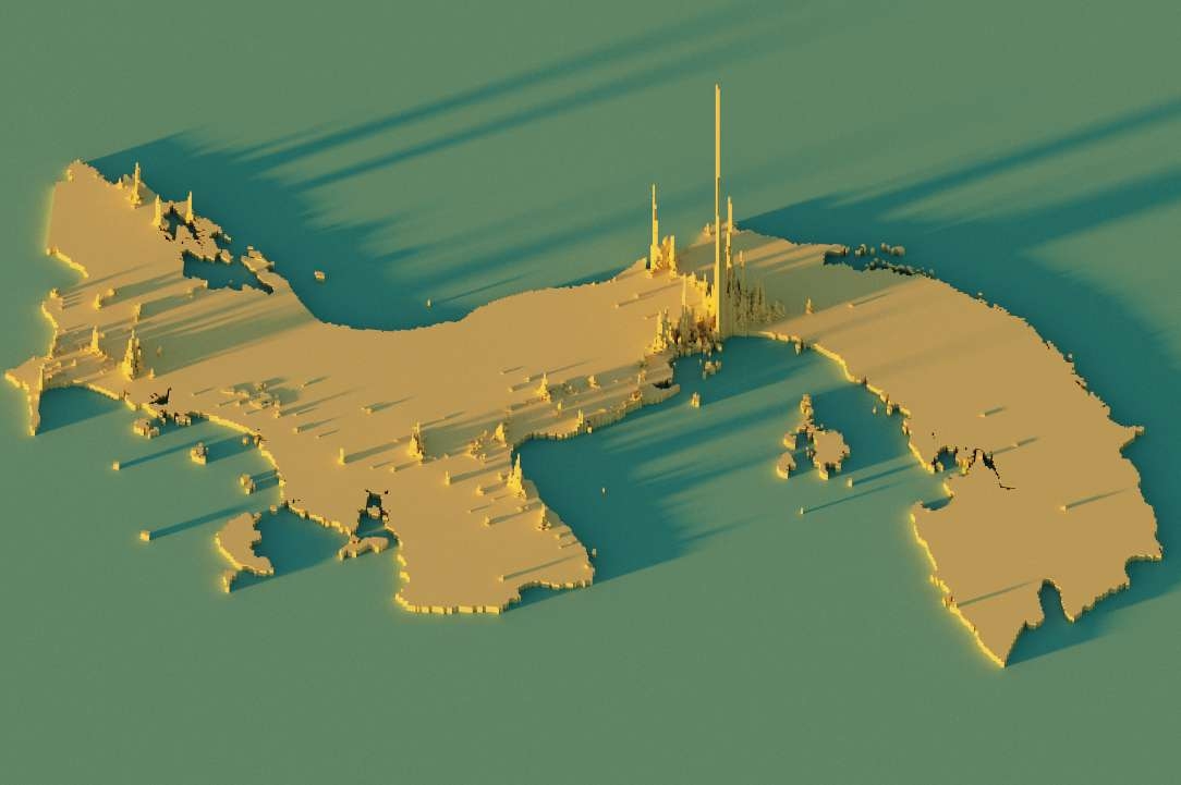
This project assessed flood-prone areas using Digital Elevation Models (DEM), slope analysis, and hydrological modeling in QGIS. I performed terrain processing to derive flow accumulation, stream networks, and elevation zones. The final map highlighted high-risk flood zones, providing a valuable tool for disaster preparedness and urban planning.
https://drive.google.com/file/d/1tFmPBeMvNG-QqDrTRbxezraxrd8V9CDe/view?usp=drive_link