Introduction
In the context of Niger Republic, evapotranspiration (ET) refers to the process through which water is transferred from the land to the atmosphere by evaporation from the soil and other surfaces and by transpiration from plants. Evapotranspiration is a critical component of the water cycle, particularly in arid and semi-arid regions like Niger. Understanding ET patterns helps in water resource management, agricultural planning, and climate studies. The variations in evapotranspiration across different regions of Niger are influenced by factors such as soil moisture, vegetation cover, and climatic conditions.
Study Area
The Republic of Niger is a landlocked country located in West Africa, bordered by Algeria, Libya, Chad, Nigeria, Benin, Burkina Faso, and Mali. Niger has a diverse landscape that includes parts of the Sahara Desert, the Sahel, and savannah regions. The country has an estimated population of about 24 million people, with the majority living in rural areas and engaged in farming and livestock activities. The climate in Niger is predominantly hot and dry, with significant variations in temperature between day and night. Over the years, there has been a gradual increase in urbanization and development, especially in the capital city, Niamey.
Materials
The dataset used for this study is Landsat 8 Level 1 satellite imagery, and hydrosheds. Google Earth Engine was utilized for processing the satellite data, and QGIS was employed for designing the map.
Result
The map shows the average evapotranspiration values over Niger Republic for a period of 10 years. The values range from 0.016667 to 4.111051. The higher evapotranspiration values are concentrated in the southern regions, depicted in darker shades of green, indicating areas with more vegetation and agricultural activity. The northern desert regions show lower evapotranspiration values, represented by lighter shades, reflecting the arid conditions and sparse vegetation.
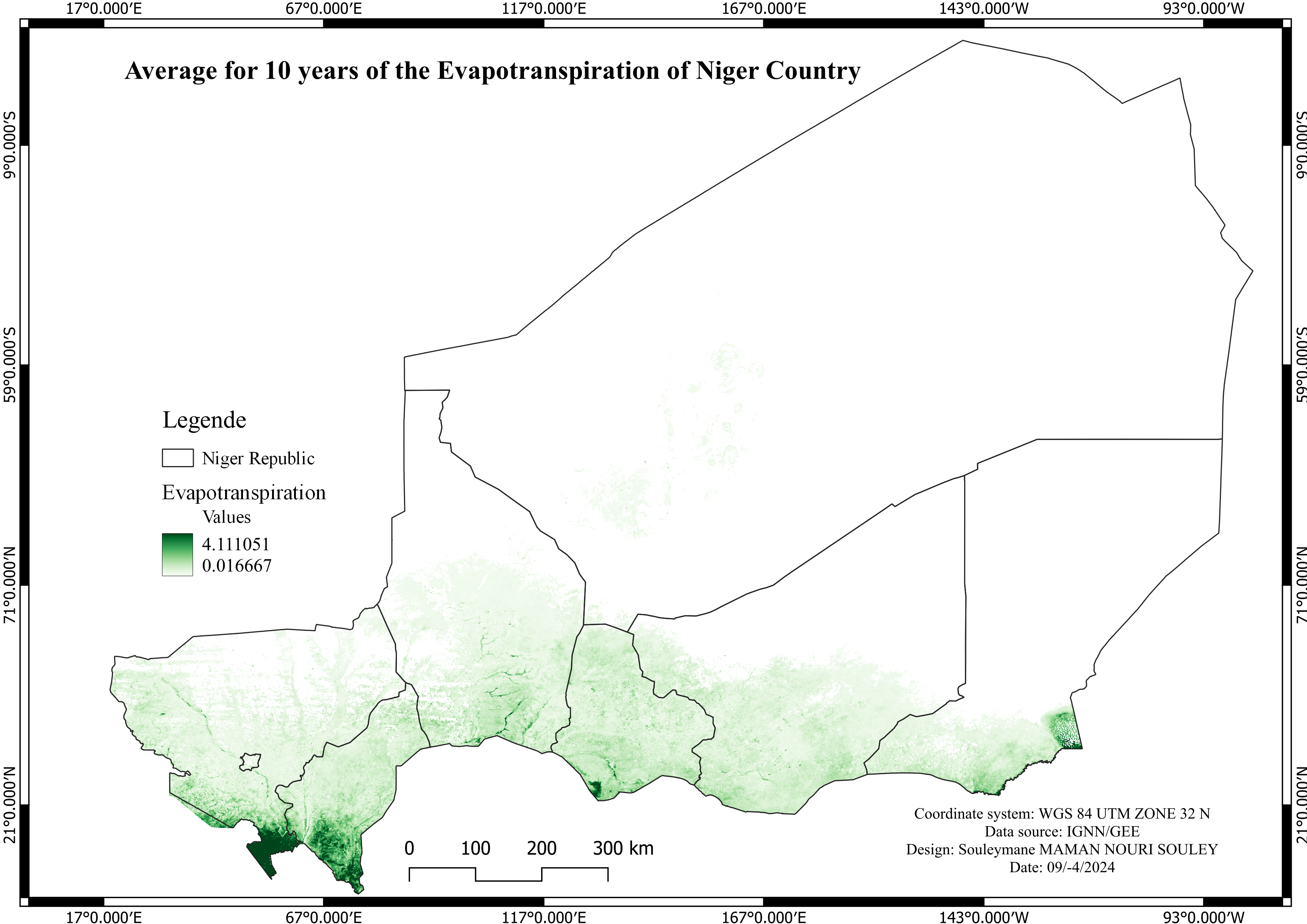
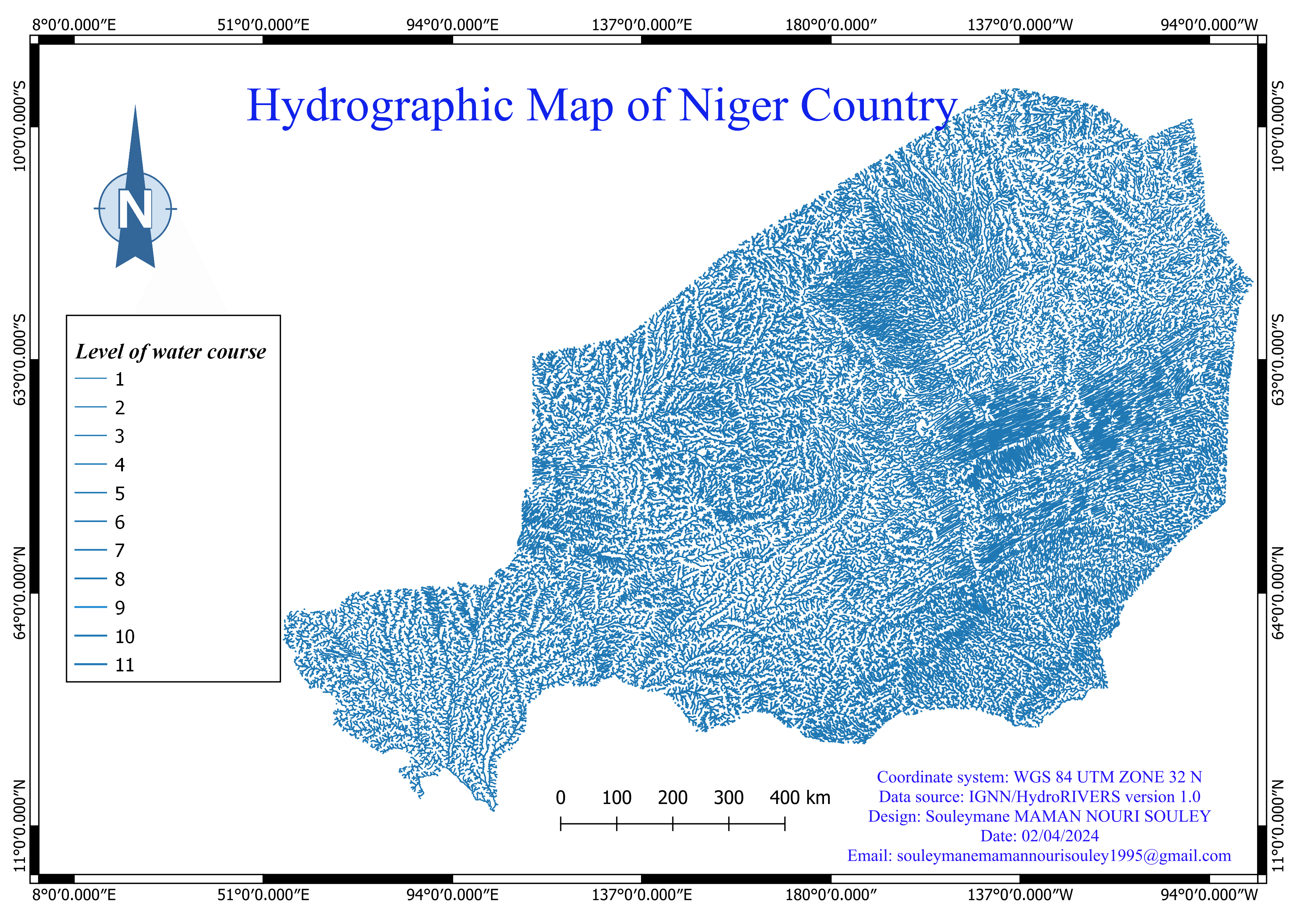
The map also highlights the hydrography of Niger Republic, emphasizing the distribution of water bodies and their impact on evapotranspiration patterns. The southern regions, with more water bodies and higher vegetation cover, show increased evapotranspiration, while the northern desert regions have significantly lower values.
Conclusion
This project demonstrates the spatial variability of evapotranspiration across Niger Republic. The map illustrates that higher evapotranspiration values are associated with the southern regions, which have more vegetation and agricultural activities. In contrast, the northern desert regions exhibit lower evapotranspiration values, highlighting the arid conditions. This project underscores the importance of understanding evapotranspiration patterns for effective water resource management and agricultural planning in Niger Republic.
Skills Demonstrated
Cloud dataset (Google Earth Engine) analysis
Satellite remote sensing and data analysis
Data visualization and interpretation
QGIS software proficiency