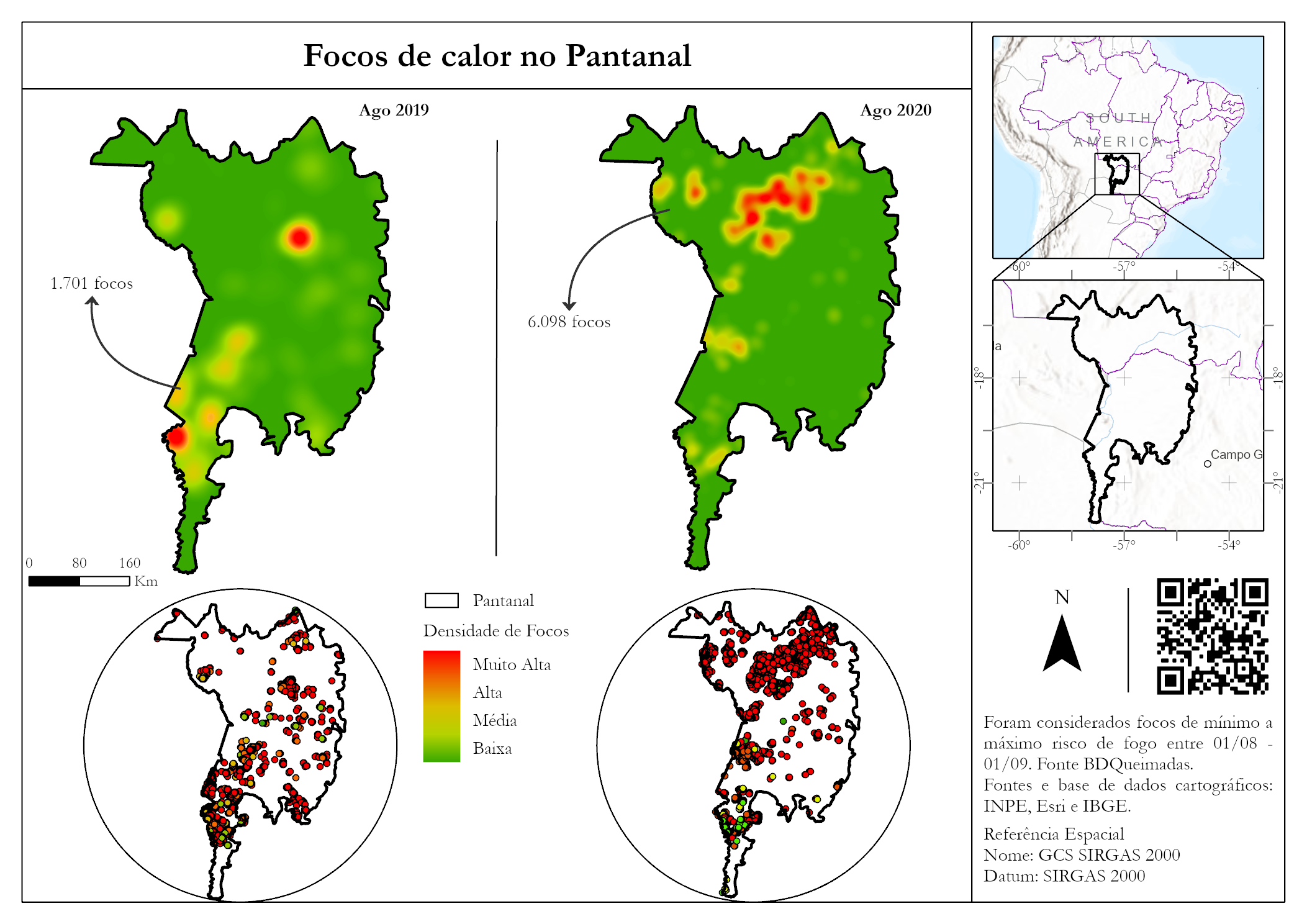
What I was achieving with this project was to create a color coded map that showed public school in Washington, DC and the school walking areas. The distances are divided by color depending on the distance they are from the schools. The tools I used to achieve this required me to expand the layers, make them visible, change symbol being used, and change the color being used.
I would be able to use this exercise in an environmental application specifically water management. These tools could be helpful to understand where people are typically walking. I could use the tools to make a map on water utility business centers, help show areas that water can be more stressed. Compared to the map, the schools could be water hydrants and help show the distances to the water main.


.png&w=3840&q=100)


.png&w=3840&q=100)
.png&w=3840&q=100)
.png&w=3840&q=100)