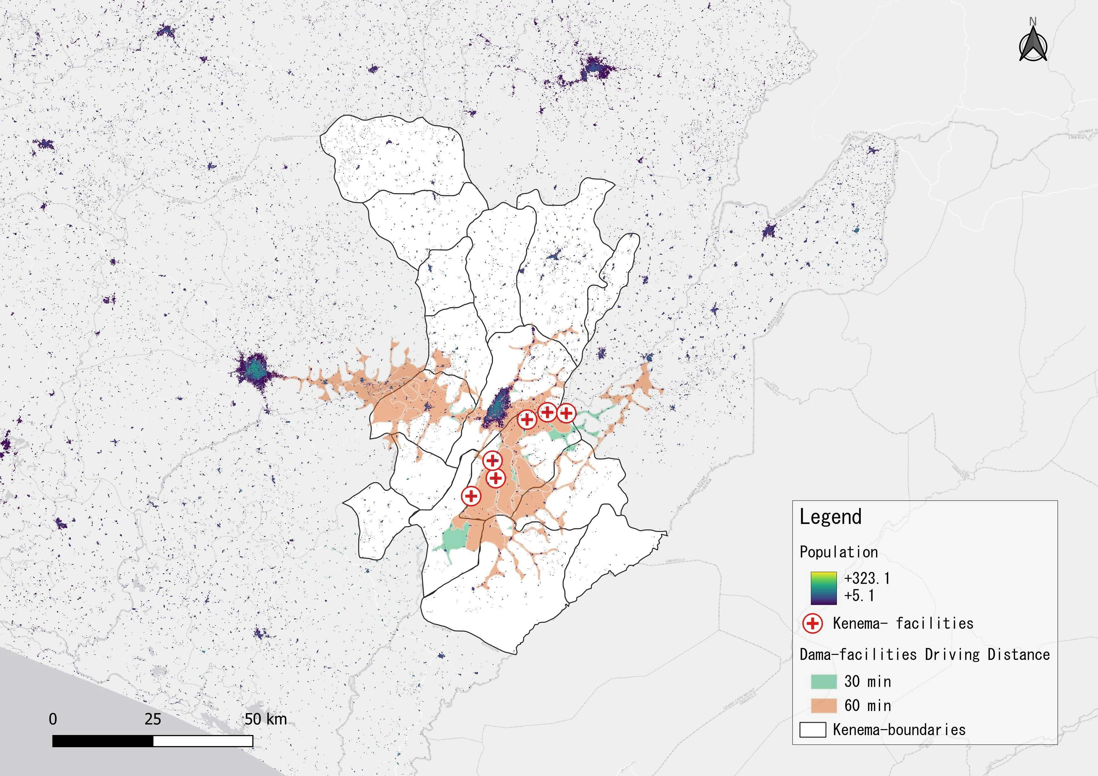
The exercise was to help understand how to add a shape files to a map, open an attribute table- edit input rows and add clause, use the export features tool, and modify a symbol manually. For this exercise I was using a map of the USA, specifically the Illinois, Michigan, Indiana, and Ohio, to represent obesity prevalence in these states.
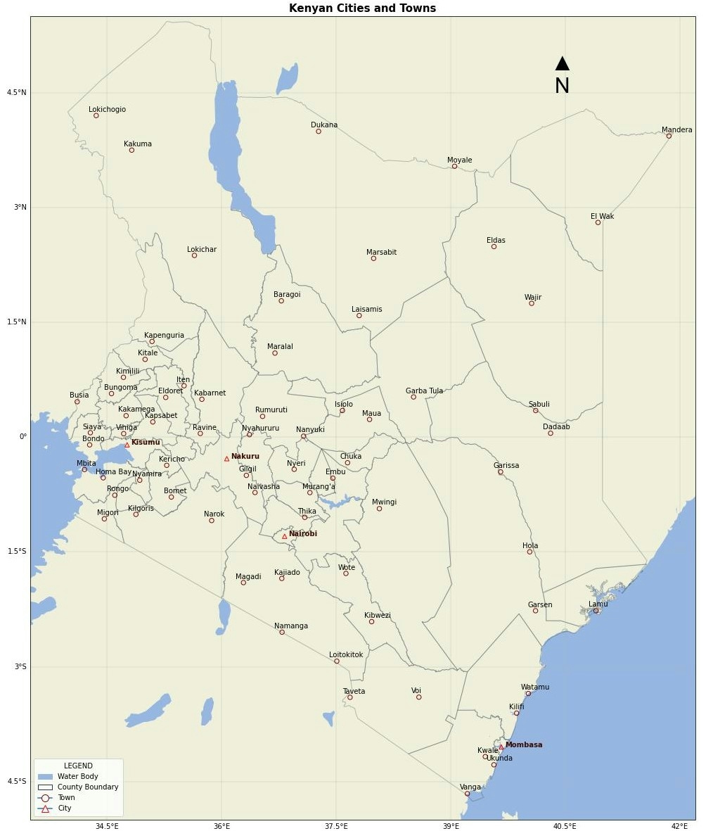
This exercise could be helpful to understand which provinces lack and/or abundance of natural resources. This would be helpful from an environmental stand point to understand which provinces need remediation, and being able to look at a map to see if there is connections with location.


.jpg&w=3840&q=100)