Sign up or log in to your Spatialnode account.

Takes less than a few seconds.

Soil and water conservation Suitability

John Wahome Gathoni
John Wahome Gathoni•

May 09, 2022

Soil and water conservation Suitability

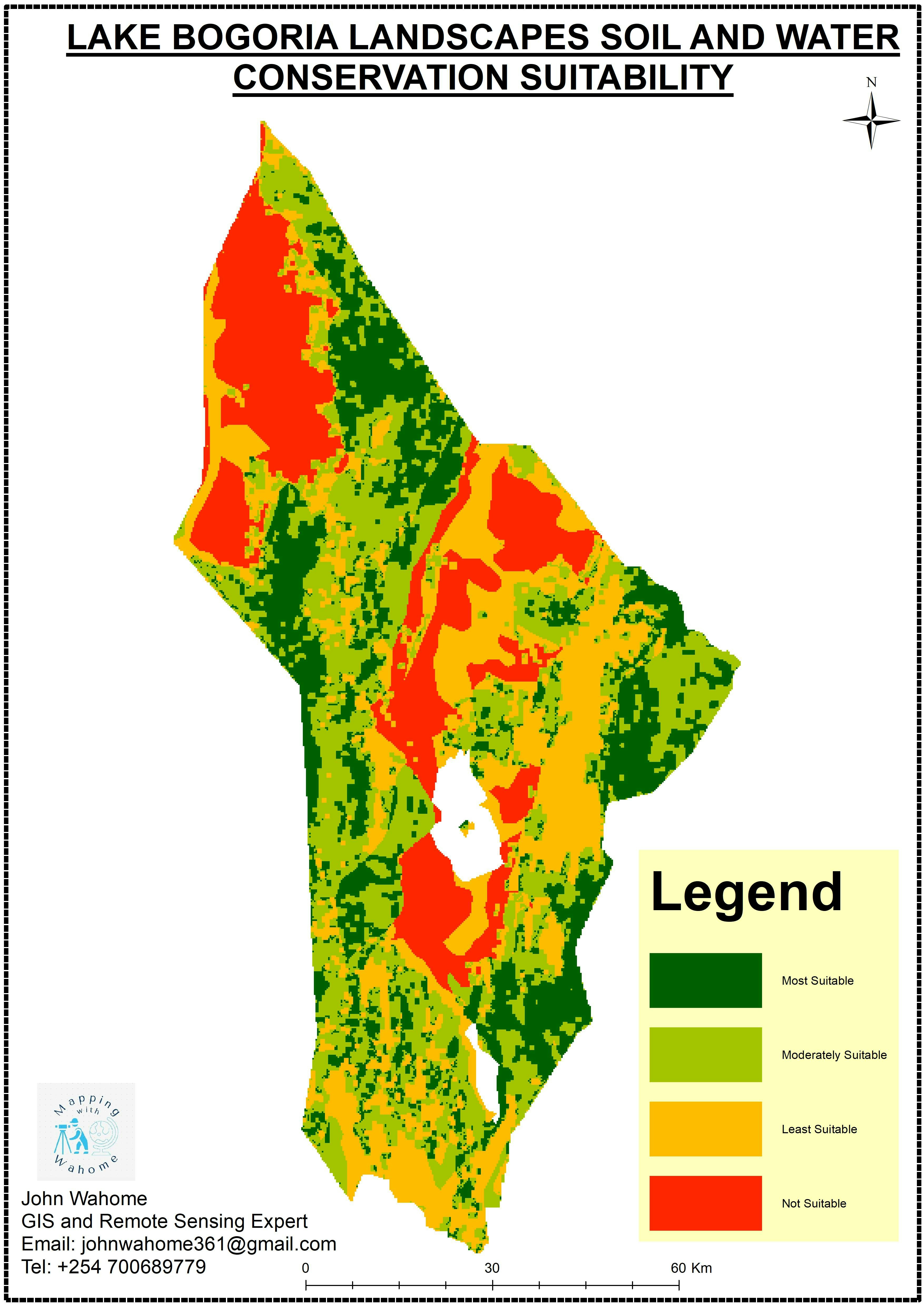
GIS-based multicriteria assessment to determine areas for soil and water conservation in the lower Lake Bogoria Landscapes in Baringo County, Kenya.


Tools used

ArcMapQGIS

Plug-ins used

QGIS

tags

GIS

More by John Wahome Gathoni

Monochrome Map
Monochrome Map
16
BARINGO COUNTY PROPOSED CONSERVANCIES
98
GEOHAZARD RISK ZONES ANALYSIS
100
Find the Nearest Health Centre
22
KERIO VALLEY SOIL LOSS USING RUSLE
99
KERIO VALLEY AGROECOLOGICAL ZONES, Kenya
94
KENYA ESRI LULC 2020
113
TANYAI FOREST LOSS ANALYSIS(1990-2020)
150
UHURU PARK LOCATION-NAIROBI, KENYA
68
Mombasa Tourist Guiding System
322
Health Centres in Kenya
19

You might also like

2D Shaded relief map of Africa.
Bamidele Daniel Ohinoyi
2D Shaded relief map of Africa.
Bamidele Daniel Ohinoyi
82
Mapa de Solos
Luiz Gustavo De Góes Sterle
Mapa de Solos
Luiz Gustavo...
29
Chapter XVII, The Yellow Book
Sebastian Silva
Chapter XVII, The Yellow Book
Sebastian Silva
115
Bigquery GIS - NYC Bikes availability
Paola Prieto Botero
Bigquery GIS - NYC Bikes availability
Paola Prieto Botero
19
Death by Design
Sara Fatimah
Death by Design
Sara Fatimah
44
Mapa de Localização de Brotas - SP
Henrique Cesar Bitencourt
Mapa de Localização de Brotas - SP
Henrique Cesar Bitencourt
179
Priority Planting in Louisville, KY
Sean Willis
Priority Planting in Louisville, KY
Sean Willis
124
Mapa Topografico de Petrópolis - RJ
Fenando Paulo Neto Alberto
Mapa Topografico de Petrópolis - RJ
Fenando Paulo...
606
DEM Data for Virginia farm
Cari Lynn Squibb
DEM Data for Virginia farm
Cari Lynn Squibb
44
Mapa do Município de Natal
Raduel Fernando da Fonseca
Mapa do Município de Natal
Raduel Fernando...
68
NYC Child Care Explorer
Loviena Garcia
NYC Child Care Explorer
Loviena Garcia
31
ÍNDICE DE VULNERABILIDADE SOCIOAMBIENTAL
Francielle Caminhas
ÍNDICE DE VULNERABILIDADE SOCIOAMBIENTAL
Francielle Caminhas
13

Join the community!

We're a place where geospatial professionals showcase their works and discover opportunities.

Sign Up for free