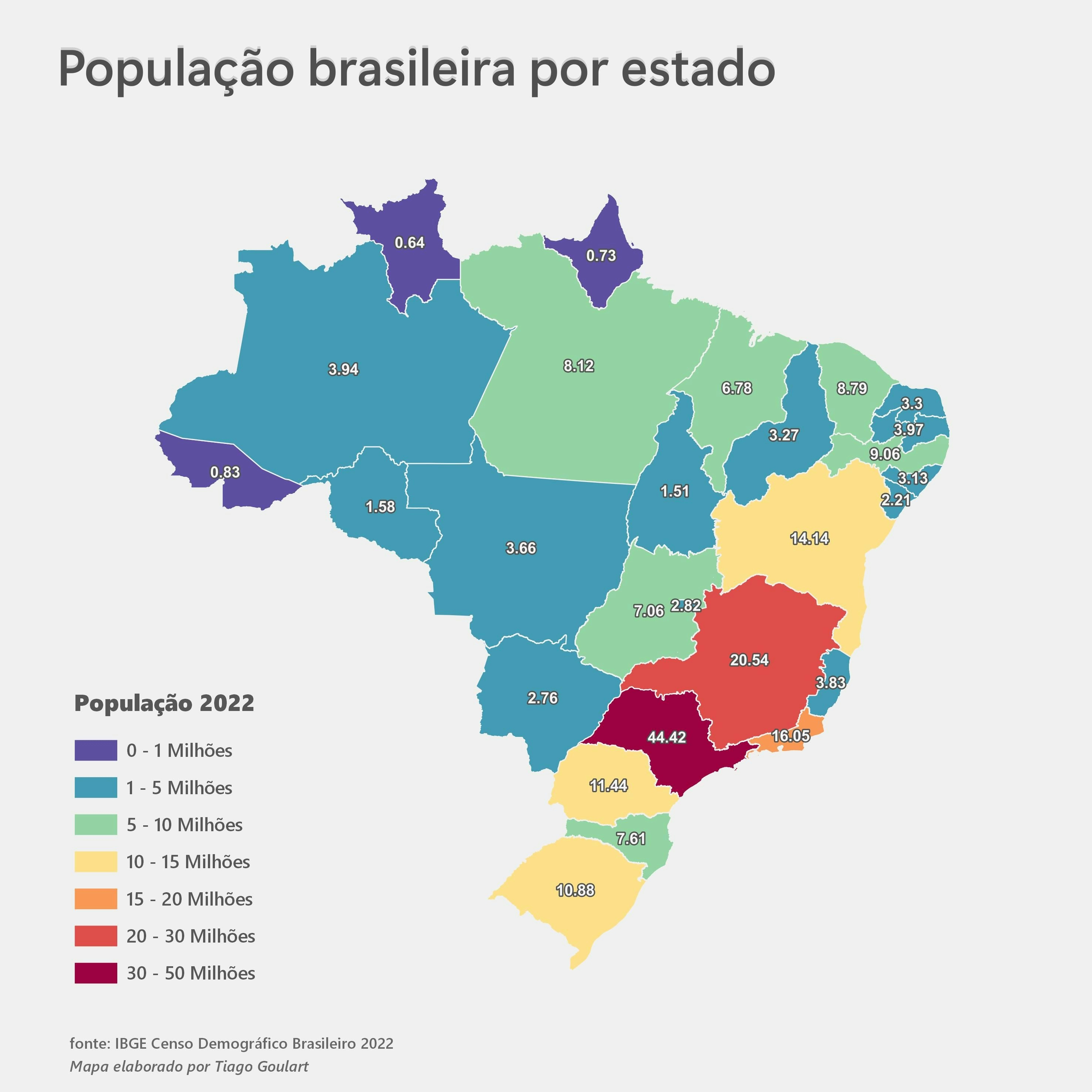
.jpeg&w=3840&q=100)
[English bellow]Este mapa apresenta a distribuição espacial de parâmetros hidrogeoquímicos no entorno de ilhas fluviais do Rio Paraná. A partir da análise de amostras de água coletadas em diferentes pontos estratégicos. O delineamento das ilhas fluviais, associado à caracterização da dinâmica hídrica local, permite identificar padrões de variação hidrogeoquímica relacionados a processos naturais e possíveis influências antrópicas. O mapa oferece uma visão integrada do ambiente fluvial, auxiliando na compreensão da qualidade da água e da interação entre os sistemas aquáticos e terrestres da região.
Hydrogeochemical Map of the Surrounding Area of Fluvial Islands in the Paraná River
This map presents the spatial distribution of hydrogeochemical parameters in the surroundings of fluvial islands in the Paraná River. Based on the analysis of water samples collected at different strategic points, physicochemical indicators such as pH, electrical conductivity, turbidity, and nutrient concentrations were mapped. The delineation of the fluvial islands, combined with the characterization of local hydrodynamic conditions, allows for the identification of hydrogeochemical variation patterns related to natural processes and potential anthropogenic influences. The map provides an integrated view of the fluvial environment, supporting the understanding of water quality and the interaction between aquatic and terrestrial systems in the region.