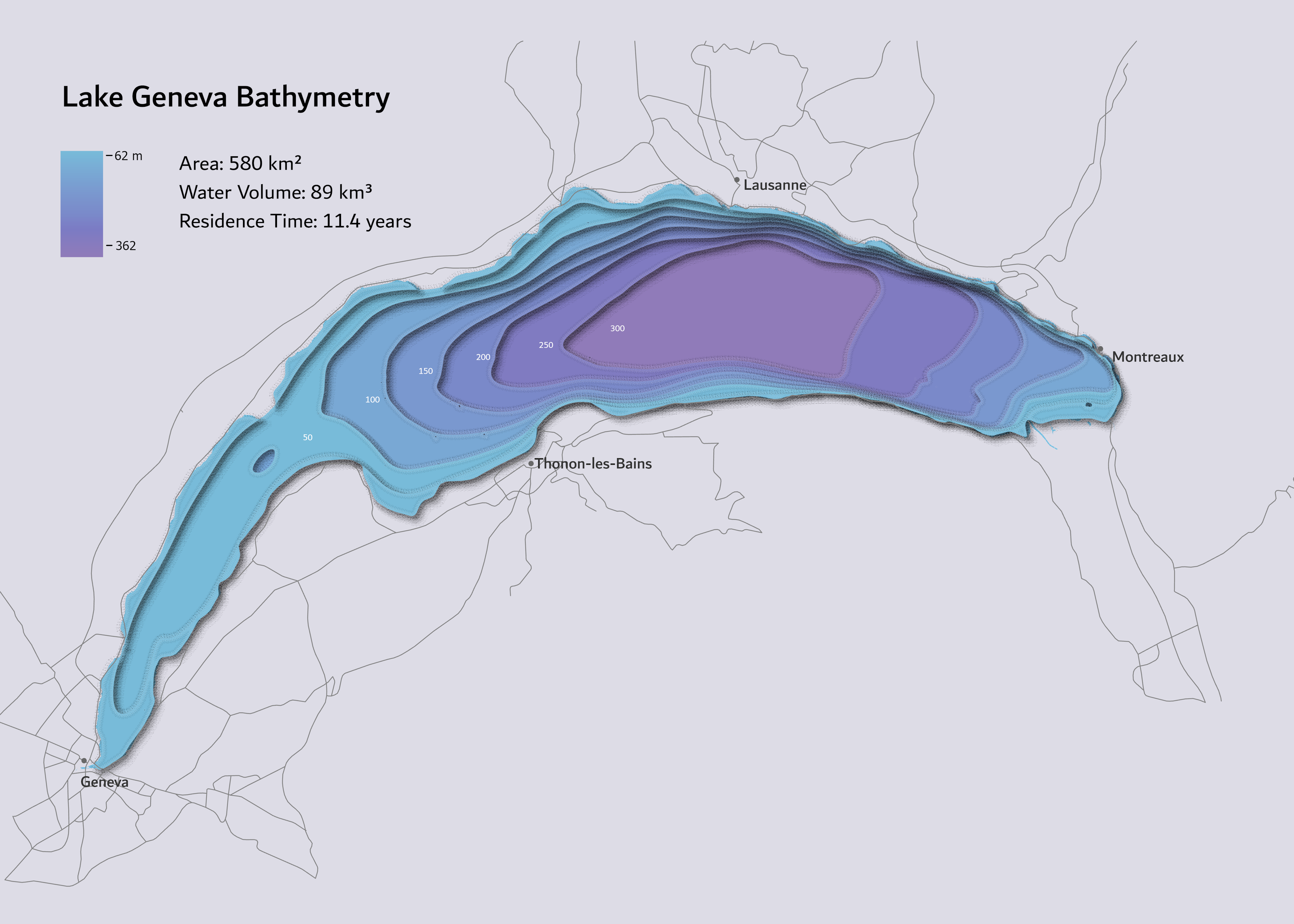
Rain in Central America


Tools used
QGIS
Plug-ins used
QGIStemporal controller
tags
animationcentral-americarain
More by Adriana Calderon

_2239484.png&w=3840&q=100)


You might also like


.svg "Keran Nkongolo")


Join the community!
We're a place where geospatial professionals showcase their works and discover opportunities.